Search Results for: Bush Hill State Forest

Ides of March with a water pick in my mouth 🦷😁🪥

As the Ides of March made famous 54 years ago… “Hey, well, I’m the friendly stranger in the black sedans / Woncha hop inside my car / I got pictures, I got candy, I’m a lovable man / And I can take you to the nearest star.” What a silly song, almost pornographic with the album cover, it’s great listening for the Ides of March. Sunday is Saint Patrick’s Day, better be prepared to be home before the drunks are on the road.

Good morning! Happy Friday. Cloudy with rain showers this morning and 46 degrees in Albany. 🌧 The next best chance for below freezing weather looks like to be early Tuesday morning, though it will poke around the freezing point on Monday AM so I’ll probably want to close the windows before then.

Today was my teeth cleaning which was originally scheduled for 7 am but my dental hygienist had a conflict 🦷so I have a substitute one — the mean one who spent a half hour berating me for how bad I do at brushing my teeth, 🪥 threatened to make me come back in two weeks for a cleaning, told me I’m wrecking my gums by eating too much hot food, and then complained some more that she didn’t have time to properly clean my teeth but by the time it was chewed out about that. She still wants me back in two weeks to see the doctor because I burned my mouth on food and that could cause mouth cancer, but there is no way in hell I’m coming back in two weeks to be checked by a doctor, lol. 🤣 I’m so canceling that appointment as soon as they text me about it.

This afternoon will continue to have scattered showers, mainly before 2pm. Mostly cloudy, 🌧 with a high near 52. North wind around 10 mph. Chance of precipitation is 30%. New precipitation amounts of less than a tenth of an inch possible. Seems like a kind of gray day. But still mild, that’s seven degrees above normal, which more like March 31st then mid-March. Record high is 72 set in 2019. Almost as warm as yesterday.

Last night as you can see I got really frustrated for a while 😠 after looking at Landwatch and coming to the sad realization that it’s going to be hard to find remote land with ample acreage and no nearby neighborhoods, and still be a short commute to work. I concede I might have to compromise, but I don’t want to compromise too much or whole venture of owning a house becomes kind of pointless. 🤷 I might as well keep renting my dumpy apartment or another similarly dumpy unit if I get evicted. Or maybe I might just have to accept a longer, more painful commute then is ideal, and sometimes calling in on bad weather days. ☃ The thing is I’m getting old at this point, and I don’t want to lose my dreams due to old age. I’m in great physical health currently 💪 but there is no guarantee in 15 years from now I’ll be the same way.

Tonight the rain stops and it will be mostly cloudy, with a low around 38. ☁️ North wind 6 to 8 mph. 12 degrees above normal, which is like April 2nd. Record low is negative 1.  Sunset is at 7:03 PM with dusk at 7:29 PM. That time change is nice, though with the rain it’s going to get cloudy early.

Besides doing more research at the library on land, 🚜 I finished up my taxes 🔢 and submitted them to the state and federal government and got a stack of books 📚 about buying land and building green. One book is on modular buildings used as cabins — there are a lot of options out there besides stick built, sheds, very conventional modular homes. The thing is I want something simple, but it needs to be durable and comply with all state codes. 🛖 And I want to do it on a budget to a certain extent so I can spend more on land. I also got a book about the residential building code, and one on buying land. Not everything I read will be relevant, but learning is important.

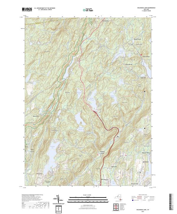
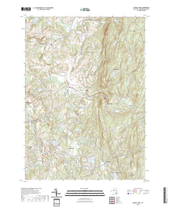
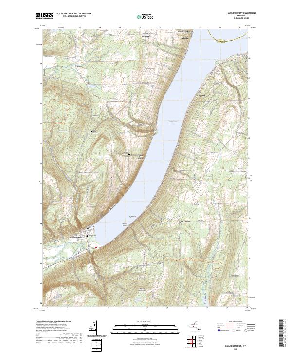
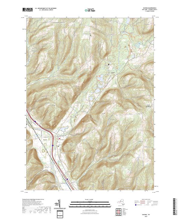
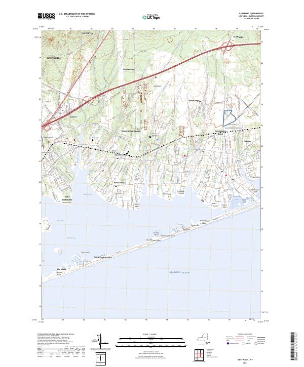
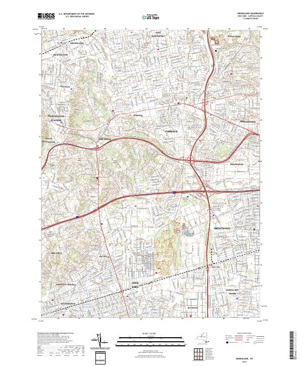
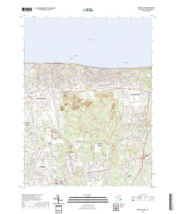
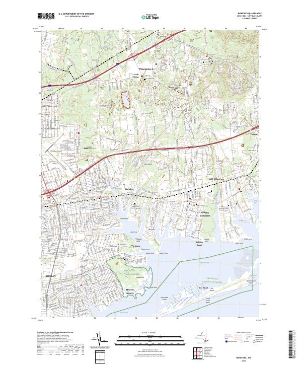
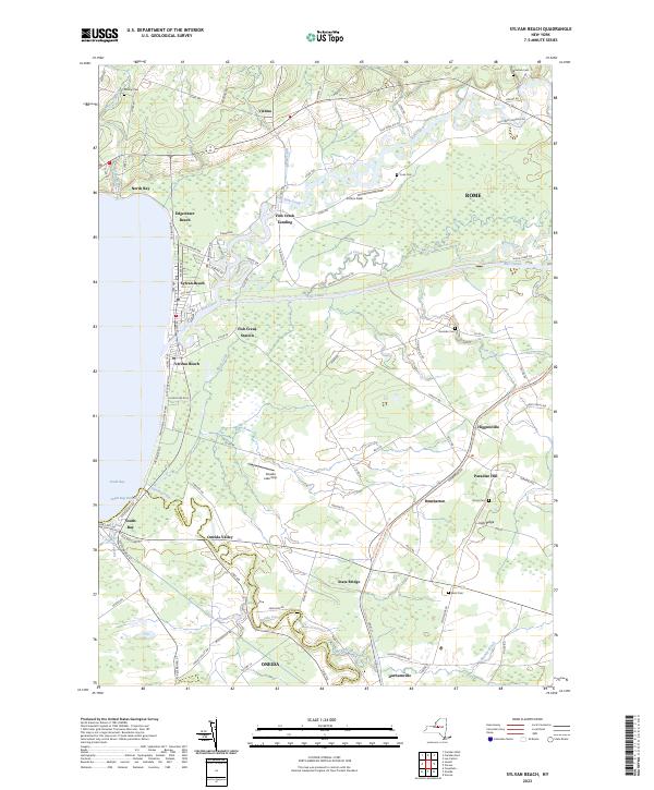
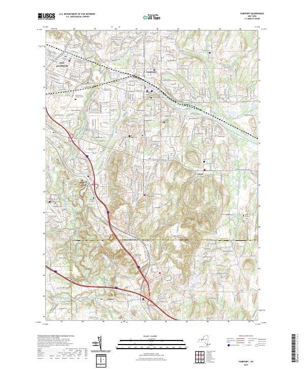
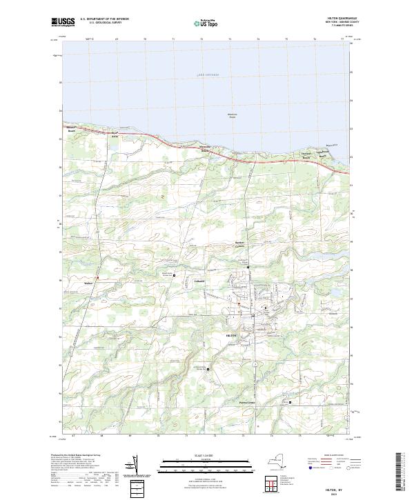
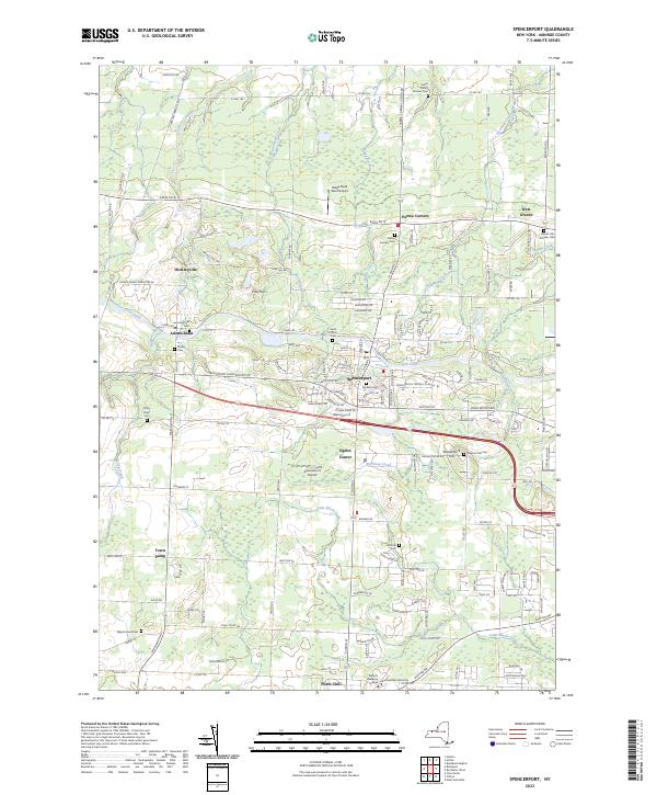
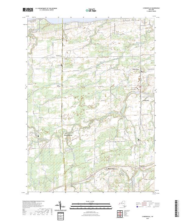
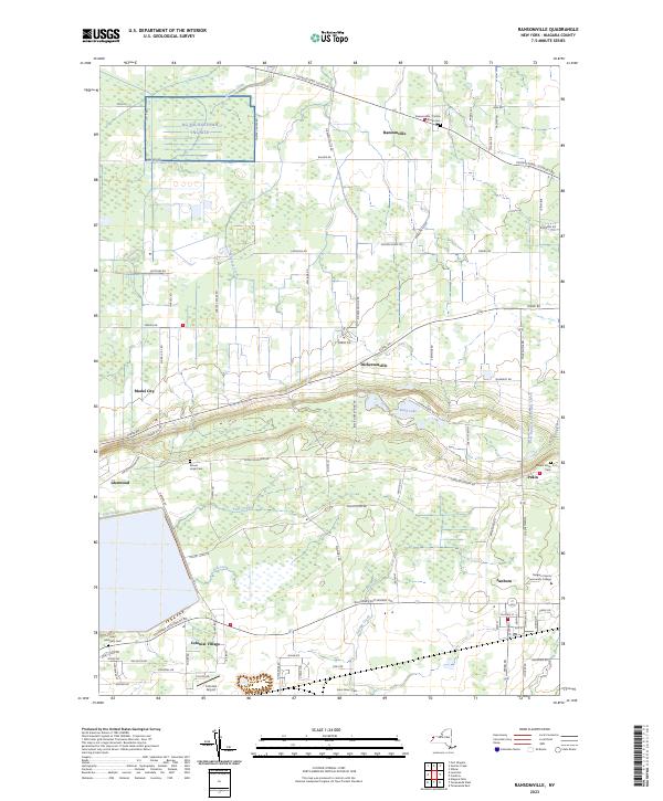
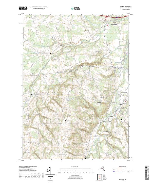
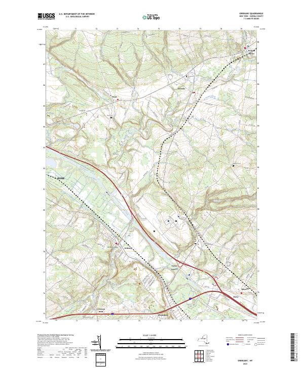
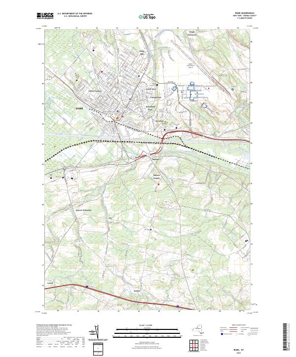
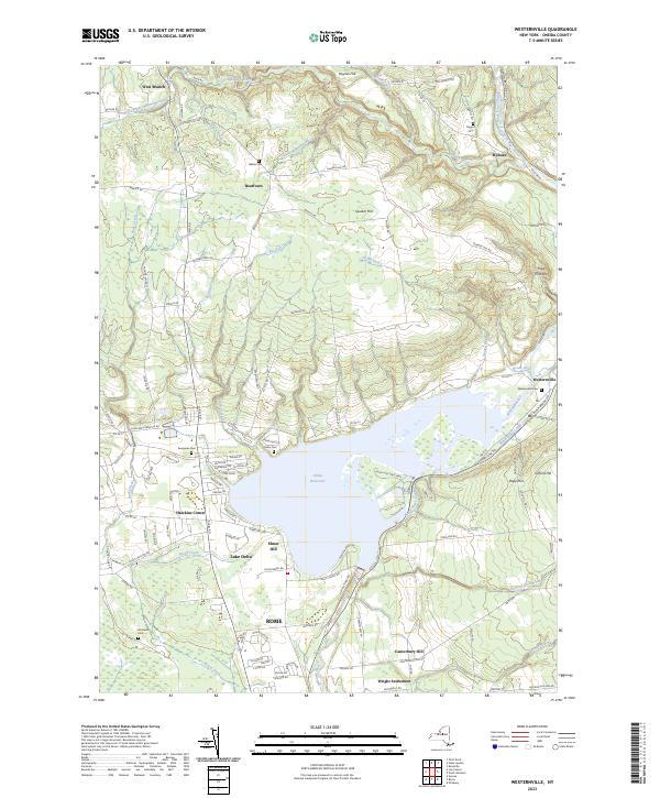
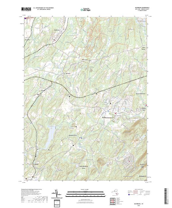
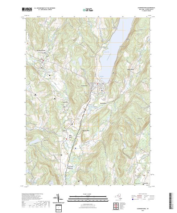
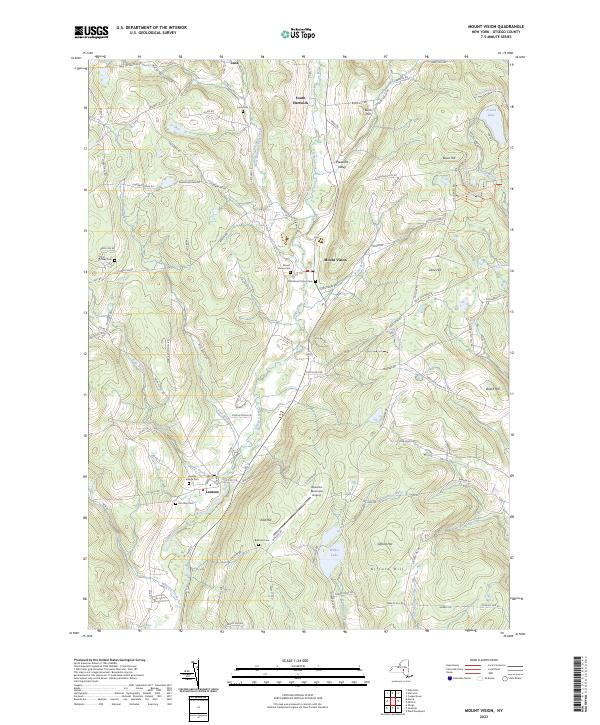
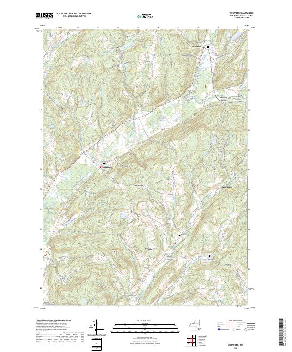
Saturday looks quite nice. 🌞 Partly sunny, with a high near 56. West wind around 8 mph. That’s going to be a nice day for cruising the back roads of Rensselaer County looking at land. While in some ways, Rensselaer County makes more sense for the proximity or rural land to where I work, the roads in Rennselaer County tend to be much more congested, as there is a lot more sprawl around Troy, Brunswick and the Greenbushes. And NY 7 is a cluster-fuck. 

But I also want check out the campsites at Tibbits State Forest to see if they are drive-in. I would do an overnight in the Green Mountain National Forest, but even if some of the roads are open — I’m not sure if they are — they’re bound to be muddy. 🏕 I know certainly north of Stratton Airfield will be gated until mid-day. Even if it’s not all looking at specific properties, I want to have a better mental map of Rensselaer County in case I see something of interest.

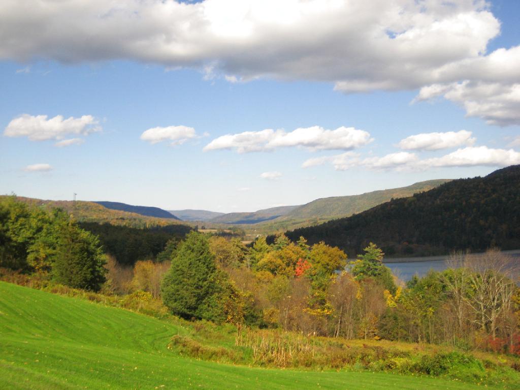
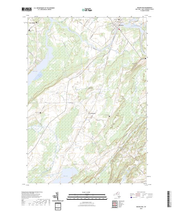
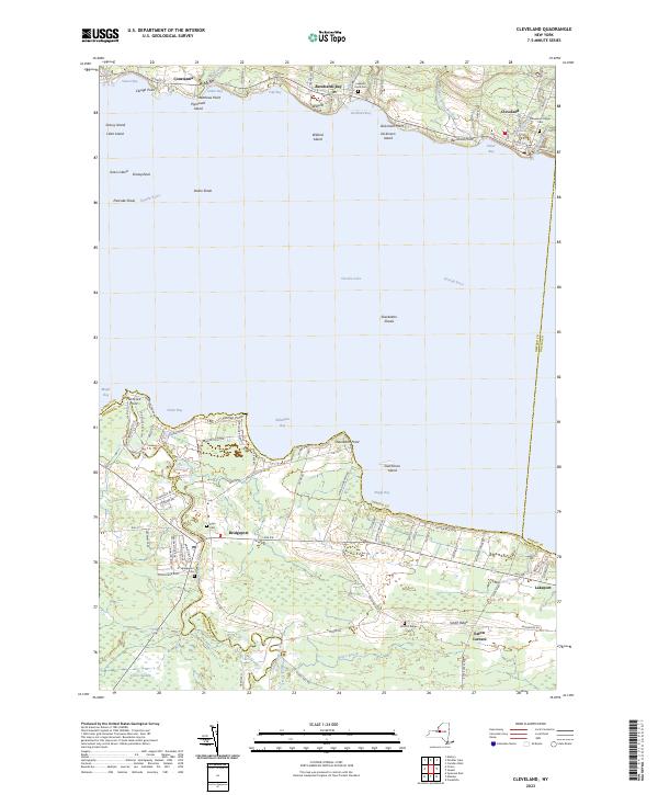
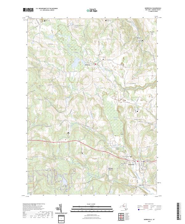
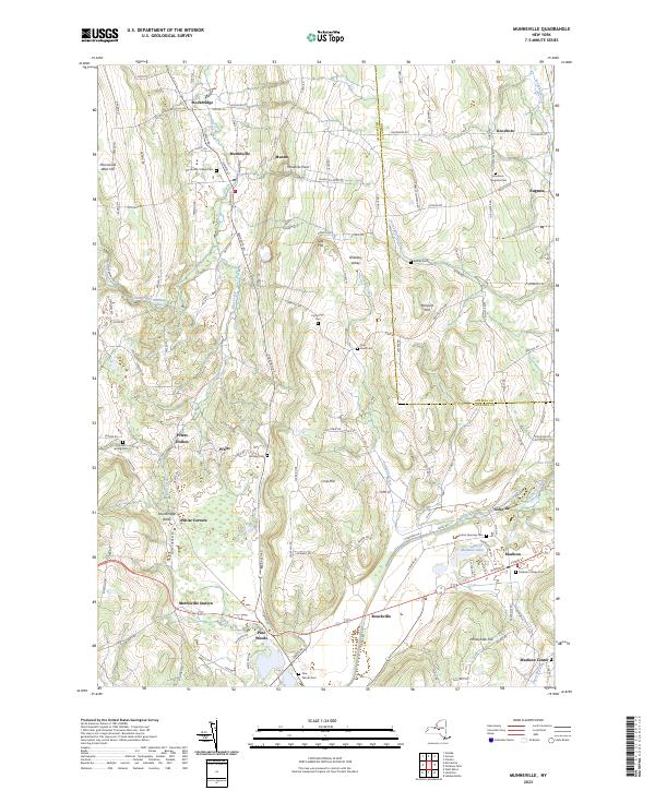
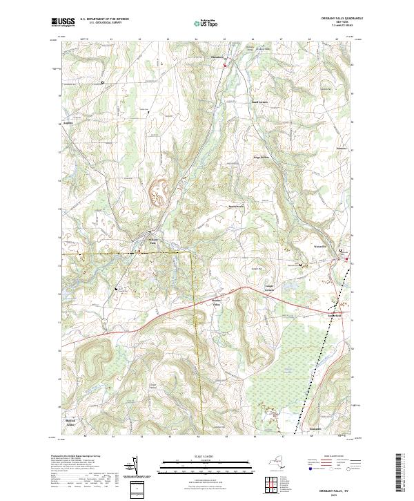
One of the most important things is to understand the communities I’m interested in. 🔍 I think I know a bit or two growing up Westerlo, but things have changed. I really don’t know much about the local culture in Rensselaer County, although I know the county’s politics is much more conservative then Albany, and it has a tradition of real colorful characters in politics, for good or bad.  👩‍🌾 The hill towns of Albany County are easier in that sense — I grew up there so I’m a lot more familiar with the back-roads and local culture. Plus I’ve spent a lot of time in back roads of West Virigina, Allegany County and Madison County, NY though most of the time it was camping, so maybe I didn’t spend that much time visiting local watering hoes.

Sunday looks to be wetter but still mild. Showers likely, mainly before 3pm. 🌦 Partly sunny, with a high near 54. Southwest wind 10 to 17 mph becoming west in the afternoon. Chance of precipitation is 60%. New precipitation amounts of less than a tenth of an inch possible.

More darkness than light 🌃

Despite the nearly full moon, it was so dark last night at 7:30 pm while I was transferring buses by that guady old state office building downtown. It seems like more and more of the time I’m walking in the darkness or delaying my morning walk due to darkness. More time to enjoy delicious food I’m cooking up in the kitchen in the morning.

Good morning! Bumping over the Hump Day and the middle of the week and the night to day balance. Partly clear and 42 degrees in Delmar, NY. 🌅 Calm wind. You’ll need your choke on this morning until it warms up this morning and maybe gloves 🧤. It’s a bit chilly this morning at least for the fingers on the morning walk. 🚶 Fog around and the air tastes of silage. 🐮 Autumn is here. 🍂 The fresh bread was good this morning. 🍞

Today will be mostly sunny 🌞, with a high of 70 degrees at 3pm. Typical for today. Maximum dew point of 51 at 6pm. Northeast wind 3 to 6 mph. A year ago, we had cloudy skies in the morning, which became cloudy by afternoon. The high last year was 68 degrees. The record high of 89 was set in 2017. Amazing how quickly the average temperature drops this time of year.

Bed time was at nine o’clock. 🛏 I rose at five to cook. Early to bed, early to rise. ☺ Peas soaked overnight, with pea soup cooked this morning for lunch. 😋 Whole wheat has been baked. The dough was been kneaded for ten minutes – I find watching YouTube helps pass the time and is rising overnight for morning baking. Also will bake squash and zucchini at the same time to save energy. On the griddle this morning was oatmeal – banana pumpkin pancakes 🥞topped with frozen strawberries. 🍓 Yum!

Last night was brown rice, lentils, black beans with lots of turmeric and Chipotle pepper spice with green beans. 🍲 I cooked that this morning, made crispy in the broiler last. 🍏 Then non-fat plain Greek yogurt with shredded apples with ginger, cinnamon. Yum. It was a great to eat as I was hungry after attending a planning board meeting in Colonie regarding a proposed solar farm in the Albany Pine Bush. 🌲

Solar noon 🌞 is at 12:47 pm with sun having an altitude of 45.8° from the due south horizon (-25° vs. 6/21). A six foot person will cast a 5.8 foot shadow today compared to 2.2 feet on the first day of summer. The golden hour 🏅 starts at 6:09 pm with the sun in the west (262°). 📸 The sunset is in the west (269°) with the sun dropping below the horizon at 6:46 pm after setting for 2 minutes and 54 seconds with dusk around 7:12 pm, which is one minute and 46 seconds earlier than yesterday. 🌇 At dusk you’ll see the Full 🌝 Moon in the east-southeast (112°) at an altitude of 10° from the horizon, 226,705 miles away. 🚀 The best time to look at the stars is after 7:47 pm. At sunset, look for partly cloudy skies 🌃 and temperatures around 66 degrees. The dew point will be 51 degrees. There will be a east-northeast breeze at 5 mph. Tomorrow will have 11 hours and 56 minutes of daytime, a decrease of 2 minutes and 52 seconds over today.

Tonight will be partly cloudy 🌃 , with a low of 44 degrees at 6am. Four degrees below normal, which is similar to a typical night around October 7th. Calm wind. In 2022, we had mostly clear skies in the evening, which became partly cloudy by the early hours of the morning. It got down to 52 degrees. The record low of 24 occurred back in 1947.

Last night I went up to a scoping overview meeting 👨 👨‍⚖️👴 
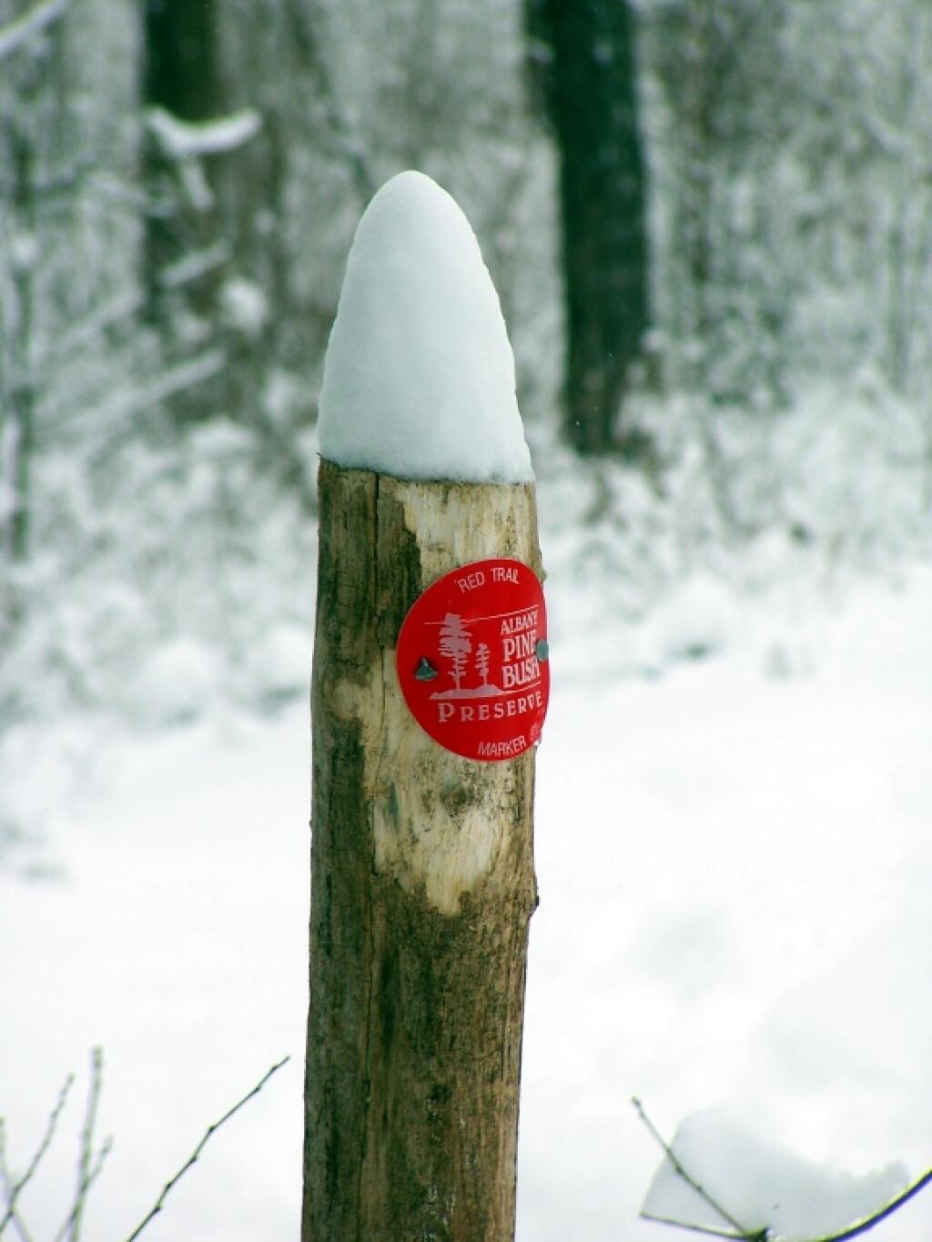
in Colonie over a proposal solar facility in the Albany Pine Bush, next to a known butterfly site. 🦋 While they didn’t take scoping comment at this meeting, and I had to leave early to catch the bus home 🚌 around 7 PM due to the next bus not being another hour, and it wouldn’t have worked with the connecting bus back home. I honestly didn’t want to drive up there, as I don’t have parking downtown, and Lynne was out of town so I couldn’t get a ride there, but it was important for as many Save the Pine Bush members as possible to be there.

Riding to the Colonie Town Hall on a bicycle at rush hour this evening was fun, bypassing all the cars stuck in traffic on the shoulder. 🚘 The hills on Lark Street aren’t that bad, Northern Boulevard is nice with the bike lanes, the merge onto US 9 from Northern Boulevard is a bit sketchy due to the narrow shoulder just past the ramp. The rest of US 9 for the most part has a good shoulder. Honestly, I did not mind the ride. Plus it got my exercise part of the day in with my morning commute downtown yesterday.

I do wish there was more CDTA Route 182 buses in the evening, had to leave the planning board meeting a few minutes early. 🚍 Or more daylight, I would have ridden back downtown if not already dark. But I certainly wasn’t going to ride US 9 after dark, especially without a bike taillight — which I lost this past weekend mountain biking up at the Thacher.

A picture perfect autumn weekend on tap. 🍁 Saturday, mostly sunny, with a high near 74. Maximum dew point of 58 at 12pm. Sunday, sunny, with a high near 76. Maximum dew point of 59 at 4pm. Typical average high for the weekend is 68 degrees. Heat wave! Even warmer next week. I really should take Friday off. Maybe I will.

I am also thinking of requesting off October 16-20th to go down to West Virginia. ⛰ 
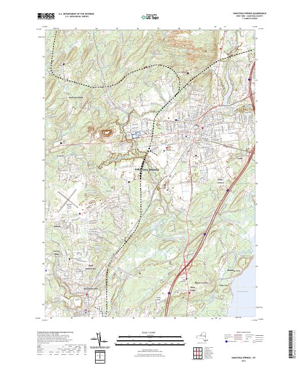
This is the week after Columbus Day Weekend, probably somewhat beyond peak color, though I expect it to be late this year due to the mild weather. 🍁 That said, it will very a lot depending on my elevation, and I’m not necessarily set on going all the way to WV — it’s such a long multi-day drive in my old truck. I could do a trip to Allegheny National Forest as an alternative, or maybe the Tug Hill Plateau and North Country. That’s a trip I will explore this afternoon most likely as a blog post.

Looking ahead but maybe not forward, next Wednesday is Last Sunset After 6:30 PM 🌆 when the sun will be setting at 6:33 pm with dusk at 7:00 pm. On that day in 2022, we had mostly cloudy, rain showers and temperatures between 60 and 47 degrees. Typically, the high temperature is 67 degrees. We hit a record high of 86 back in 1891.

Schoharie Valley

Twenty two years ago on this September 11th 🇺🇸

Hard to believe it was 22 years ago that I was a freshman in college at Hudson Valley Community College on that day with the bright blue skies, listening to Amy Goodman and seeing those terrorist attacks on television at my college statistics class before college adjourned for the day and I spent it just walking along High Point Road in Berne, looking up and noticing the skies without airplanes above.

Good morning! Rain showers and 69 degrees in Delmar. ☔ Calm wind. The dew point is 65 degrees. The skies will clear Wednesday around 11 pm.

Catching the earlier express bus 🚍 downtown so I walk 🚶 in the Plaza before work as it’s really not a particularly nice day. Kind of a dreary autumn day, though at least not so hot. Certainly not the crisp, clear day of 22 years ago. I don’t want to go back to those days with all trials and tribulations ahead of me as I started in college, 🎓 it’s kind of nice to be in the midlife even if things aren’t perfect every day. That was quite a time, when so much possibility ahead existed, when I was learning so much and changing so quickly. I was bad yesterday, didn’t get my steps in, 👣 but this morning I plan to do the stairs maybe twice at work, and walk the Plaza in an attempt to get in 10,000 steps for the day.

Twenty two years is a long time ⏳ even if in the grand scheme of things it’s not. 14 ½ years from now my mom was pointing out I will be 55 years old and if I’m still working for the state at that point I’ll have in close to 30 years and can collect my Tier 4 pension if I decide to do alternative things. 💵 Maybe move out west, have that off-grid homestead property I want. By then I’m hoping to have $1.5 million in assets put away though some I won’t be able to tap until 59 1/2 (IRA) but it’s still young enough that if I stay healthy and continue to improve my physical shape there is a lot of possibilities at that age. September 11th in 2001 seems like just yesterday but it was a long time ago now. 🏙

Today will have showers likely, with thunderstorms also possible after 1pm. Mostly cloudy 🌦, with a high of 71 degrees at 1pm. Five degrees below normal, which is similar to a typical day around September 24th. Maximum dew point of 67 at 1pm. Calm wind becoming north 5 to 7 mph in the morning. Chance of precipitation is 60%. New rainfall amounts between a tenth and quarter of an inch, except higher amounts possible in thunderstorms. A year ago, we had mostly sunny skies in the morning, remaining cloudy in the afternoon. It was somewhat humid. The high last year was 74 degrees. The record high of 98 was set in 1931.

Listening to Where Were You When the World Stopped Turning while doing my morning walk 🚶 around the Plaza. I’m actually surprised there is less of a police 👮 presence as there was in years past on the anniversary. I guess September 11th has been forgotten but then again it was more than a generation ago now – and I’m sure the threat analysis by terrorism center kept the color code green or blue. I remember that day so well, listening to the attacks live with Amy Goodman on Democracy Now, followed by that somewhat old lady troublemaker sounding Rezsin Adams who read 📖 from the Nation Magazine like she did every morning after Democracy Now on WRPI. It’s been decades now since she was kicked off the radio, 📻 and going on three years since her passing. It’s good I got to know her when I was at her house folding the Save the Pine Bush newsletter.

Solar noon 🌞 is at 12:53 pm with sun having an altitude of 52° from the due south horizon (-18.8° vs. 6/21). A six foot person will cast a 4.7 foot shadow today compared to 2.2 feet on the first day of summer. The golden hour 🏅 starts at 6:38 pm with the sun in the west (271°). 📸 The sunset is in the west (277°) with the sun dropping below the horizon at 7:15 pm after setting for 2 minutes and 55 seconds with dusk around 7:41 pm, which is one minute and 46 seconds earlier than yesterday. 🌇 The best time to look at the stars is after 8:17 pm. At sunset, look for rain 🌧 and temperatures around 70 degrees. The dew point will be 65 degrees. There will be a north breeze at 6 mph. Today will have 12 hours and 44 minutes of daytime, a decrease of 2 minutes and 50 seconds over yesterday.

Yesterday, after a few hours of cussing including on Facebook 🤬 and playing around with controls on my bike and some internet research, I got the bicycle shifting smoothly again. ⚙ 🚲 I think what happened is a snagged the front derailleur cable on some bushes when I was riding at the back country at Thacher Park, plus over the past 750 miles or so of riding, cables have stretched. I think it’s good enough for now, though come the end of the year, I’ll take Blackie to the shop for a full tune up — the gears professionally adjusted for smooth shifting along with the wheels trued again. 🚵‍♀️ If I have continued problems with noisy operation or rough shifting, I will just take it back to Steiner Sports to get tuned up and maybe that cable replaced in the front. Sucks I have to put more money into the bike already, but in the grand scheme of things it’s not going to cost that much, even in these inflationary times. The gear adjusting is actually pretty simple to do, I can’t imagine they would charge a small fortune for 5 minutes on the bike stand to index the gears.

I also glued back together the lid on my mini food processor/chopped 👨‍🍳 and it’s working fine after shattering yesterday, but I got looking at getting a full-sized food processor with a dough blade and a big enough motor to knead dough. I would then “retire” my mini-food to my camping supplies, as it works well enough now glued together but I really want something for more power for at home, especially if want to use it to help automate the bread and dough making processor, make chickpea and red lentil flower, larger batches of hummus, etc. 🍞 🍌 I don’t mind kneading dough, but it sure would be convenient to dump the ingredients in, have things kneaded for me without a full bread machine. Looking at $60 model at Wally World, which is not a super high-end but should do that trick with enough power, assuming my dough aren’t so sticky and far more powerful then the 70 watt mini processor.  Truth be told I don’t need the mini-food processor for camping, but I sure like the sauces it makes, and how it mills the oatmeal perfectly for oatmeal-banana pancakes, and perfectly scrambled eggs. And it really has minimal current draw on the inverter.

I am a little worried about money, 🤑 but this week is a pay week and my credit card bill gets retired on Friday automatically, so that will help restore my credit limit. It’s funny but when you do the Autopay, it does it the date the bill is due, so it really covers the cost of summer vacation now. Plus I’ve had more costs with inflation, high food and gas prices ⛽ and a lot more summer travel over the past few months — to say nothing of getting more spices and kitchen supplies for doing more cooking. 🥘 But it’s good as eating healthier is an investment in my future. And it most of my concerns are short-term, if I have to move money around for a few days from a rainy day fund, it’s not the end of the world.

Tonight will be scattered showers, mainly before 7pm. Patchy fog after 2am. Otherwise, mostly cloudy ☁️, with a low of 61 degrees at 5am. Seven degrees above normal, which is similar to a typical night around August 19th. Maximum dew point of 66 at 6pm. North wind around 6 mph becoming calm after midnight. Chance of precipitation is 30%. New precipitation amounts of less than a tenth of an inch possible. In 2022, we had light rain in the evening, which became cloudy by the early hours of the morning. It was humid. It got down to 65 degrees. The record low of 36 occurred back in 1875.

I think I might have a bladder infection 🚽 as I am going to the doctor’s this afternoon to get checked out. For a while I was chocking going to the bathroom at night and having to stop so much when traveling to just eating a lot of fresh fruits and vegetables with farm stand season underway, especially all those aciditic tomatoes and peaches, 🍑 🍅 but I was talking to my parents this weekend, and I think it’s best to get it checked out, especially before it could spread to my kidneys. Turns out it’s a simple test, and then antibotics if necessary. And then relief from pissing all of the time. It’s kind of bad that I can’t go anywhere these days without needing a pee break every hour or so, especially in the morning. Maybe I need to cut back on the coffee but I think I might also have an issue — and I’ve noticed some soreness since Friday.

Cool almost autumn like weekend ahead. 🍂 Maybe the North Country will have it’s first hints of autumn this weekend. I thought about heading north, but I think I’d rather wait for more color. It will be refreshing after all the heat and humidity of late. Saturday, mostly sunny, with a high near 72. Maximum dew point of 53 at 12pm. Sunday, mostly sunny, with a high near 75. Maximum dew point of 58 at 12pm. Typical average high for the weekend is 75 degrees. 😀

This weekend I would like to head out of town. ⛺ Maybe Rennselearville State Forest or hammock camping at Cole Hill State Forest is an inexpensive option, I know mom wants me to go apple 🍏 picking with dad come Sunday. Not totally sure, the sunsets are so much earlier this time of year. If I want to head north, it’s best to take off Friday and just leave early that day to get north. That said, I think I’d rather wait until there is more color for a trip up north. 🍂 I wouldn’t mind a couple of quiet nights in the woods, even though the nights are much longer now, and some trail riding.

Looking ahead but not forward, next Monday is 7 PM Sunset 🌆 with dusk at 7:28 pm. On that day in 2022, we had rain and temperatures between 80 and 62 degrees. Typically, the high temperature is 74 degrees. We hit a record high of 91 back in 1891.

Tree on Bank of Lake Ontario

USGS Topographic Maps – Putnam to Suffolk

Counties: Albany to Delaware / Dutchess to Livingston / Madison to Otsego / Putnam to Suffolk / Sullivan to Yates

Browse Topographic Maps: Full State / Historical USGS Topographic Maps

Putnam County

PDF (50-60 MB Download) Historical USGS Topo Maps State Lands (Links to DEC Website) Towns (Percent of Town’s Area)
Current Brewster GeoPDF Map
1943 Map No. 123002, 1958 Map No. 123007, 1958 Map No. 123008, 1958 Map No. 123009, 1958 Map No. 137128, 1958 Map No. 137129 Great Swamp WMA, Bog Brook Unique Area, Cranberry Mountain WMA Patterson (52%), Southeast (62%)
Current Croton Falls GeoPDF Map
1944 Map No. 137748, 1960 Map No. 137197, 1960 Map No. 137749, 1960 Map No. 137750, 1960 Map No. 137751 NA Bedford (20%), Carmel (20%), Lewisboro (22%), North Salem (32%), Somers (74%), Southeast (6%)
Current Hopewell Junction GeoPDF Map
1957 Map No. 129768, 1957 Map No. 129769, 1957 Map No. 129770, 1981 Map No. 129767 NA Beekman (1%), East Fishkill (74%), Fishkill (14%), Kent (2%), Wappinger (27%)
Current Lake Carmel GeoPDF Map
1943 Map No. 130161, 1960 Map No. 130165, 1960 Map No. 130166, 1960 Map No. 130167, 1960 Map No. 130168 White Pond Multiple Use Area, Nimham Mountain Multiple Use Area, Big Buck Mountain Multiple Use Area Carmel (50%), Kent (53%), Patterson (17%), Southeast (21%)
Current Mohegan Lake GeoPDF Map
1956 Map No. 130593, 1956 Map No. 130594, 1956 Map No. 130595, 1956 Map No. 130596, 1956 Map No. 137454 Salt Hill State Forest Carmel (13%), Cortlandt (12%), Putnam Valley (25%), Somers (23%), Yorktown (67%)
Current Oscawana Lake GeoPDF Map
1956 Map No. 135907, 1956 Map No. 135908, 1956 Map No. 135909, 1956 Map No. 137493 California Hill State Forest Carmel (17%), East Fishkill (0%), Fishkill (1%), Kent (35%), Philipstown (13%), Putnam Valley (62%)
Current Pawling GeoPDF Map
1945 Map No. 135979, 1958 Map No. 135980, 1958 Map No. 135981, 1958 Map No. 135982, 1958 Map No. 136773, 1998 Map No. 136774 West Mountain State Forest, Great Swamp WMA, Cranberry Mountain WMA Dover (7%), Patterson (26%), Pawling (70%)
Current Peach Lake GeoPDF Map
1945 Map No. 135984, 1958 Map No. 135985, 1958 Map No. 135986, 1958 Map No. 135987, 1958 Map No. 135988, 1958 Map No. 135989, 1958 Map No. 136775, 1958 Map No. 136776, 1998 Map No. 136777 NA Bedford (1%), Lewisboro (56%), North Salem (68%), Pound Ridge (7%), Southeast (10%)
Current Peekskill GeoPDF Map
1947 Map No. 128944, 1957 Map No. 128946, 1957 Map No. 128948, 1957 Map No. 128949, 1957 Map No. 136783, 1957 Map No. 136784, 1957 Map No. 136785 NA Cortlandt (40%), Highlands (20%), Peekskill city (100%), Philipstown (24%), Putnam Valley (6%), Stony Point (28%)
Current Poughquag GeoPDF Map
1948 Map No. 129160, 1948 Map No. 129161, 1960 Map No. 129162, 1960 Map No. 129163, 1960 Map No. 129164, 1960 Map No. 136833 White Pond Multiple Use Area, Depot Hill Multiple Use Area, West Mountain State Forest, Big Buck Mountain Multiple Use Area, Sylvan Lake Waterway Access Beekman (72%), Dover (0%), East Fishkill (24%), Kent (10%), Patterson (5%), Pawling (30%)
Current West Point GeoPDF Map
1941 Map No. 140199, 1947 Map No. 140198, 1957 Map No. 137014, 1957 Map No. 140200, 1957 Map No. 140201, 1957 Map No. 140202 NA Beacon city (36%), Cornwall (8%), Fishkill (29%), Highlands (21%), New Windsor (0%), Newburgh city (4%), Philipstown (63%), Putnam Valley (7%)

Queens County

PDF (50-60 MB Download) Historical USGS Topo Maps State Lands (Links to DEC Website) Towns (Percent of Town’s Area)
Current Brooklyn GeoPDF Map
1947 Map No. 123124, 1956 Map No. 123127, 1956 Map No. 123128, 1967 Map No. 123129, 1967 Map No. 123130, 1967 Map No. 123131, 1967 Map No. 123132, 1995 Map No. 137132 NA Brooklyn borough (47%), Manhattan borough (18%), Queens borough (10%)
Current Central Park GeoPDF Map
1947 Map No. 122894, 1956 Map No. 122895, 1956 Map No. 122896, 1966 Map No. 122897, 1966 Map No. 122898, 1966 Map No. 122899, 1966 Map No. 122900, 1995 Map No. 137165 Bronx River Trail Bronx borough (31%), Manhattan borough (68%), Queens borough (7%)
Current Coney Island GeoPDF Map
1947 Map No. 137694, 1955 Map No. 137695, 1966 Map No. 137182, 1966 Map No. 137183, 1966 Map No. 137696, 1966 Map No. 137698, 1995 Map No. 137185 NA Brooklyn borough (29%), Queens borough (3%)
Current Far Rockaway GeoPDF Map
1947 Map No. 138136, 1954 Map No. 138137, 1969 Map No. 138139, 1969 Map No. 138140 Norton Basin Natural Resource Area Brooklyn borough (7%), Hempstead (1%), Queens borough (11%)
Current Flushing GeoPDF Map
1947 Map No. 138246, 1947 Map No. 138247, 1955 Map No. 138248, 1955 Map No. 138249, 1966 Map No. 137330, 1966 Map No. 138250, 1966 Map No. 138251, 1966 Map No. 138252, 1995 Map No. 137332 Bronx River Trail Bronx borough (42%), North Hempstead (2%), Queens borough (17%)
Current Jamaica GeoPDF Map
1947 Map No. 129963, 1957 Map No. 129966, 1966 Map No. 129967, 1966 Map No. 137279, 1979 Map No. 129968, 1994 Map No. 137282 NA Brooklyn borough (6%), Hempstead (0%), Queens borough (41%)
Current Lawrence GeoPDF Map
1947 Map No. 130229, 1954 Map No. 130230, 1966 Map No. 130231, 1966 Map No. 130232, 1966 Map No. 130233 NA Hempstead (11%), Long Beach city (100%), Queens borough (1%)
Current Lynbrook GeoPDF Map
1947 Map No. 130380, 1954 Map No. 130381, 1954 Map No. 130382, 1969 Map No. 130383, 1969 Map No. 191791 Oceanside Landing Waterway Access Site, Inwood Bay State Tidal Wetland Hempstead (30%), North Hempstead (7%), Queens borough (9%)
Current Sea Cliff GeoPDF Map
1947 Map No. 136120, 1954 Map No. 136115, 1954 Map No. 136116, 1968 Map No. 136117, 1968 Map No. 136118 Udall’s Cove And Ravine Natural Resource Area, Udall’s Cove And Ravine Natural Resource Area Glen Cove city (36%), North Hempstead (70%), Oyster Bay (2%), Queens borough (2%)

Rensselaer County

PDF (50-60 MB Download) Historical USGS Topo Maps State Lands (Links to DEC Website) Towns (Percent of Town’s Area)
Current Averill Park GeoPDF Map
1953 Map No. 136750, 1953 Map No. 136751, 1953 Map No. 136752, 1953 Map No. 136753 Poesten Kill Fishing Access Brunswick (30%), Grafton (10%), North Greenbush (9%), Poestenkill (65%), Sand Lake (39%)
Current Berlin GeoPDF Map
1944 Map No. 123255, 1960 Map No. 123261, 1960 Map No. 123262, 1973 Map No. 123263, 1973 Map No. 123264, 1973 Map No. 350003, 1997 Map No. 137103 Berlin State Forest, Taconic Ridge State Forest Berlin (46%), Petersburgh (27%)
Current Delmar GeoPDF Map
1953 Map No. 137861, 1953 Map No. 137862, 1953 Map No. 137863, 1953 Map No. 137865, 1953 Map No. 137866, 1978 Map No. 137864 Coeymans Creek WMA, Onesquethaw Creek Fishing Access Albany city (2%), Bethlehem (81%), Coeymans (19%), East Greenbush (5%), New Scotland (0%), Rensselaer city (8%), Schodack (4%)
Current Eagle Bridge GeoPDF Map
1944 Map No. 137939, 1944 Map No. 137940, 1944 Map No. 137987 Hoosick River Waterway Access Cambridge (46%), Easton (1%), Hoosick (25%), Pittstown (24%), Schaghticoke (2%), White Creek (10%)
Current East Chatham GeoPDF Map
1953 Map No. 137998, 1953 Map No. 137999, 1953 Map No. 138000 NA Canaan (13%), Chatham (76%), Nassau (12%), New Lebanon (11%), Schodack (0%), Stephentown (0%)
Current East Greenbush GeoPDF Map
1953 Map No. 138003, 1953 Map No. 138004, 1953 Map No. 138006, 1953 Map No. 138007, 1978 Map No. 138005 NA East Greenbush (67%), Rensselaer city (5%), Sand Lake (4%), Schodack (58%)
Current Grafton GeoPDF Map
1954 Map No. 129593, 1954 Map No. 129594, 1954 Map No. 129596, 1978 Map No. 129595 Pittstown State Forest Grafton (60%), Hoosick (13%), Petersburgh (6%), Pittstown (25%)
Current Hancock MA-NY GeoPDF Map
NA Taconic Ridge State Forest Berlin (4%), New Lebanon (2%), Stephentown (27%)
Current Hoosick Falls GeoPDF Map
1943 Map No. 129760, 1943 Map No. 129761, 1943 Map No. 129762, 1943 Map No. 129763, 1995 Map No. 137261 Chestnut Woods State Forest, Mount Tom State Forest Hoosick (38%), White Creek (42%)
Current Kinderhook GeoPDF Map
1953 Map No. 130032, 1953 Map No. 130033, 1980 Map No. 130034 NA Chatham (14%), Kinderhook (81%), Nassau (1%), Schodack (18%), Stuyvesant (37%)
Current Mechanicville GeoPDF Map
1954 Map No. 130513, 1954 Map No. 130514, 1954 Map No. 130515, 1954 Map No. 137440 NA Easton (1%), Halfmoon (27%), Malta (1%), Mechanicville city (100%), Schaghticoke (22%), Stillwater (75%)
Current Nassau GeoPDF Map
1953 Map No. 130763, 1953 Map No. 130764, 1953 Map No. 130765, 1953 Map No. 130766 Kinderhook Creek Fishing Access Nassau (76%), Sand Lake (33%), Schodack (13%), Stephentown (0%)
Current North Pownal GeoPDF Map
1954 Map No. 128766, 1954 Map No. 128767 Tibbitts State Forest, Taconic Ridge State Forest Grafton (0%), Hoosick (23%), Petersburgh (62%)
Current Ravena GeoPDF Map
1953 Map No. 136024, 1953 Map No. 136025, 1953 Map No. 136026 Bronck Island, Hannacroix Unique Area, Van Schaak Unique Area, New Baltimore FP Detached Parcel, Nutten Hook State Tidal Wetland, Coeymans Creek WMA Coeymans (25%), Coxsackie (3%), New Baltimore (61%), Schodack (7%), Stuyvesant (38%)
Current Schaghticoke GeoPDF Map
1954 Map No. 129418, 1954 Map No. 129419, 1954 Map No. 136897, 1954 Map No. 136898 NA Cambridge (5%), Easton (35%), Pittstown (15%), Schaghticoke (38%), Stillwater (3%)
Current Stephentown Center GeoPDF Map
1945 Map No. 136935, 1945 Map No. 136936, 1945 Map No. 139895, 1945 Map No. 139896 Capital District WMA Berlin (8%), Nassau (11%), New Lebanon (3%), Sand Lake (7%), Stephentown (72%)
Current Taborton GeoPDF Map
1946 Map No. 139966, 1946 Map No. 139967, 1946 Map No. 139968 Cowee State Forest, Capital District WMA Berlin (42%), Grafton (22%), Petersburgh (5%), Poestenkill (35%), Sand Lake (16%)
Current Tomhannock GeoPDF Map
1954 Map No. 139329, 1954 Map No. 139330 Pittstown State Forest Brunswick (45%), Grafton (8%), Pittstown (36%), Schaghticoke (15%)
Current Troy North GeoPDF Map
1954 Map No. 139377, 1954 Map No. 139378, 1954 Map No. 139379, 1954 Map No. 139381, 1978 Map No. 139380 NA Brunswick (12%), Cohoes city (100%), Colonie (12%), Green Island (42%), Halfmoon (45%), Schaghticoke (23%), Troy city (30%), Waterford (100%)
Current Troy South GeoPDF Map
1953 Map No. 139382, 1953 Map No. 139383, 1953 Map No. 139384, 1953 Map No. 139386, 1953 Map No. 139387, 1978 Map No. 139385 NA Albany city (8%), Brunswick (12%), Colonie (18%), East Greenbush (28%), Green Island (58%), North Greenbush (91%), Rensselaer city (84%), Sand Lake (1%), Troy city (70%), Watervliet city (100%)

Richmond County

Rockland County

PDF (50-60 MB Download) Historical USGS Topo Maps State Lands (Links to DEC Website) Towns (Percent of Town’s Area)
Current Haverstraw GeoPDF Map
1938 Map No. 139675, 1955 Map No. 129836, 1955 Map No. 129837, 1967 Map No. 129835, 1979 Map No. 129834 Minisceongo Creek Err, Montrose Point State Forest Clarkstown (45%), Cortlandt (36%), Haverstraw (31%), Mount Pleasant (0%), Ossining (20%), Stony Point (15%)
Current Nyack GeoPDF Map
1937 Map No. 128835, 1940 Map No. 128836, 1957 Map No. 128843, 1957 Map No. 128844, 1967 Map No. 128833, 1967 Map No. 128845, 1967 Map No. 128846 Piermont Marsh State Tidal Wetland Clarkstown (31%), Greenburgh (13%), Mount Pleasant (10%), Orangetown (87%)
Current Park Ridge GeoPDF Map
NA NA Clarkstown (13%), Orangetown (13%), Ramapo (25%)
Current Peekskill GeoPDF Map
1947 Map No. 128944, 1957 Map No. 128946, 1957 Map No. 128948, 1957 Map No. 128949, 1957 Map No. 136783, 1957 Map No. 136784, 1957 Map No. 136785 NA Cortlandt (40%), Highlands (20%), Peekskill city (100%), Philipstown (24%), Putnam Valley (6%), Stony Point (28%)
Current Popolopen Lake GeoPDF Map
1946 Map No. 129072, 1947 Map No. 129074, 1957 Map No. 129075, 1957 Map No. 129076, 1957 Map No. 129077, 1957 Map No. 129078, 1957 Map No. 129079, 1994 Map No. 136820 NA Cornwall (1%), Highlands (47%), Stony Point (30%), Tuxedo (11%), Woodbury (69%)
Current Ramsey GeoPDF Map
NA NA Ramapo (5%)
Current Sloatsburg GeoPDF Map
1955 Map No. 136181, 1955 Map No. 136182 NA Haverstraw (7%), Ramapo (31%), Tuxedo (62%), Warwick (1%)
Current Thiells GeoPDF Map
1955 Map No. 136954, 1955 Map No. 140002, 1955 Map No. 140003, 1955 Map No. 140004 NA Clarkstown (11%), Haverstraw (62%), Ramapo (38%), Stony Point (27%), Tuxedo (4%)

Saratoga County

PDF (50-60 MB Download) Historical USGS Topo Maps State Lands (Links to DEC Website) Towns (Percent of Town’s Area)
Current Burnt Hills GeoPDF Map
1954 Map No. 123058, 1954 Map No. 123059, 1954 Map No. 123060, 1954 Map No. 123061, 1954 Map No. 137138 Saratoga FP Detached Parcel Ballston (56%), Charlton (63%), Clifton Park (4%), Galway (4%), Glenville (24%), Milton (3%)
Current Conklingville GeoPDF Map
1966 Map No. 137186, 1966 Map No. 137699 Stewarts Bridge Reservoir Fishing Access, Wilcox Lake Wild Forest Corinth (14%), Day (30%), Edinburg (1%), Hadley (61%), Lake Luzerne (0%)
Current Corinth GeoPDF Map
1935 Map No. 137818, 1968 Map No. 137819 Hudson River Waterway Access, Saratoga FP Detached Parcel, Warren FP Detached Parcel, Daniels Road State Forest, Lincoln Mountain State Forest Corinth (37%), Greenfield (32%), Lake Luzerne (5%), Moreau (2%), Wilton (22%)
Current Edinburg GeoPDF Map
1945 Map No. 138037, 1946 Map No. 138038, 1970 Map No. 138039, 1970 Map No. 138040, 1997 Map No. 137350 Wilcox Lake Wild Forest Broadalbin (1%), Edinburg (59%), Northampton (0%), Providence (32%)
Current Fort Miller GeoPDF Map
1935 Map No. 139555 Washington County Grasslands Argyle (16%), Fort Edward (65%), Greenwich (23%), Moreau (10%), Northumberland (38%)
Current Galway GeoPDF Map
1945 Map No. 138100, 1970 Map No. 138101 Saratoga FP Detached Parcel, Wilcox Lake Wild Forest Broadalbin (15%), Galway (59%), Perth (3%), Providence (48%)
Current Gansevoort GeoPDF Map
1935 Map No. 138104, 1968 Map No. 137217, 1968 Map No. 137218, 1968 Map No. 138106 Saratoga Sand Plains State Forest, Saratoga Sand Plains WMA Corinth (0%), Lake Luzerne (0%), Moreau (44%), Northumberland (48%), Wilton (54%)
Current Glens Falls GeoPDF Map
1966 Map No. 129551 NA Glens Falls city (94%), Lake George (0%), Lake Luzerne (2%), Moreau (29%), Queensbury (54%)
Current Harrisburg GeoPDF Map
NA Wilcox Lake Wild Forest Day (4%), Hadley (0%), Stony Creek (44%), Thurman (17%)
Current Hope Falls GeoPDF Map
NA Silver Lake Wilderness, Shaker Mountain Wild Forest, Wilcox Lake Wild Forest Benson (3%), Day (9%), Edinburg (7%), Hope (83%), Northampton (1%), Stony Creek (0%), Wells (3%)
Current Hudson Falls GeoPDF Map
1966 Map No. 129932, 1966 Map No. 129933, 1966 Map No. 129934 Hudson River Boat Launch, Washington County Grasslands Argyle (9%), Fort Edward (35%), Glens Falls city (6%), Kingsbury (69%), Moreau (14%), Queensbury (8%)
Current Lake Luzerne GeoPDF Map
1968 Map No. 130177, 1968 Map No. 137309, 1968 Map No. 137310 Ralph Road State Forest, Wilcox Lake Wild Forest, Hudson River Special Management Area, Lake George Wild Forest, Upper Hudson River Boat Launch, Luzerne Campground Corinth (7%), Hadley (22%), Lake George (0%), Lake Luzerne (73%), Queensbury (3%)
Current Mechanicville GeoPDF Map
1954 Map No. 130513, 1954 Map No. 130514, 1954 Map No. 130515, 1954 Map No. 137440 NA Easton (1%), Halfmoon (27%), Malta (1%), Mechanicville city (100%), Schaghticoke (22%), Stillwater (75%)
Current Middle Grove GeoPDF Map
1935 Map No. 130544, 1967 Map No. 130545, 1967 Map No. 137443 Kayaderosseras Creek Fishing Access, Daketown State Forest, Middle Grove State Forest Galway (25%), Greenfield (20%), Milton (68%), Providence (12%)
Current Niskayuna GeoPDF Map
1954 Map No. 128733, 1954 Map No. 128734, 1954 Map No. 128735, 1954 Map No. 137464 NA Clifton Park (58%), Colonie (22%), Halfmoon (17%), Niskayuna (48%)
Current Northville GeoPDF Map
1945 Map No. 128798, 1946 Map No. 128799, 1970 Map No. 128800, 1970 Map No. 128801 Shaker Mountain Wild Forest, Wilcox Lake Wild Forest, Sacandaga River State Boat Launch, Northampton Beach Campground Benson (3%), Broadalbin (9%), Edinburg (3%), Hope (0%), Mayfield (18%), Northampton (99%)
Current Ohmer Mountain GeoPDF Map
NA Wilcox Lake Wild Forest, Great Sacandaga Lake Boat Launch Day (57%), Edinburg (22%), Stony Creek (0%)
Current Pattersonville GeoPDF Map
1954 Map No. 135974, 1954 Map No. 135975 NA Amsterdam (30%), Charlton (37%), Duanesburg (0%), Florida (5%), Galway (13%), Glenville (40%), Perth (6%), Princetown (7%), Rotterdam (5%)
Current Porter Corners GeoPDF Map
1968 Map No. 129132, 1968 Map No. 129133 Saratoga FP Detached Parcel, Lake Desolation State Forest, Wilcox Lake Wild Forest Corinth (43%), Edinburg (8%), Greenfield (30%), Providence (8%)
Current Quaker Springs GeoPDF Map
1934 Map No. 135998, 1967 Map No. 135999, 1967 Map No. 136000 Parcel 48 WMA, Saratoga Sand Plains Archery Range, Saratoga Sand Plains WMA Malta (5%), Northumberland (8%), Saratoga Springs city (30%), Saratoga (66%), Stillwater (16%), Wilton (18%)
Current Round Lake GeoPDF Map
1954 Map No. 129231, 1954 Map No. 129232, 1954 Map No. 129233 Ushers Road State Forest Ballston (43%), Clifton Park (34%), Halfmoon (11%), Malta (62%), Milton (0%), Stillwater (3%)
Current Saratoga Springs GeoPDF Map
1934 Map No. 129387, 1967 Map No. 129388, 1967 Map No. 129389 Saratoga Nursery, Kayaderosseras Creek Fishing Access, Daniels Road State Forest Ballston (0%), Greenfield (17%), Malta (32%), Milton (29%), Saratoga Springs city (70%), Stillwater (0%), Wilton (6%)
Current Schaghticoke GeoPDF Map
1954 Map No. 129418, 1954 Map No. 129419, 1954 Map No. 136897, 1954 Map No. 136898 NA Cambridge (5%), Easton (35%), Pittstown (15%), Schaghticoke (38%), Stillwater (3%)
Current Schenectady GeoPDF Map
1954 Map No. 129430, 1954 Map No. 129431, 1954 Map No. 129433, 1954 Map No. 129434 Albany Pine Bush Preserve Clifton Park (4%), Colonie (4%), Glenville (32%), Guilderland (3%), Niskayuna (52%), Princetown (0%), Rotterdam (36%), Schenectady city (100%)
Current Schuylerville GeoPDF Map
1935 Map No. 136111, 1967 Map No. 136112 Victory Mills Easton (50%), Greenwich (12%), Northumberland (6%), Saratoga (34%), Stillwater (3%)
Current Stony Creek GeoPDF Map
1968 Map No. 139902 Wilcox Lake Wild Forest, Hudson River Special Management Area, Lake George Wild Forest Day (0%), Hadley (18%), Lake Luzerne (0%), Stony Creek (41%), Thurman (13%), Warrensburg (1%)
Current Troy North GeoPDF Map
1954 Map No. 139377, 1954 Map No. 139378, 1954 Map No. 139379, 1954 Map No. 139381, 1978 Map No. 139380 NA Brunswick (12%), Cohoes city (100%), Colonie (12%), Green Island (42%), Halfmoon (45%), Schaghticoke (23%), Troy city (30%), Waterford (100%)

Schenectady County

PDF (50-60 MB Download) Historical USGS Topo Maps State Lands (Links to DEC Website) Towns (Percent of Town’s Area)
Current Altamont GeoPDF Map
1944 Map No. 136597, 1944 Map No. 136598, 1944 Map No. 136599, 1944 Map No. 136602 Margaret Burke WMA Berne (12%), Duanesburg (3%), Guilderland (30%), Knox (60%), New Scotland (4%), Princetown (1%)
Current Burnt Hills GeoPDF Map
1954 Map No. 123058, 1954 Map No. 123059, 1954 Map No. 123060, 1954 Map No. 123061, 1954 Map No. 137138 Saratoga FP Detached Parcel Ballston (56%), Charlton (63%), Clifton Park (4%), Galway (4%), Glenville (24%), Milton (3%)
Current Duanesburg GeoPDF Map
1954 Map No. 137906, 1954 Map No. 137907, 1954 Map No. 137909 Featherstonhaugh State Forest Duanesburg (59%), Esperance (0%), Florida (24%)
Current Esperance GeoPDF Map
1943 Map No. 138118, 1943 Map No. 138120 Lost Valley State Forest, Charleston State Forest Carlisle (9%), Charleston (72%), Duanesburg (3%), Esperance (54%), Florida (7%), Glen (11%)
Current Gallupville GeoPDF Map
1944 Map No. 137216, 1944 Map No. 138096, 1944 Map No. 138097 Dutch Settlement State Forest Berne (3%), Duanesburg (16%), Knox (40%), Schoharie (2%), Wright (83%)
Current Niskayuna GeoPDF Map
1954 Map No. 128733, 1954 Map No. 128734, 1954 Map No. 128735, 1954 Map No. 137464 NA Clifton Park (58%), Colonie (22%), Halfmoon (17%), Niskayuna (48%)
Current Pattersonville GeoPDF Map
1954 Map No. 135974, 1954 Map No. 135975 NA Amsterdam (30%), Charlton (37%), Duanesburg (0%), Florida (5%), Galway (13%), Glenville (40%), Perth (6%), Princetown (7%), Rotterdam (5%)
Current Rotterdam Junction GeoPDF Map
1954 Map No. 129227, 1954 Map No. 129228, 1954 Map No. 129229, 1954 Map No. 129230 Featherstonhaugh State Forest Duanesburg (12%), Glenville (5%), Guilderland (0%), Princetown (92%), Rotterdam (59%)
Current Schenectady GeoPDF Map
1954 Map No. 129430, 1954 Map No. 129431, 1954 Map No. 129433, 1954 Map No. 129434 Albany Pine Bush Preserve Clifton Park (4%), Colonie (4%), Glenville (32%), Guilderland (3%), Niskayuna (52%), Princetown (0%), Rotterdam (36%), Schenectady city (100%)
Current Schoharie GeoPDF Map
1943 Map No. 129442, 1943 Map No. 129443, 1943 Map No. 129452, 1943 Map No. 136900 Cotton Hill State Forest, Dutch Settlement State Forest, Schoharie Creek Parking Fishing Access Carlisle (4%), Cobleskill (1%), Duanesburg (7%), Esperance (46%), Middleburgh (15%), Schoharie (95%), Wright (12%)

Schoharie County

PDF (50-60 MB Download) Historical USGS Topo Maps State Lands (Links to DEC Website) Towns (Percent of Town’s Area)
Current Ashland GeoPDF Map
1945 Map No. 136704, 1945 Map No. 136705, 1945 Map No. 136707, 1946 Map No. 136706 Huntersfield State Forest, Ashland Pinnacle State Forest, South Mountain State Forest, Mount Pisgah State Forest Ashland (91%), Conesville (13%), Jewett (21%), Lexington (6%), Prattsville (7%), Windham (24%)
Current Breakabeen GeoPDF Map
1943 Map No. 122989, 1943 Map No. 122990, 1943 Map No. 122992, 1943 Map No. 137126, 1943 Map No. 137127 Gates Hill State Forest, Keyserkill State Forest, Patria State Forest, Petersburg State Forest, Mallet Pond State Forest, Burnt-Rossman Hills State Forest Blenheim (13%), Broome (0%), Fulton (73%), Gilboa (0%), Middleburgh (3%), Richmondville (4%)
Current Carlisle GeoPDF Map
1943 Map No. 122809, 1943 Map No. 122810 Rural Grove State Forest, Yatesville Falls State Forest Carlisle (36%), Charleston (28%), Glen (5%), Root (56%)
Current Charlotteville GeoPDF Map
1943 Map No. 122912, 1943 Map No. 122913, 1943 Map No. 122916, 1943 Map No. 137167 Schenevus Creek Fishing Access, Lutheranville State Forest, Clapper Hollow State Forest Decatur (1%), Harpersfield (6%), Jefferson (17%), Summit (38%), Worcester (65%)
Current Cobleskill GeoPDF Map
1943 Map No. 137179, 1943 Map No. 137794, 1943 Map No. 137795, 1943 Map No. 137798, 1996 Map No. 137181 Petersburg State Forest Carlisle (41%), Cobleskill (92%), Fulton (4%), Middleburgh (13%), Richmondville (10%), Schoharie (3%)
Current Durham GeoPDF Map
1945 Map No. 137938, 1946 Map No. 137933, 1946 Map No. 137934, 1967 Map No. 137937 Catskill Creek Fishing Access, Mount Hayden State Forest, Mount Pisgah State Forest, Scott Patent State Forest, Rensselaerville State Forest Broome (4%), Conesville (0%), Durham (36%), Rensselaerville (57%), Windham (0%)
Current Esperance GeoPDF Map
1943 Map No. 138118, 1943 Map No. 138120 Lost Valley State Forest, Charleston State Forest Carlisle (9%), Charleston (72%), Duanesburg (3%), Esperance (54%), Florida (7%), Glen (11%)
Current Gallupville GeoPDF Map
1944 Map No. 137216, 1944 Map No. 138096, 1944 Map No. 138097 Dutch Settlement State Forest Berne (3%), Duanesburg (16%), Knox (40%), Schoharie (2%), Wright (83%)
Current Gilboa GeoPDF Map
1945 Map No. 129526, 1945 Map No. 129527, 1945 Map No. 129530, 1945 Map No. 129532, 1945 Map No. 129533 Keyserkill State Forest, Blenheim Hill State Forest, Burnt-Rossman Hills State Forest Blenheim (47%), Broome (0%), Conesville (18%), Gilboa (54%), Roxbury (0%)
Current Harpersfield GeoPDF Map
1945 Map No. 129799, 1945 Map No. 129800, 1982 Map No. 129798 NA Harpersfield (81%), Jefferson (19%), Kortright (15%), Stamford (6%)
Current Livingstonville GeoPDF Map
1945 Map No. 130298, 1945 Map No. 130301, 1946 Map No. 130299, 1962 Map No. 130300 South Mountain State Forest, Mount Pisgah State Forest, Stone Store State Forest, Keyserkill State Forest, Scott Patent State Forest, High Knob State Forest, Leonard Hill State Forest, Dutton Ridge State Forest, Bates State Forest Broome (42%), Conesville (64%), Durham (0%), Gilboa (13%), Rensselaerville (2%), Windham (0%)
Current Middleburgh GeoPDF Map
1944 Map No. 130551, 1944 Map No. 130552, 1944 Map No. 130555, 1944 Map No. 137444 Vroman’s Nose Unique Area, Stone Store State Forest, Armlin Hill State Forest, Gates Hill State Forest, Keyserkill State Forest, Dutton Ridge State Forest, Cotton Hill State Forest, Dutch Settlement State Forest, Franklinton Vlaie WMA Broome (45%), Fulton (8%), Middleburgh (57%), Wright (0%)
Current Prattsville GeoPDF Map
1945 Map No. 129181, 1945 Map No. 129182, 1945 Map No. 129183, 1946 Map No. 129184 Huntersfield State Forest, Bearpen Mountain State Forest Ashland (9%), Conesville (5%), Gilboa (4%), Halcott (12%), Lexington (13%), Prattsville (93%), Roxbury (18%)
Current Rensselaerville GeoPDF Map
1946 Map No. 136056, 1946 Map No. 136057 Dutch Settlement State Forest, Rensselaerville State Forest, Partridge Run State Forest, Partridge Run WMA Berne (42%), Broome (9%), Middleburgh (12%), Rensselaerville (26%), Wright (5%)
Current Richmondville GeoPDF Map
1944 Map No. 136070, 1944 Map No. 136071, 1944 Map No. 136072, 1944 Map No. 136858 NA Carlisle (2%), Cobleskill (7%), Richmondville (62%), Seward (83%), Sharon (7%), Summit (0%)
Current Schoharie GeoPDF Map
1943 Map No. 129442, 1943 Map No. 129443, 1943 Map No. 129452, 1943 Map No. 136900 Cotton Hill State Forest, Dutch Settlement State Forest, Schoharie Creek Parking Fishing Access Carlisle (4%), Cobleskill (1%), Duanesburg (7%), Esperance (46%), Middleburgh (15%), Schoharie (95%), Wright (12%)
Current Sharon Springs GeoPDF Map
1943 Map No. 136148, 1943 Map No. 136149, 1943 Map No. 136150 NA Canajoharie (39%), Carlisle (8%), Root (23%), Seward (0%), Sharon (61%)
Current South Valley GeoPDF Map
1943 Map No. 136210, 1943 Map No. 136211, 1943 Map No. 136212, 1943 Map No. 136929 Bear Swamp State Forest, Cherry Valley State Forest, Decatur State Forest, Honey Hill State Forest, Maple Valley State Forest, R. Milton Hick Memorial State Forest Decatur (95%), Richmondville (4%), Roseboom (58%), Seward (17%), Sharon (6%), Summit (0%), Worcester (13%)
Current Sprout Brook GeoPDF Map
1943 Map No. 136932, 1943 Map No. 139853, 1943 Map No. 139854 Cherry Valley State Forest, Honey Hill State Forest Canajoharie (24%), Cherry Valley (66%), Minden (9%), Roseboom (9%), Sharon (26%)
Current Stamford GeoPDF Map
1945 Map No. 136933, 1945 Map No. 139862, 1945 Map No. 139863, 1945 Map No. 139864 Stamford Regional Sub-Office, Stamford FP Detached Parcel, Blenheim Hill State Forest, Burnt-Rossman Hills State Forest Blenheim (26%), Gilboa (30%), Harpersfield (1%), Jefferson (38%), Roxbury (4%), Stamford (16%)
Current Summit GeoPDF Map
1943 Map No. 136941, 1943 Map No. 136942, 1943 Map No. 139927, 1943 Map No. 139928 Lutheranville State Forest, Mallet Pond State Forest, Burnt-Rossman Hills State Forest Blenheim (15%), Fulton (15%), Jefferson (25%), Richmondville (20%), Summit (62%)

Schuyler County

PDF (50-60 MB Download) Historical USGS Topo Maps State Lands (Links to DEC Website) Towns (Percent of Town’s Area)
Current Alpine GeoPDF Map
1950 Map No. 136593, 1950 Map No. 136594, 1969 Map No. 136595, 1969 Map No. 136596, 1969 Map No. 137064 Newfield State Forest, Cliffside State Forest, Connecticut Hill WMA Catharine (45%), Cayuta (82%), Newfield (36%), Veteran (7%)
Current Beaver Dams GeoPDF Map
1953 Map No. 123229, 1953 Map No. 123230, 1953 Map No. 137095 Beaver Dams State Forest, Sugar Hill State Forest, Coon Hollow State Forest Catlin (33%), Dix (74%), Hornby (8%), Orange (22%)
Current Bradford GeoPDF Map
1953 Map No. 123380, 1953 Map No. 123381, 1953 Map No. 137123 Goundry Hill State Forest, Beaver Dams State Forest, Sugar Hill State Forest, South Bradford State Forest, Meads Creek State Forest, Birdseye Hollow State Forest, Cinnamon Lake State Forest, Dry Run State Forest, Coon Hollow State Forest Bradford (33%), Campbell (5%), Hornby (22%), Orange (66%)
Current Burdett GeoPDF Map
1950 Map No. 123054, 1950 Map No. 123055, 1950 Map No. 123056, 1950 Map No. 137136 Texas Hollow State Forest, Catharine Creek WMA Catharine (6%), Dix (3%), Hector (44%), Montour (10%), Reading (0%)
Current Dundee GeoPDF Map
1942 Map No. 137916, 1942 Map No. 137917, 1942 Map No. 137918 Seneca Lake Boat Launch Barrington (5%), Hector (3%), Lodi (14%), Milo (37%), Starkey (68%), Torrey (2%)
Current Erin GeoPDF Map
1954 Map No. 138116, 1969 Map No. 137327, 1969 Map No. 138117 NA Baldwin (5%), Cayuta (14%), Elmira (1%), Erin (91%), Horseheads (18%), Van Etten (2%), Veteran (9%)
Current Lodi GeoPDF Map
1942 Map No. 130322, 1942 Map No. 130323 NA Covert (10%), Hector (17%), Lodi (81%)
Current Mecklenburg GeoPDF Map
1950 Map No. 130516, 1950 Map No. 130517, 1950 Map No. 130518, 1969 Map No. 130519, 1969 Map No. 130520, 1969 Map No. 137441 Cayuta Lake Boat Launch, Connecticut Hill WMA Catharine (10%), Enfield (54%), Hector (21%), Newfield (6%), Ulysses (14%)
Current Montour Falls GeoPDF Map
1950 Map No. 130637, 1950 Map No. 130638, 1950 Map No. 130640, 1950 Map No. 130641, 1961 Map No. 130639 Catharine Creek Fishing Access, Catharine Creek WMA Catharine (39%), Catlin (11%), Dix (17%), Montour (90%), Veteran (40%)
Current Reading Center GeoPDF Map
1950 Map No. 136032, 1950 Map No. 136033, 1950 Map No. 136034, 1950 Map No. 136035 Sugar Hill State Forest Barrington (1%), Dix (6%), Hector (7%), Orange (2%), Reading (100%), Starkey (32%), Tyrone (11%)
Current Trumansburg GeoPDF Map
1942 Map No. 139388, 1970 Map No. 136969, 1970 Map No. 139391 NA Covert (79%), Genoa (0%), Hector (8%), Lansing (6%), Ulysses (32%)
Current Wayne GeoPDF Map
1953 Map No. 140089, 1953 Map No. 140090 Sugar Hill State Forest, Waneta Lamoka WMA Barrington (16%), Bradford (4%), Jerusalem (0%), Orange (10%), Tyrone (89%), Wayne (33%)
Current West Danby GeoPDF Map
1950 Map No. 140144, 1950 Map No. 140145, 1969 Map No. 140146, 1969 Map No. 140147 Danby State Forest Cayuta (3%), Danby (23%), Newfield (48%), Spencer (8%), Van Etten (23%)

Seneca County

PDF (50-60 MB Download) Historical USGS Topo Maps State Lands (Links to DEC Website) Towns (Percent of Town’s Area)
Current Cayuga GeoPDF Map
1954 Map No. 122871, 1954 Map No. 122872 Northern Montezuma WMA Aurelius (81%), Fayette (0%), Fleming (3%), Montezuma (40%), Seneca Falls (14%), Springport (26%), Throop (35%), Tyre (10%)
Current Dresden GeoPDF Map
1943 Map No. 137338, 1943 Map No. 137895, 1943 Map No. 137897 NA Benton (9%), Lodi (1%), Milo (5%), Ovid (10%), Romulus (28%), Torrey (90%), Varick (0%)
Current Dundee GeoPDF Map
1942 Map No. 137916, 1942 Map No. 137917, 1942 Map No. 137918 Seneca Lake Boat Launch Barrington (5%), Hector (3%), Lodi (14%), Milo (37%), Starkey (68%), Torrey (2%)
Current Geneva North GeoPDF Map
1953 Map No. 129490, 1953 Map No. 129491, 1953 Map No. 129492, 1953 Map No. 129493 Junius Pond Unique Area Fayette (6%), Geneva city (29%), Geneva (12%), Junius (65%), Phelps (19%), Waterloo (81%)
Current Geneva South GeoPDF Map
1953 Map No. 129495, 1953 Map No. 129496, 1953 Map No. 129497, 1953 Map No. 129498, 1953 Map No. 129499 NA Benton (6%), Fayette (34%), Geneva city (56%), Geneva city (100%), Geneva (36%), Romulus (0%), Varick (39%), Waterloo (1%)
Current Lodi GeoPDF Map
1942 Map No. 130322, 1942 Map No. 130323 NA Covert (10%), Hector (17%), Lodi (81%)
Current Ludlowville GeoPDF Map
1942 Map No. 130370, 1942 Map No. 130371, 1942 Map No. 130372, 1971 Map No. 130374, 1971 Map No. 137423 Myers Point Boat Launch Covert (4%), Genoa (1%), Lansing (57%), Ulysses (36%)
Current Lyons GeoPDF Map
1953 Map No. 130403, 1953 Map No. 130404, 1953 Map No. 130405 Galen WMA Galen (56%), Junius (18%), Lyons (38%), Phelps (3%), Rose (1%)
Current Montezuma GeoPDF Map
1954 Map No. 130619, 1954 Map No. 130620, 1954 Map No. 130621 Northern Montezuma WMA Conquest (41%), Mentz (61%), Montezuma (60%), Savannah (39%), Throop (7%), Tyre (8%)
Current Ovid GeoPDF Map
1942 Map No. 135941, 1942 Map No. 135942, 1970 Map No. 135943, 1970 Map No. 136762 Willard WMA Covert (1%), Lodi (4%), Ovid (59%), Romulus (59%)
Current Romulus GeoPDF Map
1953 Map No. 136106, 1953 Map No. 136107, 1953 Map No. 136871 NA Fayette (43%), Romulus (2%), Varick (55%)
Current Savannah GeoPDF Map
1953 Map No. 129406, 1953 Map No. 129407, 1953 Map No. 129408, 1953 Map No. 136895 Northern Montezuma WMA Galen (43%), Junius (4%), Savannah (55%), Tyre (24%)
Current Seneca Falls GeoPDF Map
1943 Map No. 136137, 1953 Map No. 136138, 1953 Map No. 136139, 1953 Map No. 136140, 1953 Map No. 136141 Northern Montezuma WMA Fayette (6%), Junius (13%), Seneca Falls (86%), Tyre (58%), Waterloo (18%)
Current Sheldrake GeoPDF Map
1942 Map No. 136151, 1971 Map No. 136152, 1971 Map No. 136912 NA Covert (7%), Genoa (23%), Ledyard (51%), Ovid (31%), Romulus (11%)
Current Trumansburg GeoPDF Map
1942 Map No. 139388, 1970 Map No. 136969, 1970 Map No. 139391 NA Covert (79%), Genoa (0%), Hector (8%), Lansing (6%), Ulysses (32%)
Current Union Springs GeoPDF Map
1955 Map No. 139440, 1955 Map No. 139441, 1955 Map No. 139442 Canoga Marsh WMA Fayette (10%), Fleming (4%), Ledyard (48%), Romulus (0%), Scipio (3%), Springport (74%), Varick (5%), Venice (0%)

St. Lawrence County

PDF (50-60 MB Download) Historical USGS Topo Maps State Lands (Links to DEC Website) Towns (Percent of Town’s Area)
Current Albert Marsh GeoPDF Map
1970 Map No. 136560 Grass River Wild Forest, Taylor Creek State Forest Clare (20%), Colton (11%), Pierrepont (11%)
Current Augerhole Falls GeoPDF Map
1970 Map No. 136744 Raquette-Jordan Boreal Primitive Area Hopkinton (13%), Tupper Lake (2%), Waverly (20%)
Current Bigelow GeoPDF Map
1956 Map No. 123289, 1956 Map No. 137106 Wolf Lake State Forest, Fire-Fall State Forest De Kalb (33%), Hermon (48%)
Current Brasher Falls GeoPDF Map
1946 Map No. 122986, 1964 Map No. 122987, 1964 Map No. 122988 Brasher State Forest, Buckton State Forest, Knapp Station State Forest, Lost Nation State Forest Brasher (19%), Lawrence (4%), Norfolk (7%), Stockholm (31%)
Current Brother Ponds GeoPDF Map
1970 Map No. 123133 Unclassified, Cranberry Lake Wild Forest, Grass River Wild Forest Clifton (13%), Colton (13%)
Current Brushton GeoPDF Map
1964 Map No. 123031, 1964 Map No. 123032 Deer River State Forest, Bombay State Forest Brasher (0%), Dickinson (26%), Lawrence (3%), Moira (89%)
Current Canton GeoPDF Map
1964 Map No. 122793, 1964 Map No. 122794 Upper And Lower Lakes WMA Canton (48%), De Kalb (0%), Russell (2%)
Current Carry Falls Reservoir GeoPDF Map
NA Raquette River Wild Forest, Raquette-Jordan Boreal Primitive Area, White Hill Wild Forest Colton (6%), Hopkinton (17%), Parishville (6%)
Current Chase Mills GeoPDF Map
1942 Map No. 122917, 1964 Map No. 122920 Sodom State Forest Louisville (16%), Madrid (44%), Norfolk (16%), Potsdam (4%), Waddington (10%)
Current Childwold GeoPDF Map
1968 Map No. 122976 Cranberry Lake Wild Forest, Grass River Wild Forest, Raquette River Wild Forest, Raquette-Jordan Boreal Primitive Area Colton (12%), Hopkinton (3%), Piercefield (15%)
Current Chippewa Bay GeoPDF Map
1948 Map No. 122977, 1948 Map No. 122978, 1958 Map No. 122980, 1958 Map No. 122981, 1958 Map No. 122982 NA Alexandria (6%), Hammond (38%)
Current Colton GeoPDF Map
1943 Map No. 137685, 1964 Map No. 137688, 1964 Map No. 137689 High Flats State Forest, West Parishville State Forest Colton (7%), Parishville (15%), Pierrepont (30%), Potsdam (1%)
Current Cranberry Lake GeoPDF Map
1968 Map No. 137741, 1968 Map No. 137742, 1999 Map No. 137195 Unclassified, Cranberry Lake Wild Forest, Five Ponds Wilderness, Grass River Wild Forest, Cranberry Lake Boat Launch, Cranberry Lake Campground Clifton (25%), Colton (6%)
Current Degrasse GeoPDF Map
1969 Map No. 137974, 1969 Map No. 137975, 1969 Map No. 137976 Grass River Wild Forest, Degrasse State Forest, Orebed Creek State Forest, Silver Hill State Forest Clare (25%), Clifton (1%), Fine (8%), Russell (15%)
Current Edwards GeoPDF Map
1956 Map No. 138048, 1956 Map No. 138050 Trout Lake State Forest, Wolf Lake State Forest, Fire-Fall State Forest Edwards (54%), Fowler (21%), Gouverneur (0%), Hermon (23%)
Current Edwardsville GeoPDF Map
1963 Map No. 137352, 1963 Map No. 138047 De Peyster FP Detached Parcel, Fish Creek WMA De Peyster (13%), Macomb (15%), Morristown (34%), Oswegatchie (24%)
Current Fine GeoPDF Map
1966 Map No. 138147, 1966 Map No. 138148, 1966 Map No. 138149 Cold Spring Brook State Forest, Grass River Wild Forest, Aldrich Pond Wild Forest, Sucker Lake Water Access, Greenwood Creek State Forest Diana (0%), Edwards (2%), Fine (18%), Pitcairn (38%)
Current Five Ponds GeoPDF Map
1969 Map No. 138155, 1969 Map No. 138156, 1999 Map No. 137329 Cranberry Lake Wild Forest, Buck Pond Primitive Area, Five Ponds Wilderness, Wanakena Primitive Area Clifton (2%), Fine (14%), Webb (6%)
Current Gouverneur GeoPDF Map
1956 Map No. 129586, 1956 Map No. 129587, 1982 Map No. 129588 Gouverneur FP Detached Parcel Fowler (52%), Gouverneur (29%), Hermon (2%)
Current Hammond GeoPDF Map
1951 Map No. 129700, 1951 Map No. 129701, 1961 Map No. 129702, 1961 Map No. 129703 South Hammond State Forest, Lonesome Bay State Forest, Black Lake Waterway Access Hammond (50%), Macomb (5%), Morristown (12%), Rossie (11%)
Current Harrisville GeoPDF Map
1951 Map No. 129808, 1951 Map No. 129809, 1951 Map No. 129810, 1951 Map No. 137245 Diana FP Detached Parcel, Pitcairn FP Detached Parcel, St. Lawrence FP Detached Parcel, Cold Spring Brook State Forest, Toothaker Creek State Forest, Aldrich Pond Wild Forest, Frank E. Jadwin Memorial State Forest, Bonaparte’s Cave State Forest, California Road State Forest Diana (10%), Edwards (6%), Fine (0%), Fowler (4%), Pitcairn (56%)
Current Hermon GeoPDF Map
1966 Map No. 129910, 1966 Map No. 137248 Whippoorwill Corners State Forest Canton (3%), De Kalb (1%), Hermon (23%), Russell (38%)
Current Heuvelton GeoPDF Map
1963 Map No. 129911, 1963 Map No. 129912 Beaver Creek State Forest, Fish Creek WMA De Kalb (7%), De Peyster (81%), Macomb (0%), Oswegatchie (15%)
Current Hogansburg GeoPDF Map
1964 Map No. 129877, 1964 Map No. 129878, 1964 Map No. 137253 Bombay State Forest, Brasher State Forest Bombay (17%), Brasher (32%), Massena (7%), Moira (0%), St. Regis Mohawk Reservation (61%)
Current Lake Bonaparte GeoPDF Map
1951 Map No. 130158, 1951 Map No. 130159, 1951 Map No. 130160, 1951 Map No. 137301, 1951 Map No. 137302 St. Lawrence FP Detached Parcel, Sand Bay State Forest, Bonaparte’s Cave State Forest, California Road State Forest Antwerp (7%), Diana (21%), Fowler (19%), Pitcairn (6%)
Current Lake Ozonia GeoPDF Map
1964 Map No. 130178, 1964 Map No. 130179 Debar Mountain Wild Forest, Lake Ozonia Fishing Access Site Hopkinton (9%), Waverly (29%)
Current Lisbon GeoPDF Map
1963 Map No. 130271, 1963 Map No. 130272 Lisbon FP Detached Parcel, Upper And Lower Lakes WMA Canton (1%), Lisbon (45%), Oswegatchie (0%)
Current Little Tupper Lake GeoPDF Map
NA Sargent Ponds Wild Forest, Horseshoe Lake Wild Forest, Round Lake Wilderness, William C. Whitney Wilderness, Winding Falls Primitive Area Long Lake (9%), Piercefield (8%), Tupper Lake (2%)
Current Long Tom Mountain GeoPDF Map
NA Dead Creek Primitive Area, Cranberry Lake Wild Forest, Eastern Five Ponds Access Primitive Area, Five Ponds Wilderness, Horseshoe Lake Wild Forest, Round Lake Wilderness Colton (15%), Piercefield (14%)
Current Louisville GeoPDF Map
1946 Map No. 130358, 1964 Map No. 130359 Wilson Hill WMA Louisville (39%), Waddington (1%)
Current Massena GeoPDF Map
1942 Map No. 130474, 1964 Map No. 130477, 1964 Map No. 130478, 1964 Map No. 130479 Louisville FP Detached Parcel, Grantville State Forest Brasher (0%), Louisville (42%), Massena (26%), Norfolk (10%)
Current Morley GeoPDF Map
1964 Map No. 130672, 1964 Map No. 130673 Lisbon FP Detached Parcel, Upper And Lower Lakes WMA Canton (15%), Lisbon (14%), Madrid (23%), Potsdam (9%)
Current Morrisburg GeoPDF Map
1964 Map No. 130678 NA Louisville (1%), Waddington (8%)
Current Morristown GeoPDF Map
1942 Map No. 130682, 1963 Map No. 130683, 1963 Map No. 130684, 1963 Map No. 130685 NA Hammond (6%), Morristown (47%)
Current Mount Matumbla GeoPDF Map
1968 Map No. 130710, 1968 Map No. 130711 Raquette-Jordan Boreal Primitive Area Hopkinton (3%), Piercefield (25%), Tupper Lake (16%)
Current Muskellunge Lake GeoPDF Map
1961 Map No. 130739, 1961 Map No. 130740 Lake Of The Woods Waterway Access, Moon Lake Fishing Access, South Hammond State Forest, Pulpit Rock State Forest, Indian River WMA, Grass Lake Fishing Access Antwerp (14%), Hammond (4%), Macomb (0%), Rossie (47%), Theresa (23%)
Current Natural Dam GeoPDF Map
1951 Map No. 130771, 1961 Map No. 130772, 1961 Map No. 130773, 1961 Map No. 130774 Pleasant Lake State Forest, Yellow Lake State Forest, Oswegatchie River At Oxbow Fishing Access, Yellow Lake Waterway Access Antwerp (8%), Fowler (3%), Gouverneur (30%), Macomb (8%), Rossie (42%)
Current Newton Falls GeoPDF Map
1968 Map No. 130853, 1968 Map No. 130854, 1999 Map No. 137415 Cranberry Lake Wild Forest, Alice Brook Primitive Area, Five Ponds Wilderness, Wanakena Primitive Area Clifton (28%), Fine (7%)
Current Nicholville GeoPDF Map
1964 Map No. 128721, 1964 Map No. 137421 Fort Jackson State Forest, Catherineville State Forest, Whiskey Flats State Forest Hopkinton (19%), Lawrence (33%), Stockholm (3%)
Current Norfolk GeoPDF Map
1942 Map No. 128736, 1964 Map No. 128738 Louisville FP Detached Parcel, Raymondville State Forest, Grantville State Forest, Knapp Station State Forest, Lost Nation State Forest Louisville (2%), Norfolk (66%), Potsdam (0%), Stockholm (14%)
Current North Lawrence GeoPDF Map
1964 Map No. 128754, 1964 Map No. 137467 Bombay State Forest, Brasher State Forest Brasher (29%), Lawrence (53%), Moira (1%), Stockholm (0%)
Current Ogdensburg East GeoPDF Map
1963 Map No. 128854, 1963 Map No. 128855 NA Lisbon (16%), Ogdensburg city (87%), Oswegatchie (33%)
Current Ogdensburg West GeoPDF Map
1963 Map No. 128857, 1963 Map No. 128858 NA Morristown (0%), Ogdensburg city (13%), Oswegatchie (21%)
Current Oswegatchie GeoPDF Map
1966 Map No. 135923, 1966 Map No. 137496, 1966 Map No. 137497 Alice Brook Primitive Area, Buck Pond Primitive Area, Five Ponds Wilderness, Aldrich Pond Wild Forest, Sucker Lake Water Access, Tamarack Creek Primitive Area Clifton (8%), Fine (24%)
Current Oswegatchie SE GeoPDF Map
1966 Map No. 135918, 1966 Map No. 135920 Buck Pond Primitive Area, Five Ponds Wilderness, Pepperbox Wilderness, Aldrich Pond Wild Forest, Watson’s East Triangle Wild Forest Fine (17%), Webb (5%)
Current Oswegatchie SW GeoPDF Map
1966 Map No. 135921 Five Ponds Wilderness, Aldrich Pond Wild Forest, Watson’s East Triangle Wild Forest Croghan (8%), Diana (13%), Fine (5%), Webb (2%)
Current Parishville GeoPDF Map
1943 Map No. 135966, 1964 Map No. 135967, 1964 Map No. 135968, 1964 Map No. 136772 Buckton State Forest, Fort Jackson State Forest, Southville State Forest, Whiskey Flats State Forest Hopkinton (5%), Parishville (15%), Stockholm (30%)
Current Piercefield GeoPDF Map
NA Dead Creek Primitive Area, Horseshoe Lake Wild Forest, Raquette-Jordan Boreal Primitive Area Piercefield (35%), Tupper Lake (11%)
Current Pierrepont GeoPDF Map
1964 Map No. 128994, 1964 Map No. 128995, 1964 Map No. 136800 Crary Mills State Forest, Glenmeal State Forest Canton (13%), Pierrepont (40%), Potsdam (11%), Russell (4%)
Current Pope Mills GeoPDF Map
1951 Map No. 129068, 1961 Map No. 129069, 1961 Map No. 129070, 1961 Map No. 129071 Hickory Lake State Forest, Pleasant Lake State Forest, Beaver Creek State Forest, Fish Creek WMA Gouverneur (8%), Macomb (68%), Morristown (7%)
Current Potsdam GeoPDF Map
1943 Map No. 129140, 1964 Map No. 129144, 1964 Map No. 129145, 1964 Map No. 129146 Southville State Forest Norfolk (0%), Parishville (6%), Pierrepont (0%), Potsdam (26%), Stockholm (22%)
Current Rainbow Falls GeoPDF Map
1964 Map No. 136005, 1964 Map No. 136006, 1964 Map No. 136844 High Flats State Forest, White Hill Wild Forest, Whiskey Flats State Forest Colton (4%), Hopkinton (3%), Parishville (37%)
Current Raquette River GeoPDF Map
1946 Map No. 136017, 1964 Map No. 136019, 1964 Map No. 136021 Indian Meadows FP Detached Parcel, Brasher State Forest Brasher (19%), Massena (67%), Norfolk (1%)
Current Red Mills GeoPDF Map
1963 Map No. 136038 NA Lisbon (4%)
Current Redwood GeoPDF Map
1958 Map No. 136044, 1958 Map No. 136045, 1958 Map No. 136046 Hyde Lake Fishing Access, Millsite Lake Fishing Access, Butterfield Lake Waterway Access, Sixberry Lake Fishing Access, Indian River WMA Alexandria (43%), Hammond (2%), Theresa (21%)
Current Rensselaer Falls GeoPDF Map
1963 Map No. 136055 Dekalb FP Detached Parcel, Upper And Lower Lakes WMA Canton (20%), De Kalb (30%), De Peyster (0%), Lisbon (3%), Oswegatchie (6%)
Current Richville GeoPDF Map
1956 Map No. 136073, 1956 Map No. 136074, 1956 Map No. 136859 Beaver Creek State Forest De Kalb (29%), De Peyster (6%), Gouverneur (32%), Hermon (1%), Macomb (4%)
Current Sabattis GeoPDF Map
NA Eastern Five Ponds Access Primitive Area, Five Ponds Wilderness, Horseshoe Lake Wild Forest, Nehasane Primitive Area, Round Lake Wilderness, William C. Whitney Wilderness Colton (5%), Long Lake (8%), Piercefield (3%)
Current Saint Regis Falls GeoPDF Map
NA Deer River State Forest, St. Regis River State Forest, Debar Mountain Wild Forest Dickinson (59%), Hopkinton (3%), Lawrence (7%), Waverly (15%)
Current South Edwards GeoPDF Map
1969 Map No. 136194, 1969 Map No. 136927 Trout Lake State Forest, Silver Hill State Forest, Stammer Creek State Forest, Bonner Lake State Forest Edwards (38%), Fine (7%), Hermon (2%), Russell (21%)
Current Sparrowhawk Point GeoPDF Map
1963 Map No. 139823, 1963 Map No. 139824 Swallow Bluffs WMA Lisbon (19%), Waddington (18%)
Current Stark GeoPDF Map
1968 Map No. 139876 Grass River Wild Forest, Raquette River Wild Forest, White Hill Wild Forest, Snow Bowl State Forest Colton (16%), Parishville (11%)
Current Sylvan Falls GeoPDF Map
1964 Map No. 139936 Lake Ozonia Fishing Access Site, White Hill Wild Forest, Catherineville State Forest Hopkinton (24%), Parishville (9%)
Current Tooley Pond GeoPDF Map
1969 Map No. 139349 Grass River Wild Forest Clare (31%), Clifton (10%), Colton (3%)
Current Waddington GeoPDF Map
1942 Map No. 139508, 1964 Map No. 139512, 1964 Map No. 139513 Waddington FP Detached Parcel Lisbon (0%), Madrid (28%), Waddington (63%)
Current West Pierrepont GeoPDF Map
1969 Map No. 137013, 1969 Map No. 140195 Grass River Wild Forest, Taylor Creek State Forest, Degrasse State Forest, Glenmeal State Forest, Downerville State Forest, Whippoorwill Corners State Forest Clare (24%), Pierrepont (18%), Russell (20%)
Current West Potsdam GeoPDF Map
1964 Map No. 140216 NA Canton (0%), Madrid (4%), Potsdam (49%)
Current Wolf Mountain GeoPDF Map
1968 Map No. 140367, 1968 Map No. 140368, 1999 Map No. 137042 Eastern Five Ponds Access Primitive Area, Five Ponds Wilderness, Partlow Lake Primitive Area, Nehasane Primitive Area, William C. Whitney Wilderness Clifton (12%), Colton (1%), Long Lake (6%), Webb (1%)

Steuben County

PDF (50-60 MB Download) Historical USGS Topo Maps State Lands (Links to DEC Website) Towns (Percent of Town’s Area)
Current Addison GeoPDF Map
1953 Map No. 136532, 1953 Map No. 136533, 1969 Map No. 136534, 1969 Map No. 136535, 1969 Map No. 137053 Mccarthy Hill State Forest, Erwin Mountain State Forest Addison (23%), Erwin (24%), Lindley (64%), Tuscarora (43%)
Current Arkport GeoPDF Map
1965 Map No. 136691, 1965 Map No. 136692, 1965 Map No. 136693 NA Almond (4%), Burns (22%), Dansville (62%), Fremont (24%), Hornell city (10%), Hornellsville (14%), Ossian (7%)
Current Avoca GeoPDF Map
1953 Map No. 136754, 1953 Map No. 136755, 1953 Map No. 136756, 1953 Map No. 136757 Cohocton River Fishing Access Avoca (86%), Bath (0%), Cohocton (15%), Howard (4%), Prattsburgh (3%), Wheeler (25%)
Current Bath GeoPDF Map
1953 Map No. 123205, 1953 Map No. 123206, 1953 Map No. 123207 Mount Washington Multiple Use Area, Moss Hill State Forest, Bath Fish Hatchery Bath (46%), Cameron (6%), Thurston (20%), Urbana (3%)
Current Beaver Dams GeoPDF Map
1953 Map No. 123229, 1953 Map No. 123230, 1953 Map No. 137095 Beaver Dams State Forest, Sugar Hill State Forest, Coon Hollow State Forest Catlin (33%), Dix (74%), Hornby (8%), Orange (22%)
Current Big Flats GeoPDF Map
1953 Map No. 123273, 1953 Map No. 123274, 1969 Map No. 123275, 1969 Map No. 123276, 1969 Map No. 123277 Catlin State Forest Big Flats (53%), Catlin (42%), Corning (24%), Hornby (16%)
Current Borden GeoPDF Map
1953 Map No. 123363, 1953 Map No. 123364, 1953 Map No. 123365 NA Addison (13%), Rathbone (31%), Tuscarora (57%), Woodhull (35%)
Current Bradford GeoPDF Map
1953 Map No. 123380, 1953 Map No. 123381, 1953 Map No. 137123 Goundry Hill State Forest, Beaver Dams State Forest, Sugar Hill State Forest, South Bradford State Forest, Meads Creek State Forest, Birdseye Hollow State Forest, Cinnamon Lake State Forest, Dry Run State Forest, Coon Hollow State Forest Bradford (33%), Campbell (5%), Hornby (22%), Orange (66%)
Current Cameron GeoPDF Map
1953 Map No. 123171, 1953 Map No. 123172, 1953 Map No. 137144 Cameron Mills State Forest, Cameron State Forest, West Cameron WMA Cameron (65%), Canisteo (15%), Jasper (20%), Rathbone (8%), Woodhull (6%)
Current Campbell GeoPDF Map
1953 Map No. 123071, 1953 Map No. 123072, 1969 Map No. 123073, 1969 Map No. 123074, 1969 Map No. 123075 Meads Creek State Forest, Erwin Mountain State Forest, Erwin WMA, NA Addison (39%), Campbell (59%), Erwin (40%), Thurston (15%)
Current Canisteo GeoPDF Map
1954 Map No. 122780, 1954 Map No. 122781, 1954 Map No. 122782 Burt Hill Multiple Use Area Canisteo (25%), Fremont (15%), Hartsville (0%), Hornellsville (11%), Howard (52%)
Current Caton GeoPDF Map
1953 Map No. 122853, 1953 Map No. 122854, 1969 Map No. 122855, 1969 Map No. 137159 NA Caton (71%), Corning (27%), Erwin (13%), Lindley (36%)
Current Corning GeoPDF Map
1953 Map No. 137825, 1953 Map No. 137826, 1969 Map No. 137827, 1969 Map No. 137828, 1969 Map No. 137829 West Hill State Forest, Meads Creek State Forest, Dry Run State Forest, Erwin Hollow State Forest, NA Campbell (16%), Corning city (100%), Corning (39%), Erwin (23%), Hornby (54%)
Current Dansville GeoPDF Map
1942 Map No. 137198, 1942 Map No. 137957, 1942 Map No. 137958, 1942 Map No. 137961 NA Dansville (20%), North Dansville (100%), Ossian (17%), Sparta (44%), Springwater (8%), Wayland (20%), West Sparta (13%)
Current Greenwood GeoPDF Map
1965 Map No. 129641, 1965 Map No. 129642, 1978 Map No. 129643 Rock Creek State Forest, Greenwood State Forest Alfred (6%), Andover (4%), Canisteo (0%), Greenwood (67%), Hartsville (66%)
Current Hammondsport GeoPDF Map
1953 Map No. 129688, 1953 Map No. 129689, 1953 Map No. 129690, 1953 Map No. 129691 Urbana State Forest, Mount Washington Multiple Use Area, Birdseye Hollow State Forest, Cold Brook WMA Bradford (8%), Jerusalem (1%), Prattsburgh (1%), Pulteney (30%), Urbana (60%), Wayne (66%)
Current Haskinville GeoPDF Map
1965 Map No. 129833, 1978 Map No. 129832 NA Avoca (7%), Cohocton (18%), Dansville (17%), Fremont (56%), Howard (13%), Wayland (21%)
Current Hornell GeoPDF Map
1965 Map No. 129772, 1965 Map No. 129773, 1978 Map No. 129771 Canacadea State Forest, Bully Hill State Forest Alfred (4%), Almond (11%), Fremont (4%), Hartsville (33%), Hornell city (90%), Hornellsville (75%)
Current Naples GeoPDF Map
1942 Map No. 130756, 1942 Map No. 130761, 1942 Map No. 137395 High Tor WMA Cohocton (47%), Naples (49%), Prattsburgh (15%), Springwater (3%)
Current Prattsburg GeoPDF Map
1942 Map No. 129177, 1942 Map No. 129178 Italy Hill State Forest, High Tor WMA – Parrish Gully, High Tor WMA Italy (50%), Naples (4%), Prattsburgh (65%)
Current Pulteney GeoPDF Map
1942 Map No. 129195, 1942 Map No. 129196 Italy Hill State Forest Italy (3%), Jerusalem (40%), Prattsburgh (4%), Pulteney (70%)
Current Rathbone GeoPDF Map
1953 Map No. 136022, 1953 Map No. 136023 Tracy Creek State Forest, Cameron Mills State Forest, Helmer Creek WMA Addison (24%), Cameron (16%), Rathbone (55%), Thurston (60%)
Current Rexville GeoPDF Map
1965 Map No. 136058, 1965 Map No. 136059 NA Andover (1%), Greenwood (25%), Independence (2%), Troupsburg (5%), West Union (100%)
Current Rheims GeoPDF Map
1953 Map No. 136060, 1953 Map No. 136061 Urbana State Forest, Pigtail Hollow State Forest, Keuka Lake Inlet Parking Area, Bath Fish Hatchery Avoca (0%), Bath (3%), Prattsburgh (12%), Urbana (26%), Wheeler (75%)
Current Savona GeoPDF Map
1953 Map No. 129409, 1953 Map No. 129410, 1953 Map No. 129411, 1953 Map No. 129412 South Bradford State Forest, Mount Washington Multiple Use Area, Moss Hill State Forest, Meads Creek State Forest, Birdseye Hollow State Forest Bath (27%), Bradford (56%), Campbell (20%), Thurston (5%), Urbana (12%)
Current Seeley Creek GeoPDF Map
1953 Map No. 136130, 1953 Map No. 136131, 1969 Map No. 136132, 1969 Map No. 136133, 1969 Map No. 136134 Big Flats WMA Big Flats (34%), Caton (29%), Corning (11%), Southport (52%)
Current South Canisteo GeoPDF Map
1954 Map No. 136193, 1954 Map No. 136926 Turkey Ridge State Forest Canisteo (51%), Greenwood (6%), Hartsville (0%), Jasper (48%)
Current Towlesville GeoPDF Map
1953 Map No. 139354, 1953 Map No. 139355 Cameron State Forest Avoca (7%), Bath (24%), Cameron (13%), Canisteo (9%), Howard (31%)
Current Troupsburg GeoPDF Map
1954 Map No. 139364, 1954 Map No. 139365, 1954 Map No. 139366 NA Greenwood (2%), Jasper (22%), Troupsburg (70%)
Current Wayland GeoPDF Map
1943 Map No. 140081, 1953 Map No. 140079 Mill Creek Fishing Access Cohocton (20%), Dansville (1%), Springwater (38%), Wayland (59%)
Current Wayne GeoPDF Map
1953 Map No. 140089, 1953 Map No. 140090 Sugar Hill State Forest, Waneta Lamoka WMA Barrington (16%), Bradford (4%), Jerusalem (0%), Orange (10%), Tyrone (89%), Wayne (33%)
Current Woodhull GeoPDF Map
1953 Map No. 140369, 1953 Map No. 140370 NA Jasper (10%), Rathbone (6%), Troupsburg (25%), Woodhull (60%)

Suffolk County

PDF (50-60 MB Download) Historical USGS Topo Maps State Lands (Links to DEC Website) Towns (Percent of Town’s Area)
Current Amityville GeoPDF Map
1947 Map No. 136609, 1954 Map No. 136610, 1969 Map No. 136611, 1969 Map No. 136612, 1994 Map No. 137067 Babylon Marsh-Elder And Petteanger Isl Stw Babylon (34%), Hempstead (4%), Oyster Bay (23%)
Current Bay Shore East GeoPDF Map
NA Ludlow Creek State Tidal Wetland, Pepperidge Hall Marsh State Tidal Wetland, Pickman-Rimmer State Tidal Wetland, Timber Point State Tidal Wetland Brookhaven (2%), Islip (34%)
Current Bay Shore West GeoPDF Map
NA Isbrandtsen Marsh State Tidal Wetland Babylon (51%), Islip (15%)
Current Bellport GeoPDF Map
1947 Map No. 123237, 1956 Map No. 123238, 1967 Map No. 123239, 1967 Map No. 137099, 1967 Map No. 137100 Carmans River Pine Barrens State Forest, East Bartlett Pine Barrens State Forest, Longwood Pine Barrens State Forest, Bellport Bay State Tidal Wetland, Fireplace Neck State Tidal Wetland Brookhaven (17%)
Current Central Islip GeoPDF Map
1947 Map No. 122885, 1956 Map No. 122886, 1956 Map No. 122887, 1967 Map No. 122888, 1967 Map No. 122889, 1967 Map No. 122890, 1967 Map No. 122892 Kings Park, Lake Ronkonkoma Boat Launch Brookhaven (0%), Islip (25%), Smithtown (40%)
Current East Hampton GeoPDF Map
1947 Map No. 138012, 1956 Map No. 138013, 1956 Map No. 138014, 1956 Map No. 138015, 1956 Map No. 138016 NA East Hampton (29%), Southampton (0%)
Current Eastport GeoPDF Map
1947 Map No. 138028, 1956 Map No. 138029, 1956 Map No. 138030 Eastport Pine Barrens State Forest, Westhampton Dwarf Pine Plains Pine Barrens State Forest, Otis Pike Pine Barrens State Forest – Toppings Path, Moriches Bay Marine Waterway Access, David A. Sarnoff Pine Barrens State Forest, Havens Point State Tidal Wetland, Moneyboque Bay State Tidal Wetland Brookhaven (3%), Southampton (16%)
Current Gardiners Island East GeoPDF Map
NA Napeague Harbor State Tidal Wetland East Hampton (12%)
Current Gardiners Island West GeoPDF Map
NA Accabonac Marsh State Tidal Wetland, Northwest Harbor State Tidal Wetland East Hampton (22%)
Current Greenlawn GeoPDF Map
1947 Map No. 129614, 1954 Map No. 129615, 1954 Map No. 129616, 1967 Map No. 129617, 1967 Map No. 137231, 1967 Map No. 137232, 1979 Map No. 129618 Edgewood Oak Brush Plains State Forest Babylon (10%), Huntington (31%), Islip (7%), Smithtown (19%)
Current Greenport GeoPDF Map
1947 Map No. 129619, 1956 Map No. 129620, 1956 Map No. 129622, 1956 Map No. 129623 Linda A. Gronlund Memorial Nature State Forest At Barcelona Neck, Little Northwest Creek State Tidal Wetland, North Haven State Tidal Wetland, Shelter Island State Tidal Wetland East Hampton (5%), Shelter Island (94%), Southampton (5%), Southold (5%)
Current Howells Point GeoPDF Map
1947 Map No. 129797, 1956 Map No. 129793, 1956 Map No. 129794, 1967 Map No. 129791, 1967 Map No. 129795, 1967 Map No. 129796 Lymans Marsh State Tidal Wetland Brookhaven (6%)
Current Huntington GeoPDF Map
1947 Map No. 129952, 1954 Map No. 129954, 1954 Map No. 129955, 1967 Map No. 130047, 1967 Map No. 137270 NA Babylon (3%), Huntington (33%), Oyster Bay (20%)
Current Lloyd Harbor GeoPDF Map
1954 Map No. 130306, 1954 Map No. 130307, 1967 Map No. 130308, 1967 Map No. 137367 NA Huntington (21%), Oyster Bay (1%)
Current Mattituck GeoPDF Map
1947 Map No. 130485, 1956 Map No. 130486, 1956 Map No. 130487, 1956 Map No. 130488, 1956 Map No. 130489 Henry’s Hollow Pine Barrens State Forest, David A. Sarnoff Pine Barrens State Forest, Laurel Lake Waterway Access Riverhead (22%), Southampton (12%), Southold (18%)
Current Mattituck Hills GeoPDF Map
1947 Map No. 130482, 1956 Map No. 130483, 1956 Map No. 130484 Mattituck Creek Waterway Access Site, Oregon Marsh State Tidal Wetland Southold (8%)
Current Middle Island GeoPDF Map
1947 Map No. 130546, 1947 Map No. 130547, 1956 Map No. 130548, 1967 Map No. 130550 East Bartlett Pine Barrens State Forest, Brookhaven Pine Barrens State Forest, Longwood Pine Barrens State Forest, Rocky Point Pine Barrens State Forest, Ridge Pine Barrens State Forest And Maintenance Center Brookhaven (12%)
Current Montauk Point GeoPDF Map
1942 Map No. 130612, 1956 Map No. 130613, 1956 Map No. 130614 NA East Hampton (20%)
Current Moriches GeoPDF Map
1957 Map No. 130668, 1967 Map No. 130669, 1967 Map No. 130671 Eastport Pine Barrens State Forest, Otis Pike Pine Barrens State Forest – West, Mastic-Shirley Conservation Area, Johns Neck State Tidal Wetland, Tuthill Cove State Tidal Wetland Brookhaven (17%), Poospatuck Reservation (100%)
Current Mystic GeoPDF Map
NA NA Southold (3%)
Current Napeague Beach GeoPDF Map
1947 Map No. 130747, 1956 Map No. 130748, 1956 Map No. 130749, 1956 Map No. 130750 Napeague Harbor State Tidal Wetland East Hampton (6%)
Current New London GeoPDF Map
NA NA Southold (2%)
Current Northport GeoPDF Map
1947 Map No. 128792, 1954 Map No. 128793, 1954 Map No. 128794, 1967 Map No. 128795, 1967 Map No. 128797 Kings Park Huntington (15%), Smithtown (12%)
Current Orient GeoPDF Map
1947 Map No. 135892, 1956 Map No. 135893, 1956 Map No. 135894, 1956 Map No. 137489 Oyster Ponds Waterway Access Site, Long Beach Bay State Tidal Wetland Southold (8%)
Current Patchogue GeoPDF Map
1947 Map No. 135969, 1956 Map No. 135970, 1956 Map No. 135971, 1967 Map No. 135972, 1967 Map No. 135973 NA Brookhaven (12%), Islip (14%), Smithtown (0%)
Current Pattersquash Island GeoPDF Map
1956 Map No. 135976, 1967 Map No. 135977, 1967 Map No. 135978 Johns Neck State Tidal Wetland Brookhaven (1%)
Current Plum Island GeoPDF Map
1947 Map No. 129053, 1954 Map No. 129055, 1954 Map No. 129056 Long Beach Bay State Tidal Wetland Southold (2%)
Current Port Jefferson GeoPDF Map
1947 Map No. 129090, 1955 Map No. 129091, 1955 Map No. 129092, 1967 Map No. 129093 Patriots Hollow State Forest, Little Bay State Tidal Wetland, Mount Sinai State Tidal Wetland Brookhaven (13%)
Current Quogue GeoPDF Map
1947 Map No. 136001, 1956 Map No. 136002, 1956 Map No. 136003 Henry’s Hollow Pine Barrens State Forest, Westhampton Dwarf Pine Plains Pine Barrens State Forest, David A. Sarnoff Pine Barrens State Forest Southampton (13%)
Current Riverhead GeoPDF Map
1947 Map No. 136077, 1956 Map No. 136078, 1956 Map No. 136079, 1956 Map No. 136080 Otis Pike Pine Barrens State Forest – Canoe Lake, Otis Pike Pine Barrens State Forest – East, Otis Pike Pine Barrens State Forest – Nugent Drive, Otis Pike Pine Barrens State Forest – South River Road, Otis Pike Pine Barrens State Forest – Toppings Path, David A. Sarnoff Pine Barrens State Forest, Wildwood Lake Waterway Access Brookhaven (2%), Riverhead (40%), Southampton (6%)
Current Sag Harbor GeoPDF Map
1946 Map No. 129284, 1956 Map No. 129285, 1956 Map No. 129286 Linda A. Gronlund Memorial Nature State Forest At Barcelona Neck, Little Northwest Creek State Tidal Wetland, Sag Harbor State Tidal Wetland East Hampton (6%), Southampton (21%)
Current Saint James GeoPDF Map
1955 Map No. 129287, 1967 Map No. 129288, 1967 Map No. 129289 Kings Park, Flax Pond State Tidal Wetland, Stony Brook Harbor State Tidal Wetland, Youngs Island State Tidal Wetland Brookhaven (2%), Smithtown (29%)
Current Sayville GeoPDF Map
1947 Map No. 129415, 1955 Map No. 129416, 1967 Map No. 129417, 1967 Map No. 136896 Browns River State Tidal Wetland, Ludlow Creek State Tidal Wetland, Namkee Creek State Tidal Wetland, Pepperidge Hall Marsh State Tidal Wetland, Stillman Creek State Tidal Wetland Brookhaven (9%), Islip (6%)
Current Shinnecock Inlet GeoPDF Map
1955 Map No. 136159, 1955 Map No. 136160, 1955 Map No. 136161 Shinnecock Bay State Tidal Wetland Shinnecock Reservation (56%), Southampton (5%)
Current Southampton GeoPDF Map
1947 Map No. 136213, 1956 Map No. 136214, 1956 Map No. 136215 NA Shinnecock Reservation (44%), Southampton (21%), Southold (16%)
Current Southold GeoPDF Map
1947 Map No. 136216, 1956 Map No. 136217, 1956 Map No. 136218, 1956 Map No. 136219 Hashamomuck Pond Waterway Access Shelter Island (6%), Southampton (1%), Southold (37%)
Current Wading River GeoPDF Map
1957 Map No. 139515, 1967 Map No. 139516 Panamoka Pine Barrens State Forest, Calverton Pine Barrens State Forest, Otis Pike Pine Barrens State Forest – Canoe Lake, Otis Pike Pine Barrens State Forest – East, Otis Pike Pine Barrens State Forest – Fresh Pond, Otis Pike Pine Barrens State Forest – Toppings Path, Otis Pike Pine Barrens State Forest – West, Baiting Hollow State Tidal Wetland Brookhaven (4%), Riverhead (38%)
Current West Gilgo Beach GeoPDF Map
NA Babylon Marsh-Elder And Petteanger Isl Stw Babylon (2%), Hempstead (1%), Oyster Bay (4%)

USGS Topographic Maps – Madison to Otsego Counties

Counties: Albany to Delaware / Dutchess to Livingston / Madison to Otsego / Putnam to Suffolk / Sullivan to Yates

Browse Topographic Maps: Full State / Historical USGS Topographic Maps

Madison County

PDF (50-60 MB Download) Historical USGS Topo Maps State Lands (Links to DEC Website) Towns (Percent of Town’s Area)
Current Brookfield GeoPDF Map
1943 Map No. 123110, 1943 Map No. 123111 Mount Hunger State Forest, Gorton Lake State Forest, Charles E. Baker State Forest, Brookfield Railroad State Forest, Beaver Creek State Forest Bridgewater (4%), Brookfield (63%), Edmeston (6%), Plainfield (0%), Sangerfield (5%)
Current Canastota GeoPDF Map
1957 Map No. 122776, 1957 Map No. 122777, 1957 Map No. 137151 NA Cazenovia (1%), Fenner (8%), Lenox (36%), Lincoln (38%), Sullivan (40%)
Current Cazenovia GeoPDF Map
1943 Map No. 122876, 1943 Map No. 122877, 1943 Map No. 122878, 1943 Map No. 137162 Chittenango Creek Fishing Access, Stoney Pond State Forest, Nelson Swamp Unique Area Cazenovia (41%), Fenner (65%), Nelson (29%)
Current Cleveland GeoPDF Map
1941 Map No. 137657, 1941 Map No. 137658, 1957 Map No. 137662, 1957 Map No. 137663, 1973 Map No. 137178, 1973 Map No. 137664, 1973 Map No. 137665 Training Academy, Unclassifed, Oneida Lake Boat Launch, Cicero Swamp WMA, Oneida Fish Hatchery Cicero (11%), Constantia (34%), Sullivan (19%), Vienna (1%)
Current Cuyler GeoPDF Map
1943 Map No. 137763, 1943 Map No. 137850, 1943 Map No. 137853, 1943 Map No. 137854 East Branch Tioughnioga River Fishing Access, Cuyler Hill State Forest, Dog Hollow State Forest, Maxon Creek State Forest, Taylor Valley State Forest, Morgan Hill State Forest, Mariposa State Forest Cuyler (66%), DeRuyter (5%), Lincklaen (13%), Pitcher (1%), Solon (7%), Taylor (31%), Truxton (21%)
Current Deruyter GeoPDF Map
1943 Map No. 137206 Morgan Hill State Forest, Deruyter State Forest, Fabius Brook Fishing Access Cazenovia (8%), Cuyler (33%), DeRuyter (18%), Fabius (55%), Pompey (8%)
Current Earlville GeoPDF Map
1943 Map No. 137989, 1943 Map No. 137990 Sherburne Sub-Office, Rogers Environmental Education Center, Pigeon Hill State Forest, Lebanon State Forest, Earlville State Forest Hamilton (4%), Lebanon (7%), North Norwich (14%), Plymouth (14%), Sherburne (37%), Smyrna (57%)
Current Erieville GeoPDF Map
1943 Map No. 138236, 1943 Map No. 138237 Three Springs State Forest, Muller Hill State Forest, Morrow Mountain State Forest, Deruyter State Forest, Tioughnioga WMA Cazenovia (20%), DeRuyter (59%), Georgetown (38%), Nelson (24%)
Current Hamilton GeoPDF Map
1943 Map No. 129672, 1943 Map No. 129673, 1943 Map No. 137238 Chenango River Fishing Access, Earlville State Forest, Lebanon Reservoir Fishing Access, Madison Reservoir Fishing Access Eaton (21%), Hamilton (41%), Lebanon (46%), Madison (21%)
Current Hubbardsville GeoPDF Map
1943 Map No. 129928, 1943 Map No. 129929 Gorton Lake State Forest, Charles E. Baker State Forest Brookfield (30%), Hamilton (51%), Madison (20%), Sangerfield (7%)
Current Jewell GeoPDF Map
1941 Map No. 129994, 1957 Map No. 130091, 1957 Map No. 130092, 1957 Map No. 137285 Stone Barn State Forest, Oneida Lake At Jewell Fishing Access Constantia (0%), Lenox (23%), Sullivan (9%), Vienna (41%)
Current Manlius GeoPDF Map
1957 Map No. 130446, 1957 Map No. 130447, 1973 Map No. 130448, 1973 Map No. 137429, 1973 Map No. 137430, 1973 Map No. 137431 Cicero Swamp WMA, Limestone Creek Fishing Access Cazenovia (2%), Cicero (2%), Manlius (59%), Sullivan (32%)
Current Morrisville GeoPDF Map
1943 Map No. 130686, 1943 Map No. 130687 Stoney Pond State Forest Eaton (30%), Fenner (24%), Nelson (25%), Smithfield (91%), Stockbridge (1%)
Current Munnsville GeoPDF Map
1943 Map No. 130731, 1943 Map No. 130732 Chenango River Fishing Access, Leland Pond Fishing Access Augusta (39%), Eaton (26%), Madison (31%), Smithfield (0%), Stockbridge (60%)
Current New Berlin North GeoPDF Map
NA Charles E. Baker State Forest Brookfield (3%), Columbus (56%), Edmeston (43%), New Berlin (8%), Pittsfield (23%)
Current Oneida GeoPDF Map
1947 Map No. 128908, 1955 Map No. 128909, 1955 Map No. 128910, 1955 Map No. 128911, 1955 Map No. 137484 NA Fenner (3%), Lenox (28%), Lincoln (62%), Oneida city (84%), Smithfield (9%), Stockbridge (9%), Vernon (3%), Verona (5%)
Current Oran GeoPDF Map
1942 Map No. 128929, 1943 Map No. 128930, 1973 Map No. 128933, 1973 Map No. 137488 Chittenango Creek Fishing Access, Limestone Creek Fishing Access Parking, Limestone Creek Fishing Access Cazenovia (27%), Manlius (8%), Pompey (55%)
Current Oriskany Falls GeoPDF Map
1943 Map No. 135895, 1943 Map No. 135896, 1943 Map No. 137490, 1944 Map No. 135898 NA Augusta (36%), Kirkland (1%), Madison (29%), Marshall (57%), Sangerfield (44%)
Current Otselic GeoPDF Map
1943 Map No. 135937, 1943 Map No. 135940, 1943 Map No. 136760 Texas Hill State Forest, Pigeon Hill State Forest, Perkins Pond State Forest, Otselic State Forest, Muller Hill State Forest, Lebanon State Forest, Beaver Meadow State Forest, Pharsalia WMA Georgetown (10%), Lebanon (7%), Otselic (58%), Pharsalia (11%), Plymouth (8%), Smyrna (43%)
Current Sherburne GeoPDF Map
1943 Map No. 136155, 1943 Map No. 136156, 1943 Map No. 136914, 1943 Map No. 136915 Skinner Hill State Forest, Pine Ridge State Forest, Charles E. Baker State Forest Brookfield (3%), Columbus (44%), Hamilton (4%), New Berlin (7%), North Norwich (14%), Sherburne (63%)
Current South Otselic GeoPDF Map
1943 Map No. 136928 Perkins Pond State Forest, Otselic State Forest, Muller Hill State Forest, Mariposa State Forest, Lincklaen State Forest, Bucks Brook State Forest, South Otselic Fish Hatchery DeRuyter (19%), Georgetown (10%), Lincklaen (87%), Otselic (42%), Pharsalia (6%), Pitcher (14%)
Current Sylvan Beach GeoPDF Map
1947 Map No. 139931, 1955 Map No. 136943, 1955 Map No. 139933, 1955 Map No. 139934, 1955 Map No. 139935 NA Lenox (13%), Oneida city (4%), Rome city (5%), Verona (39%), Vienna (19%)
Current Unadilla Forks GeoPDF Map
1943 Map No. 139435, 1943 Map No. 139436 Plainfield State Forest, Basswood Pond State Forest Bridgewater (0%), Brookfield (1%), Burlington (18%), Edmeston (16%), Exeter (15%), Plainfield (97%), Richfield (2%), Winfield (19%)
Current Vernon GeoPDF Map
1955 Map No. 139488, 1955 Map No. 139489 NA Augusta (13%), Oneida city (12%), Stockbridge (30%), Vernon (73%), Verona (13%), Westmoreland (0%)
Current West Eaton GeoPDF Map
1943 Map No. 140153, 1943 Map No. 140154 Texas Hill State Forest, Morrow Mountain State Forest, Lebanon State Forest, Eaton Reservoir Boat Launch Eaton (23%), Georgetown (42%), Lebanon (41%), Nelson (22%)

Monroe County

PDF (50-60 MB Download) Historical USGS Topo Maps State Lands (Links to DEC Website) Towns (Percent of Town’s Area)
Current Braddock Heights GeoPDF Map
1934 Map No. 123371, 1934 Map No. 123372, 1934 Map No. 123373, 1952 Map No. 123374, 1952 Map No. 123375, 1952 Map No. 123376, 1952 Map No. 123377, 1971 Map No. 123378, 1971 Map No. 123379 Slater Creek Waterway Access, Braddock Bay WMA Greece (45%), Parma (0%)
Current Brockport GeoPDF Map
1934 Map No. 123100, 1952 Map No. 123101, 1952 Map No. 123102, 1952 Map No. 123103, 1971 Map No. 123104, 1971 Map No. 123106 NA Bergen (9%), Clarendon (2%), Clarkson (38%), Murray (1%), Ogden (11%), Riga (1%), Sweden (99%)
Current Caledonia GeoPDF Map
1950 Map No. 123137, 1950 Map No. 123138, 1950 Map No. 123139, 1950 Map No. 123142 Caledonia Fish Hatchery Avon (22%), Caledonia (68%), Rush (0%), Wheatland (17%), York (21%)
Current Churchville GeoPDF Map
1935 Map No. 122736, 1950 Map No. 122738, 1950 Map No. 122739 NA Bergen (72%), Le Roy (32%), Riga (48%), Wheatland (13%)
Current Clifton GeoPDF Map
1934 Map No. 137669, 1934 Map No. 137670, 1950 Map No. 137671, 1950 Map No. 137672, 1950 Map No. 137673, 1971 Map No. 137674, 1971 Map No. 137675, 1971 Map No. 137676 Cedar Springs Fish Hatchery Chili (54%), Riga (49%), Wheatland (53%)
Current Fairport GeoPDF Map
1932 Map No. 139532, 1934 Map No. 138126, 1952 Map No. 138129, 1952 Map No. 138130, 1952 Map No. 138131, 1952 Map No. 138132, 1971 Map No. 138133, 1971 Map No. 138134, 1971 Map No. 138135 NA East Rochester (98%), Mendon (5%), Penfield (2%), Perinton (97%), Pittsford (16%), Victor (37%)
Current Hamlin GeoPDF Map
1932 Map No. 139631, 1935 Map No. 129677, 1935 Map No. 129678, 1952 Map No. 129679, 1952 Map No. 129680, 1971 Map No. 129681, 1978 Map No. 129682 Sandy Creek Fishing Access Parking, Sandy Creek Wetlands Clarkson (44%), Hamlin (73%), Kendall (4%), Murray (2%)
Current Hilton GeoPDF Map
1934 Map No. 129854, 1934 Map No. 129855, 1952 Map No. 129851, 1952 Map No. 129852, 1952 Map No. 129853, 1971 Map No. 129849, 1971 Map No. 129850 Braddock Bay WMA Clarkson (12%), Greece (0%), Hamlin (27%), Parma (59%)
Current Honeoye Falls GeoPDF Map
1934 Map No. 129754, 1951 Map No. 129752, 1951 Map No. 129753, 1971 Map No. 129750, 1971 Map No. 129751, 1971 Map No. 137256 NA Lima (49%), Mendon (58%), Rush (4%), West Bloomfield (57%)
Current Le Roy GeoPDF Map
1950 Map No. 130235, 1950 Map No. 130236, 1950 Map No. 130237, 1950 Map No. 137314 Groveland Secondary Trailway Caledonia (24%), Le Roy (40%), Pavilion (39%), Wheatland (5%), York (23%)
Current Macedon GeoPDF Map
1951 Map No. 130414, 1951 Map No. 130415, 1951 Map No. 130416, 1951 Map No. 130417 NA Farmington (37%), Macedon (98%), Marion (0%), Penfield (0%), Perinton (3%), Victor (1%), Walworth (2%)
Current Ninemile Point GeoPDF Map
1934 Map No. 128722, 1934 Map No. 128725, 1952 Map No. 128723, 1952 Map No. 128724, 1952 Map No. 128726, 1971 Map No. 128727, 1971 Map No. 137422 NA Ontario (0%), Webster (18%)
Current Pittsford GeoPDF Map
1971 Map No. 129031, 1971 Map No. 129032, 1971 Map No. 129033, 1994 Map No. 136811 NA Brighton (47%), East Rochester (2%), Henrietta (38%), Mendon (29%), Penfield (0%), Pittsford (84%), Rochester city (2%), Rush (5%)
Current Rochester East GeoPDF Map
1931 Map No. 148332, 1935 Map No. 136081, 1935 Map No. 136082, 1935 Map No. 136083, 1952 Map No. 136084, 1952 Map No. 136085, 1952 Map No. 136086, 1971 Map No. 136087, 1971 Map No. 136088, 1971 Map No. 136089 NA Brighton (33%), Greece (1%), Irondequoit (100%), Penfield (15%), Rochester city (54%), Webster (15%)
Current Rochester West GeoPDF Map
1931 Map No. 148335, 1935 Map No. 136091, 1935 Map No. 136092, 1952 Map No. 136093, 1952 Map No. 136094, 1952 Map No. 136095, 1971 Map No. 136096, 1971 Map No. 136097, 1971 Map No. 136860, 1971 Map No. 136861, 1994 Map No. 136862 NA Chili (0%), Gates (95%), Greece (53%), Rochester city (37%)
Current Rush GeoPDF Map
1931 Map No. 148375, 1934 Map No. 129251, 1934 Map No. 129252, 1951 Map No. 129253, 1951 Map No. 129254, 1971 Map No. 129255, 1971 Map No. 129256, 1971 Map No. 136877 Avon Regional Office, Genesee River Waterway Access, Twin Cedars Environmental Area, Rush Oak Openings Unique Area Avon (52%), Caledonia (8%), Lima (22%), Mendon (1%), Rush (70%), Wheatland (3%)
Current Spencerport GeoPDF Map
1932 Map No. 148525, 1934 Map No. 139834, 1934 Map No. 139835, 1952 Map No. 139836, 1952 Map No. 139837, 1952 Map No. 139838, 1971 Map No. 139839, 1971 Map No. 139840 NA Chili (1%), Clarkson (6%), Gates (5%), Greece (1%), Ogden (89%), Parma (41%), Riga (2%), Sweden (1%)
Current Victor GeoPDF Map
1951 Map No. 139496, 1951 Map No. 139497, 1951 Map No. 139498, 1971 Map No. 139499, 1971 Map No. 139500, 1971 Map No. 139501 NA East Bloomfield (74%), Mendon (8%), Victor (59%), West Bloomfield (21%)
Current Webster GeoPDF Map
1932 Map No. 144023, 1934 Map No. 140091, 1934 Map No. 140092, 1934 Map No. 140093, 1952 Map No. 140094, 1952 Map No. 140095, 1952 Map No. 140096, 1971 Map No. 136996, 1971 Map No. 140097, 1971 Map No. 140098 NA Ontario (0%), Penfield (82%), Walworth (0%), Webster (67%)
Current West Henrietta GeoPDF Map
1971 Map No. 140165, 1971 Map No. 140166 Black Creek Waterway Access Brighton (20%), Chili (45%), Henrietta (62%), Rochester city (6%), Rush (20%), Wheatland (10%)

Montgomery County

PDF (50-60 MB Download) Historical USGS Topo Maps State Lands (Links to DEC Website) Towns (Percent of Town’s Area)
Current Amsterdam GeoPDF Map
1954 Map No. 136622, 1954 Map No. 136623, 1954 Map No. 136624, 1954 Map No. 137071 NA Amsterdam city (100%), Amsterdam (56%), Duanesburg (0%), Florida (47%), Perth (28%), Princetown (0%)
Current Canajoharie GeoPDF Map
1944 Map No. 123405, 1944 Map No. 123406 NA Canajoharie (28%), Ephratah (9%), Minden (1%), Palatine (84%), Root (3%), St. Johnsville (9%)
Current Carlisle GeoPDF Map
1943 Map No. 122809, 1943 Map No. 122810 Rural Grove State Forest, Yatesville Falls State Forest Carlisle (36%), Charleston (28%), Glen (5%), Root (56%)
Current Duanesburg GeoPDF Map
1954 Map No. 137906, 1954 Map No. 137907, 1954 Map No. 137909 Featherstonhaugh State Forest Duanesburg (59%), Esperance (0%), Florida (24%)
Current East Springfield GeoPDF Map
1943 Map No. 138023, 1943 Map No. 138024 NA Cherry Valley (34%), Middlefield (19%), Minden (1%), Otsego (0%), Roseboom (4%), Springfield (57%), Stark (3%)
Current Esperance GeoPDF Map
1943 Map No. 138118, 1943 Map No. 138120 Lost Valley State Forest, Charleston State Forest Carlisle (9%), Charleston (72%), Duanesburg (3%), Esperance (54%), Florida (7%), Glen (11%)
Current Fort Plain GeoPDF Map
1944 Map No. 138157, 1944 Map No. 138280 NA Canajoharie (9%), Danube (4%), Manheim (0%), Minden (87%), Palatine (2%), St. Johnsville (25%)
Current Oppenheim GeoPDF Map
1945 Map No. 128927, 1945 Map No. 128928 Fulton FP Detached Parcel, Lassellsville State Forest, Ferris Lake Wild Forest Danube (0%), Manheim (3%), Oppenheim (75%), Salisbury (0%), St. Johnsville (62%), Stratford (1%)
Current Pattersonville GeoPDF Map
1954 Map No. 135974, 1954 Map No. 135975 NA Amsterdam (30%), Charlton (37%), Duanesburg (0%), Florida (5%), Galway (13%), Glenville (40%), Perth (6%), Princetown (7%), Rotterdam (5%)
Current Randall GeoPDF Map
1944 Map No. 136007, 1944 Map No. 136008, 1944 Map No. 136009 Yatesville Falls State Forest Ephratah (1%), Glen (28%), Johnstown city (27%), Johnstown (7%), Mohawk (62%), Palatine (14%), Root (18%)
Current Sharon Springs GeoPDF Map
1943 Map No. 136148, 1943 Map No. 136149, 1943 Map No. 136150 NA Canajoharie (39%), Carlisle (8%), Root (23%), Seward (0%), Sharon (61%)
Current Sprout Brook GeoPDF Map
1943 Map No. 136932, 1943 Map No. 139853, 1943 Map No. 139854 Cherry Valley State Forest, Honey Hill State Forest Canajoharie (24%), Cherry Valley (66%), Minden (9%), Roseboom (9%), Sharon (26%)
Current Tribes Hill GeoPDF Map
1944 Map No. 139361, 1944 Map No. 139363 NA Amsterdam (13%), Florida (17%), Glen (56%), Johnstown city (8%), Johnstown (6%), Mohawk (38%), Perth (8%)
Current Van Hornesville GeoPDF Map
1943 Map No. 139474, 1943 Map No. 139475 Otsquago State Forest, Ohisa State Forest, Van Hornesville Fish Hatchery Danube (69%), Little Falls (7%), Minden (2%), Springfield (6%), Stark (90%), Warren (0%)

Nassau County

PDF (50-60 MB Download) Historical USGS Topo Maps State Lands (Links to DEC Website) Towns (Percent of Town’s Area)
Current Amityville GeoPDF Map
1947 Map No. 136609, 1954 Map No. 136610, 1969 Map No. 136611, 1969 Map No. 136612, 1994 Map No. 137067 Babylon Marsh-Elder And Petteanger Isl Stw Babylon (34%), Hempstead (4%), Oyster Bay (23%)
Current Bayville GeoPDF Map
1954 Map No. 123220, 1954 Map No. 123221, 1967 Map No. 123222, 1967 Map No. 123223, 1967 Map No. 123224 Oyster Bay Western Waterfront Waterway Glen Cove city (9%), Oyster Bay (10%)
Current Far Rockaway GeoPDF Map
1947 Map No. 138136, 1954 Map No. 138137, 1969 Map No. 138139, 1969 Map No. 138140 Norton Basin Natural Resource Area Brooklyn borough (7%), Hempstead (1%), Queens borough (11%)
Current Flushing GeoPDF Map
1947 Map No. 138246, 1947 Map No. 138247, 1955 Map No. 138248, 1955 Map No. 138249, 1966 Map No. 137330, 1966 Map No. 138250, 1966 Map No. 138251, 1966 Map No. 138252, 1995 Map No. 137332 Bronx River Trail Bronx borough (42%), North Hempstead (2%), Queens borough (17%)
Current Freeport GeoPDF Map
1947 Map No. 138178, 1955 Map No. 138179, 1969 Map No. 138180, 1969 Map No. 138181, 1994 Map No. 137214 NA Hempstead (40%), North Hempstead (1%), Oyster Bay (1%)
Current Hicksville GeoPDF Map
1947 Map No. 129919, 1954 Map No. 129917, 1954 Map No. 129918, 1967 Map No. 129914, 1967 Map No. 129915, 1967 Map No. 129916 Old Westbury Unique Area, Underhill Unique Area Glen Cove city (29%), Hempstead (0%), North Hempstead (19%), Oyster Bay (39%)
Current Huntington GeoPDF Map
1947 Map No. 129952, 1954 Map No. 129954, 1954 Map No. 129955, 1967 Map No. 130047, 1967 Map No. 137270 NA Babylon (3%), Huntington (33%), Oyster Bay (20%)
Current Jones Inlet GeoPDF Map
1947 Map No. 129875, 1954 Map No. 130099, 1954 Map No. 130100, 1967 Map No. 130101, 1967 Map No. 130103 Lido Beach State Tidal Wetland Hempstead (12%)
Current Lawrence GeoPDF Map
1947 Map No. 130229, 1954 Map No. 130230, 1966 Map No. 130231, 1966 Map No. 130232, 1966 Map No. 130233 NA Hempstead (11%), Long Beach city (100%), Queens borough (1%)
Current Lloyd Harbor GeoPDF Map
1954 Map No. 130306, 1954 Map No. 130307, 1967 Map No. 130308, 1967 Map No. 137367 NA Huntington (21%), Oyster Bay (1%)
Current Lynbrook GeoPDF Map
1947 Map No. 130380, 1954 Map No. 130381, 1954 Map No. 130382, 1969 Map No. 130383, 1969 Map No. 191791 Oceanside Landing Waterway Access Site, Inwood Bay State Tidal Wetland Hempstead (30%), North Hempstead (7%), Queens borough (9%)
Current Mamaroneck GeoPDF Map
1947 Map No. 130436, 1955 Map No. 130438, 1955 Map No. 130439, 1967 Map No. 130440, 1967 Map No. 137428 NA Glen Cove city (27%), Harrison (30%), Mamaroneck (52%), Rye city (100%), Rye (31%), Scarsdale (3%), White Plains city (9%)
Current Sea Cliff GeoPDF Map
1947 Map No. 136120, 1954 Map No. 136115, 1954 Map No. 136116, 1968 Map No. 136117, 1968 Map No. 136118 Udall’s Cove And Ravine Natural Resource Area, Udall’s Cove And Ravine Natural Resource Area Glen Cove city (36%), North Hempstead (70%), Oyster Bay (2%), Queens borough (2%)
Current West Gilgo Beach GeoPDF Map
NA Babylon Marsh-Elder And Petteanger Isl Stw Babylon (2%), Hempstead (1%), Oyster Bay (4%)

New York County

PDF (50-60 MB Download) Historical USGS Topo Maps State Lands (Links to DEC Website) Towns (Percent of Town’s Area)
Current Brooklyn GeoPDF Map
1947 Map No. 123124, 1956 Map No. 123127, 1956 Map No. 123128, 1967 Map No. 123129, 1967 Map No. 123130, 1967 Map No. 123131, 1967 Map No. 123132, 1995 Map No. 137132 NA Brooklyn borough (47%), Manhattan borough (18%), Queens borough (10%)
Current Central Park GeoPDF Map
1947 Map No. 122894, 1956 Map No. 122895, 1956 Map No. 122896, 1966 Map No. 122897, 1966 Map No. 122898, 1966 Map No. 122899, 1966 Map No. 122900, 1995 Map No. 137165 Bronx River Trail Bronx borough (31%), Manhattan borough (68%), Queens borough (7%)
Current Jersey City GeoPDF Map
NA NA Brooklyn borough (7%), Manhattan borough (12%), Staten Island borough (7%)

Niagara County

PDF (50-60 MB Download) Historical USGS Topo Maps State Lands (Links to DEC Website) Towns (Percent of Town’s Area)
Current Akron GeoPDF Map
1949 Map No. 136539, 1951 Map No. 136540, 1951 Map No. 710097 Onondaga Escarpment Unique Area, John White WMA, Tonawanda WMA Alabama (46%), Newstead (17%), Pembroke (24%), Royalton (6%), Tonawanda Reservation (100%), Tonawanda Reservation (100%), Tonawanda Reservation (100%)
Current Barker GeoPDF Map
1949 Map No. 123175, 1965 Map No. 123176 Hartland Swamp WMA Hartland (45%), Somerset (73%)
Current Cambria GeoPDF Map
1949 Map No. 123146, 1965 Map No. 123148 NA Cambria (92%), Lockport (3%), Newfane (1%), Pendleton (8%), Wheatfield (5%), Wilson (25%)
Current Clarence Center GeoPDF Map
1950 Map No. 137625, 1950 Map No. 137626, 1965 Map No. 137627 Great Baehre Swamp WMA Amherst (28%), Clarence (41%), Lockport (21%), Pendleton (29%)
Current Fort Niagara GeoPDF Map
NA NA Porter (13%)
Current Gasport GeoPDF Map
1950 Map No. 129475, 1965 Map No. 129476 NA Hartland (27%), Lockport (4%), Royalton (55%)
Current Lewiston GeoPDF Map
1950 Map No. 130254, 1965 Map No. 130255 NA Lewiston (37%), Niagara Falls city (3%), Niagara (10%), Porter (17%)
Current Lockport GeoPDF Map
1950 Map No. 130317, 1965 Map No. 130318 NA Hartland (2%), Lockport city (100%), Lockport (69%), Newfane (24%), Pendleton (5%)
Current Lyndonville GeoPDF Map
1951 Map No. 130384, 1951 Map No. 130385 NA Hartland (13%), Ridgeway (34%), Somerset (22%), Yates (59%)
Current Medina GeoPDF Map
1949 Map No. 130524, 1951 Map No. 130527 Tonawanda WMA Alabama (4%), Hartland (9%), Ridgeway (20%), Royalton (16%), Shelby (58%)
Current Newfane GeoPDF Map
1950 Map No. 130845, 1965 Map No. 130846 NA Hartland (4%), Newfane (73%), Somerset (5%)
Current Niagara Falls GeoPDF Map
1949 Map No. 128711, 1965 Map No. 128712 NA Grand Island (9%), Niagara Falls city (67%), Niagara (10%)
Current Ransomville GeoPDF Map
1950 Map No. 136015, 1965 Map No. 136016 NA Cambria (8%), Lewiston (63%), Niagara (15%), Porter (31%), Tuscarora Nation Reservation (100%), Wheatfield (6%), Wilson (5%)
Current Sixmile Creek GeoPDF Map
1949 Map No. 136173, 1965 Map No. 136174, 1973 Map No. 136175 NA Porter (38%), Wilson (10%)
Current Tonawanda East GeoPDF Map
1950 Map No. 139339, 1950 Map No. 139340, 1965 Map No. 139341, 1980 Map No. 139342 NA Amherst (31%), North Tonawanda city (64%), Pendleton (57%), Tonawanda city (41%), Tonawanda (13%), Wheatfield (39%)
Current Tonawanda West GeoPDF Map
1948 Map No. 139343, 1948 Map No. 139344, 1950 Map No. 139345, 1965 Map No. 139347 Spicer Creek WMA Grand Island (66%), Niagara Falls city (30%), Niagara (65%), North Tonawanda city (36%), Tonawanda city (57%), Tonawanda (3%), Wheatfield (51%)
Current Wilson GeoPDF Map
1949 Map No. 140342, 1965 Map No. 140343 NA Newfane (3%), Wilson (60%)
Current Wolcottsville GeoPDF Map
1950 Map No. 140363, 1965 Map No. 140364 Tonawanda WMA, Tonawanda Creek Fishing Access Clarence (25%), Lockport (2%), Newstead (47%), Royalton (23%)

Oneida County

PDF (50-60 MB Download) Historical USGS Topo Maps State Lands (Links to DEC Website) Towns (Percent of Town’s Area)
Current Boonville GeoPDF Map
1945 Map No. 123359, 1955 Map No. 123361, 1955 Map No. 123362, 1955 Map No. 137122 Hogsback State Forest, Buck Hill State Forest, Clark Hill State Forest, Penn Mountain State Forest, Jackson Hill State Forest, Black River Fishing Access Ava (3%), Boonville (59%), Leyden (0%), Steuben (16%), Western (7%)
Current Brookfield GeoPDF Map
1943 Map No. 123110, 1943 Map No. 123111 Mount Hunger State Forest, Gorton Lake State Forest, Charles E. Baker State Forest, Brookfield Railroad State Forest, Beaver Creek State Forest Bridgewater (4%), Brookfield (63%), Edmeston (6%), Plainfield (0%), Sangerfield (5%)
Current Camden East GeoPDF Map
1955 Map No. 123164, 1955 Map No. 123165, 1955 Map No. 137141 Oneida FP Detached Parcel, Fish Creek State Forest, Cobb Brook State Forest, Furnace Creek State Forest, West Branch Fish Creek Fishing Access Annsville (36%), Camden (33%), Florence (3%), Rome city (0%), Vienna (14%)
Current Camden West GeoPDF Map
1943 Map No. 123170, 1960 Map No. 123168, 1960 Map No. 123169, 1960 Map No. 137142 Oneida FP Detached Parcel, Stone Barn State Forest Amboy (1%), Camden (54%), Constantia (2%), Vienna (24%)
Current Cassville GeoPDF Map
1943 Map No. 122832, 1943 Map No. 122833 Sauquoit Creek Fishing Access, Mount Hunger State Forest, Gorton Lake State Forest, Beaver Creek State Forest, Albert J. Woodford Memorial State Forest Bridgewater (55%), Marshall (40%), Paris (48%), Sangerfield (43%)
Current Cleveland GeoPDF Map
1941 Map No. 137657, 1941 Map No. 137658, 1957 Map No. 137662, 1957 Map No. 137663, 1973 Map No. 137178, 1973 Map No. 137664, 1973 Map No. 137665 Training Academy, Unclassifed, Oneida Lake Boat Launch, Cicero Swamp WMA, Oneida Fish Hatchery Cicero (11%), Constantia (34%), Sullivan (19%), Vienna (1%)
Current Clinton GeoPDF Map
1949 Map No. 137768, 1955 Map No. 137769, 1955 Map No. 137770 NA Augusta (11%), Kirkland (58%), Marshall (0%), Vernon (24%), Westmoreland (51%), Whitestown (0%)
Current Florence GeoPDF Map
1955 Map No. 138243, 1955 Map No. 138244, 1955 Map No. 138245 Lewis FP Detached Parcel, Lot 127 FP Detached Parcel, Lot 134 FP Detached Parcel, Salmon River Fishing Access, Big Brook State Forest, Swancott Hill State Forest, Tri-County State Forest, Fall Brook State Forest, Furnace Creek State Forest, Mad River State Forest, West Osceola State Forest, Swancott Mill State Forest, East Osceola State Forest, Salmon River East Branch Fishing Access Annsville (10%), Camden (0%), Florence (51%), Lewis (13%), Osceola (13%)
Current Forestport GeoPDF Map
1945 Map No. 138257, 1945 Map No. 138258, 1945 Map No. 138259, 1945 Map No. 138260 Forestport FP Detached Parcel, Woodhull Creek Fishing Access, Hogsback State Forest, Punkeyville State Forest, Woodhull State Forest, Penn Mountain State Forest, Black River Fishing Access Boonville (16%), Forestport (39%), Remsen (24%), Steuben (7%)
Current Hinckley GeoPDF Map
1946 Map No. 129856, 1946 Map No. 129857, 1946 Map No. 137252 Hinckley State Forest, Ferris Lake Wild Forest, Black River Wild Forest, Hinckley Day Use Area Norway (2%), Ohio (2%), Remsen (23%), Russia (66%), Trenton (1%)
Current Hubbardsville GeoPDF Map
1943 Map No. 129928, 1943 Map No. 129929 Gorton Lake State Forest, Charles E. Baker State Forest Brookfield (30%), Hamilton (51%), Madison (20%), Sangerfield (7%)
Current Jewell GeoPDF Map
1941 Map No. 129994, 1957 Map No. 130091, 1957 Map No. 130092, 1957 Map No. 137285 Stone Barn State Forest, Oneida Lake At Jewell Fishing Access Constantia (0%), Lenox (23%), Sullivan (9%), Vienna (41%)
Current Lee Center GeoPDF Map
1955 Map No. 130240, 1955 Map No. 130241, 1955 Map No. 130242 West Branch State Forest, Canada Creek State Forest, Point Rock State Forest, Rome Sand Plains Unique Area Annsville (30%), Lee (61%), Rome city (10%), Vienna (1%)
Current Mckeever GeoPDF Map
NA Black River Wild Forest Forestport (11%), Lyonsdale (1%), Ohio (6%), Webb (5%)
Current Munnsville GeoPDF Map
1943 Map No. 130731, 1943 Map No. 130732 Chenango River Fishing Access, Leland Pond Fishing Access Augusta (39%), Eaton (26%), Madison (31%), Smithfield (0%), Stockbridge (60%)
Current Newport GeoPDF Map
1943 Map No. 130848, 1943 Map No. 130849, 1943 Map No. 130850, 1982 Map No. 130852 West Canada Creek Fishing Access Deerfield (24%), Herkimer (2%), Newport (85%), Norway (0%), Russia (14%), Schuyler (24%)
Current North Western GeoPDF Map
1955 Map No. 128773, 1955 Map No. 128774 Buck Hill State Forest, South Hill State Forest, Clark Hill State Forest, Penn Mountain State Forest Floyd (43%), Steuben (48%), Trenton (2%), Western (32%)
Current North Wilmurt GeoPDF Map
1946 Map No. 128775, 1946 Map No. 128777 Forestport FP Detached Parcel, Woodhull Detached Parcel, Black River Wild Forest, Black River Fishing Access Forestport (14%), Ohio (10%), Remsen (12%), Russia (11%)
Current Oneida GeoPDF Map
1947 Map No. 128908, 1955 Map No. 128909, 1955 Map No. 128910, 1955 Map No. 128911, 1955 Map No. 137484 NA Fenner (3%), Lenox (28%), Lincoln (62%), Oneida city (84%), Smithfield (9%), Stockbridge (9%), Vernon (3%), Verona (5%)
Current Oriskany GeoPDF Map
1949 Map No. 135899, 1955 Map No. 135900, 1955 Map No. 135902 Mohawk River Fishing Access, Oriskany Flats WMA Floyd (45%), Marcy (66%), Rome city (2%), Trenton (7%), Whitestown (45%)
Current Oriskany Falls GeoPDF Map
1943 Map No. 135895, 1943 Map No. 135896, 1943 Map No. 137490, 1944 Map No. 135898 NA Augusta (36%), Kirkland (1%), Madison (29%), Marshall (57%), Sangerfield (44%)
Current Panther Lake GeoPDF Map
1959 Map No. 135963, 1959 Map No. 135964, 1959 Map No. 136770 Klondike State Forest, Oneida Fish Hatchery Amboy (42%), Camden (1%), Constantia (38%)
Current Point Rock GeoPDF Map
1955 Map No. 129062, 1955 Map No. 129063, 1955 Map No. 136814, 1955 Map No. 136815 Lewis FP Detached Parcel, East Branch Fish Creek Fishing Access, Fish Creek Fishing Access, Fall Brook State Forest, Point Rock State Forest, Raywood Unique Area, Swancott Mill State Forest, East Branch Fish Creek State Forest, Cottrell State Forest, Kotary Road Fishing Access Annsville (23%), Ava (21%), Lee (4%), Lewis (47%)
Current Port Leyden GeoPDF Map
1966 Map No. 129118, 1966 Map No. 129119 Boonville FP Detached Parcel, Lyonsdale FP Detached Parcel, Popple Pond State Forest, Independence River Wild Forest, Black River Wild Forest, Sand Flats State Forest, Black River Fishing Access Boonville (14%), Leyden (48%), Lyonsdale (38%), West Turin (1%)
Current Remsen GeoPDF Map
1955 Map No. 136052, 1955 Map No. 136053, 1955 Map No. 136054, 1955 Map No. 136855 Cincinnati Creek Waterway Access, Penn Mountain State Forest Floyd (1%), Remsen (41%), Russia (9%), Steuben (29%), Trenton (48%)
Current Rome GeoPDF Map
1949 Map No. 136103, 1955 Map No. 136104, 1955 Map No. 136105, 1955 Map No. 136869, 1955 Map No. 136870 Rome WMA Floyd (5%), Rome city (42%), Westmoreland (39%), Whitestown (17%)
Current South Trenton GeoPDF Map
1955 Map No. 136206, 1955 Map No. 136207, 1983 Map No. 136208 NA Deerfield (72%), Marcy (31%), Russia (0%), Schuyler (4%), Trenton (41%), Utica city (2%)
Current Sylvan Beach GeoPDF Map
1947 Map No. 139931, 1955 Map No. 136943, 1955 Map No. 139933, 1955 Map No. 139934, 1955 Map No. 139935 NA Lenox (13%), Oneida city (4%), Rome city (5%), Verona (39%), Vienna (19%)
Current Utica East GeoPDF Map
1943 Map No. 139462, 1955 Map No. 139464, 1955 Map No. 139465, 1983 Map No. 139466 Herkimer FP Detached Parcel, Utica Marsh WMA Deerfield (3%), Frankfort (60%), Litchfield (12%), Marcy (2%), New Hartford (24%), Paris (8%), Schuyler (15%), Utica city (74%)
Current Utica West GeoPDF Map
1949 Map No. 139468, 1955 Map No. 136980, 1955 Map No. 139470 NA Kirkland (41%), Marcy (1%), Marshall (2%), New Hartford (76%), Paris (17%), Utica city (24%), Westmoreland (0%), Whitestown (38%)
Current Vernon GeoPDF Map
1955 Map No. 139488, 1955 Map No. 139489 NA Augusta (13%), Oneida city (12%), Stockbridge (30%), Vernon (73%), Verona (13%), Westmoreland (0%)
Current Verona GeoPDF Map
1948 Map No. 139490, 1955 Map No. 139491, 1955 Map No. 139492, 1955 Map No. 139493 Rome WMA, Rome Sand Plains Unique Area Rome city (28%), Verona (42%), Vienna (0%), Westmoreland (9%)
Current West Leyden GeoPDF Map
1955 Map No. 137009, 1955 Map No. 140171 Buck Hill State Forest, Webster Hill State Forest, Point Rock State Forest, Jackson Hill State Forest, Mohawk Springs State Forest Ava (77%), Boonville (4%), Lee (3%), Lewis (16%), Leyden (13%), West Turin (0%), Western (10%)
Current West Winfield GeoPDF Map
1943 Map No. 137017, 1943 Map No. 140225, 1943 Map No. 140226 NA Bridgewater (41%), Litchfield (63%), Paris (27%), Plainfield (1%), Richfield (0%), Winfield (72%)
Current Westdale GeoPDF Map
1946 Map No. 140228, 1959 Map No. 137018, 1959 Map No. 140230, 1959 Map No. 140231 West Branch Fish Creek Fishing Access, Florence Hill State Forest, Tri-County State Forest, Mad River State Forest, O’hara State Forest, Orton Hollow State Forest, West Osceola State Forest Amboy (5%), Camden (12%), Florence (46%), Osceola (1%), Redfield (7%), Williamstown (33%)
Current Westernville GeoPDF Map
1955 Map No. 140237, 1955 Map No. 140238, 1955 Map No. 140239, 1955 Map No. 140241, 1955 Map No. 140242 Buck Hill State Forest, Rome Fish Hatchery Floyd (5%), Lee (32%), Rome city (14%), Western (51%)
Current Woodgate GeoPDF Map
NA Boonville FP Detached Parcel, Hogsback State Forest, Popple Pond State Forest, Black River Wild Forest, Sand Flats State Forest Boonville (8%), Forestport (36%), Lyonsdale (28%)

Onondaga County

PDF (50-60 MB Download) Historical USGS Topo Maps State Lands (Links to DEC Website) Towns (Percent of Town’s Area)
Current Baldwinsville GeoPDF Map
1948 Map No. 123393, 1957 Map No. 123394, 1957 Map No. 123395, 1973 Map No. 123400, 1973 Map No. 123401, 1973 Map No. 123402 Peter Scott Swamp Freshwater Wetlands, Three Rivers WMA, Seneca River Boat Launch Clay (11%), Granby (6%), Lysander (47%), Salina (0%), Schroeppel (18%), Van Buren (23%)
Current Brewerton GeoPDF Map
1940 Map No. 122993, 1957 Map No. 122998, 1957 Map No. 122999, 1973 Map No. 123000, 1973 Map No. 123001 Seneca River Waterway Access, Hamlin Marsh WMA Cicero (11%), Clay (81%), Hastings (3%), Lysander (2%), Salina (5%), Schroeppel (14%), West Monroe (1%)
Current Camillus GeoPDF Map
1943 Map No. 123173, 1943 Map No. 123174, 1955 Map No. 123068, 1955 Map No. 123069 Split Rock Unique Area, Nine Mile Creek Fishing Access, Camillus Forest Unique Area Camillus (90%), Elbridge (1%), Geddes (14%), Lysander (0%), Marcellus (11%), Onondaga (7%), Salina (0%), Skaneateles (0%), Van Buren (38%)
Current Central Square GeoPDF Map
1956 Map No. 122904, 1956 Map No. 122906, 1956 Map No. 122907, 1956 Map No. 122908, 1956 Map No. 122909 Three Mile Bay WMA Clay (4%), Hastings (76%), Palermo (24%), Schroeppel (17%), West Monroe (1%)
Current Cicero GeoPDF Map
1940 Map No. 137611, 1957 Map No. 137615, 1957 Map No. 137616, 1973 Map No. 137617, 1973 Map No. 137618, 1973 Map No. 137619, 1973 Map No. 137620 Unclassifed, Cicero Swamp WMA, Three Mile Bay WMA Cicero (72%), Constantia (14%), West Monroe (15%)
Current Cleveland GeoPDF Map
1941 Map No. 137657, 1941 Map No. 137658, 1957 Map No. 137662, 1957 Map No. 137663, 1973 Map No. 137178, 1973 Map No. 137664, 1973 Map No. 137665 Training Academy, Unclassifed, Oneida Lake Boat Launch, Cicero Swamp WMA, Oneida Fish Hatchery Cicero (11%), Constantia (34%), Sullivan (19%), Vienna (1%)
Current Deruyter GeoPDF Map
1943 Map No. 137206 Morgan Hill State Forest, Deruyter State Forest, Fabius Brook Fishing Access Cazenovia (8%), Cuyler (33%), DeRuyter (18%), Fabius (55%), Pompey (8%)
Current Jamesville GeoPDF Map
1943 Map No. 129980, 1955 Map No. 129985, 1955 Map No. 129986, 1973 Map No. 129988 Butternut Creek Fishing Access De Witt (15%), LaFayette (60%), Manlius (2%), Onondaga (6%), Pompey (32%), Syracuse city (0%)
Current Jordan GeoPDF Map
1955 Map No. 130109, 1955 Map No. 130110, 1978 Map No. 130111, 1978 Map No. 130112 Cold Brook Parking Area, Carpenter’s Creek Fishing Access, Cross Lake Islands WMA, Cross Lake Waterway Access Brutus (5%), Camillus (0%), Cato (5%), Elbridge (99%), Lysander (4%), Sennett (3%), Skaneateles (5%), Van Buren (19%)
Current Lysander GeoPDF Map
1955 Map No. 130408, 1955 Map No. 130409, 1955 Map No. 137424 Three Rivers WMA Cato (13%), Granby (16%), Ira (15%), Lysander (47%), Van Buren (20%)
Current Manlius GeoPDF Map
1957 Map No. 130446, 1957 Map No. 130447, 1973 Map No. 130448, 1973 Map No. 137429, 1973 Map No. 137430, 1973 Map No. 137431 Cicero Swamp WMA, Limestone Creek Fishing Access Cazenovia (2%), Cicero (2%), Manlius (59%), Sullivan (32%)
Current Marcellus GeoPDF Map
1955 Map No. 130455, 1955 Map No. 130456, 1955 Map No. 130457, 1955 Map No. 130458 Otisco Lake Waterway Access Marcellus (89%), Onondaga (21%), Otisco (14%), Skaneateles (8%), Spafford (13%)
Current Oran GeoPDF Map
1942 Map No. 128929, 1943 Map No. 128930, 1973 Map No. 128933, 1973 Map No. 137488 Chittenango Creek Fishing Access, Limestone Creek Fishing Access Parking, Limestone Creek Fishing Access Cazenovia (27%), Manlius (8%), Pompey (55%)
Current Otisco Valley GeoPDF Map
1955 Map No. 135933, 1955 Map No. 135934, 1955 Map No. 135935, 1955 Map No. 136759 Hewitt State Forest, Tully Lake Fishing Access LaFayette (8%), Otisco (52%), Preble (24%), Scott (20%), Spafford (23%), Tully (59%)
Current Owasco GeoPDF Map
1943 Map No. 135945, 1955 Map No. 135946, 1955 Map No. 135947, 1955 Map No. 135948 Dutch Hollow Brook Parking Area, Frozen Ocean State Forest, Owasco Lake Water Access Moravia (35%), Niles (64%), Owasco (23%), Scipio (7%), Skaneateles (14%), Spafford (1%), Venice (3%)
Current Skaneateles GeoPDF Map
1955 Map No. 136178, 1955 Map No. 136179, 1955 Map No. 136180 Skaneateles Lake Boat Launch Owasco (36%), Sennett (35%), Skaneateles (72%), Spafford (4%)
Current South Onondaga GeoPDF Map
1955 Map No. 136195, 1955 Map No. 136196, 1955 Map No. 136197, 1973 Map No. 136198 NA LaFayette (18%), Onondaga Nation Reservation (100%), Onondaga (50%), Otisco (24%), Syracuse city (8%)
Current Spafford GeoPDF Map
1955 Map No. 139819, 1955 Map No. 139820 Grout Brook Fishing Access, Carpenter Falls Unique Area, Bear Swamp State Forest, Otisco Lake Waterway Access Site Moravia (1%), Niles (33%), Otisco (10%), Scott (8%), Sempronius (39%), Skaneateles (1%), Spafford (60%)
Current Syracuse East GeoPDF Map
1938 Map No. 139939, 1938 Map No. 139940, 1957 Map No. 139943, 1957 Map No. 139944, 1957 Map No. 139945, 1957 Map No. 139947, 1977 Map No. 139946 NA Cicero (4%), De Witt (85%), Manlius (31%), Onondaga (1%), Salina (8%), Syracuse city (25%)
Current Syracuse West GeoPDF Map
1939 Map No. 139950, 1939 Map No. 139952, 1958 Map No. 139953, 1958 Map No. 139954, 1973 Map No. 139955, 1973 Map No. 139956 Onondaga Lake Access, Split Rock Unique Area Camillus (10%), Cicero (0%), Clay (5%), Geddes (86%), Onondaga (14%), Salina (86%), Syracuse city (67%)
Current Tully GeoPDF Map
1943 Map No. 139399, 1955 Map No. 136971, 1955 Map No. 139401, 1955 Map No. 139402, 1955 Map No. 139403 Labrador Hollow Unique Area, Morgan Hill State Forest, Kettlebail State Forest Cuyler (1%), Fabius (45%), LaFayette (14%), Pompey (5%), Preble (17%), Truxton (20%), Tully (41%)

Ontario County

PDF (50-60 MB Download) Historical USGS Topo Maps State Lands (Links to DEC Website) Towns (Percent of Town’s Area)
Current Bristol Center GeoPDF Map
1951 Map No. 123015, 1951 Map No. 123016, 1951 Map No. 123017, 1951 Map No. 137130 Stid Hill Mua Bristol (95%), East Bloomfield (21%), Richmond (18%), South Bristol (7%), West Bloomfield (7%)
Current Bristol Springs GeoPDF Map
1943 Map No. 123020, 1943 Map No. 123021, 1943 Map No. 123022, 1943 Map No. 123023 Honeoye Inlet WMA, High Tor WMA, Stid Hill Mua Canadice (2%), Naples (44%), Richmond (13%), South Bristol (69%), Springwater (3%)
Current Canandaigua GeoPDF Map
1951 Map No. 122761, 1951 Map No. 122762, 1951 Map No. 122764 NA Canandaigua city (89%), Canandaigua (40%), East Bloomfield (3%), Farmington (60%), Victor (2%)
Current Canandaigua Lake GeoPDF Map
1951 Map No. 122751, 1951 Map No. 122752, 1951 Map No. 122753, 1951 Map No. 122754 Bare Hill Unique Area, Skenoh Island WMA, Canandaigua Lake Access Bristol (5%), Canandaigua city (11%), Canandaigua (58%), East Bloomfield (1%), Gorham (21%), Middlesex (8%), South Bristol (4%)
Current Clifton Springs GeoPDF Map
1951 Map No. 137666, 1951 Map No. 137667, 1951 Map No. 137668 Canandaigua Outlet Boat Launch Canandaigua (2%), Farmington (2%), Hopewell (78%), Manchester (58%), Phelps (4%), Seneca (1%)
Current Fairport GeoPDF Map
1932 Map No. 139532, 1934 Map No. 138126, 1952 Map No. 138129, 1952 Map No. 138130, 1952 Map No. 138131, 1952 Map No. 138132, 1971 Map No. 138133, 1971 Map No. 138134, 1971 Map No. 138135 NA East Rochester (98%), Mendon (5%), Penfield (2%), Perinton (97%), Pittsford (16%), Victor (37%)
Current Geneva North GeoPDF Map
1953 Map No. 129490, 1953 Map No. 129491, 1953 Map No. 129492, 1953 Map No. 129493 Junius Pond Unique Area Fayette (6%), Geneva city (29%), Geneva (12%), Junius (65%), Phelps (19%), Waterloo (81%)
Current Geneva South GeoPDF Map
1953 Map No. 129495, 1953 Map No. 129496, 1953 Map No. 129497, 1953 Map No. 129498, 1953 Map No. 129499 NA Benton (6%), Fayette (34%), Geneva city (56%), Geneva city (100%), Geneva (36%), Romulus (0%), Varick (39%), Waterloo (1%)
Current Honeoye GeoPDF Map
1951 Map No. 129741, 1951 Map No. 129742, 1951 Map No. 129743 Hemlock-Canadice State Forest, Honeoye Creek WMA Canadice (14%), Conesus (2%), Lima (17%), Livonia (29%), Richmond (65%), West Bloomfield (15%)
Current Honeoye Falls GeoPDF Map
1934 Map No. 129754, 1951 Map No. 129752, 1951 Map No. 129753, 1971 Map No. 129750, 1971 Map No. 129751, 1971 Map No. 137256 NA Lima (49%), Mendon (58%), Rush (4%), West Bloomfield (57%)
Current Lyons GeoPDF Map
1953 Map No. 130403, 1953 Map No. 130404, 1953 Map No. 130405 Galen WMA Galen (56%), Junius (18%), Lyons (38%), Phelps (3%), Rose (1%)
Current Macedon GeoPDF Map
1951 Map No. 130414, 1951 Map No. 130415, 1951 Map No. 130416, 1951 Map No. 130417 NA Farmington (37%), Macedon (98%), Marion (0%), Penfield (0%), Perinton (3%), Victor (1%), Walworth (2%)
Current Middlesex GeoPDF Map
1942 Map No. 130556, 1942 Map No. 130558, 1942 Map No. 130559 Bare Hill Unique Area, Italy Hill State Forest, High Tor WMA – Clark Gully, High Tor WMA – Parrish Gully, High Tor WMA, Woodville Boat Launch Italy (45%), Middlesex (80%), Naples (3%), Potter (1%), South Bristol (19%)
Current Naples GeoPDF Map
1942 Map No. 130756, 1942 Map No. 130761, 1942 Map No. 137395 High Tor WMA Cohocton (47%), Naples (49%), Prattsburgh (15%), Springwater (3%)
Current Newark GeoPDF Map
1952 Map No. 130822, 1952 Map No. 130823, 1952 Map No. 130824, 1952 Map No. 130825 NA Arcadia (67%), Lyons (37%), Phelps (9%)
Current Palmyra GeoPDF Map
1952 Map No. 135960, 1952 Map No. 135961 NA Arcadia (8%), Farmington (1%), Macedon (2%), Manchester (42%), Marion (0%), Palmyra (98%), Phelps (1%)
Current Phelps GeoPDF Map
1953 Map No. 128973, 1953 Map No. 128974 NA Geneva city (2%), Geneva (12%), Phelps (66%), Seneca (19%)
Current Prattsburg GeoPDF Map
1942 Map No. 129177, 1942 Map No. 129178 Italy Hill State Forest, High Tor WMA – Parrish Gully, High Tor WMA Italy (50%), Naples (4%), Prattsburgh (65%)
Current Rushville GeoPDF Map
1952 Map No. 129258, 1952 Map No. 129259, 1952 Map No. 129260 NA Canandaigua (1%), Gorham (78%), Hopewell (22%), Middlesex (2%), Potter (12%), Seneca (1%)
Current Springwater GeoPDF Map
1942 Map No. 136931, 1942 Map No. 139848, 1942 Map No. 139849, 1942 Map No. 139850 Hemlock-Canadice State Forest, Honeoye Inlet WMA Canadice (84%), Conesus (16%), Richmond (3%), Springwater (38%)
Current Stanley GeoPDF Map
1952 Map No. 139873, 1952 Map No. 139874 NA Benton (13%), Geneva city (13%), Geneva (40%), Gorham (1%), Potter (0%), Seneca (79%)
Current Victor GeoPDF Map
1951 Map No. 139496, 1951 Map No. 139497, 1951 Map No. 139498, 1971 Map No. 139499, 1971 Map No. 139500, 1971 Map No. 139501 NA East Bloomfield (74%), Mendon (8%), Victor (59%), West Bloomfield (21%)

Orange County

PDF (50-60 MB Download) Historical USGS Topo Maps State Lands (Links to DEC Website) Towns (Percent of Town’s Area)
Current Cornwall-on-Hudson GeoPDF Map
1994 Map No. 137191 Moodna Creek Waterway Access, Stewart State Forest, Kowawese Unique Area Blooming Grove (4%), Cornwall (92%), Fishkill (0%), Highlands (12%), New Windsor (54%), Newburgh city (33%), Newburgh (2%), Woodbury (6%)
Current Goshen GeoPDF Map
1942 Map No. 129570, 1957 Map No. 129576, 1957 Map No. 129577, 1957 Map No. 129578 NA Blooming Grove (0%), Chester (2%), Goshen (49%), Hamptonburgh (53%), Montgomery (3%), Wallkill (28%), Wawayanda (0%)
Current Greenwood Lake GeoPDF Map
1954 Map No. 129633, 1954 Map No. 129634, 1954 Map No. 129635, 1954 Map No. 129636, 1954 Map No. 137234 Mount Peter Hawk Watch Trailway Warwick (31%)
Current Maybrook GeoPDF Map
1957 Map No. 130490, 1957 Map No. 130491, 1957 Map No. 130492, 1957 Map No. 130493 Stewart State Forest Blooming Grove (72%), Chester (0%), Hamptonburgh (47%), Montgomery (7%), New Windsor (38%), Woodbury (1%)
Current Middletown GeoPDF Map
1942 Map No. 130561, 1969 Map No. 130564, 1969 Map No. 137445 NA Goshen (10%), Middletown city (100%), Mount Hope (18%), Wallkill (37%), Wawayanda (53%)
Current Monroe GeoPDF Map
1957 Map No. 130608, 1957 Map No. 130609, 1957 Map No. 130610, 1957 Map No. 130611, 1957 Map No. 137458 NA Blooming Grove (24%), Chester (23%), Monroe (100%), Palm Tree (100%), Tuxedo (23%), Warwick (0%), Woodbury (25%)
Current Newburgh GeoPDF Map
1957 Map No. 130832, 1957 Map No. 130833, 1957 Map No. 130834, 1957 Map No. 130835 Ulster FP Detached Parcel Marlborough (18%), Montgomery (0%), New Windsor (1%), Newburgh city (60%), Newburgh (83%), Plattekill (24%)
Current Otisville GeoPDF Map
1942 Map No. 135936, 1969 Map No. 135938, 1969 Map No. 135939 Graham Mountain State Forest, Gobbler’s Knob State Forest, Huckleberry Ridge State Forest, Bashakill WMA Deerpark (25%), Forestburgh (0%), Greenville (46%), Mamakating (0%), Minisink (0%), Mount Hope (78%), Wallkill (1%), Wawayanda (14%)
Current Peekskill GeoPDF Map
1947 Map No. 128944, 1957 Map No. 128946, 1957 Map No. 128948, 1957 Map No. 128949, 1957 Map No. 136783, 1957 Map No. 136784, 1957 Map No. 136785 NA Cortlandt (40%), Highlands (20%), Peekskill city (100%), Philipstown (24%), Putnam Valley (6%), Stony Point (28%)
Current Pine Bush GeoPDF Map
1956 Map No. 128999, 1956 Map No. 129000, 1956 Map No. 136802 NA Crawford (88%), Mamakating (0%), Montgomery (15%), Shawangunk (12%), Wallkill (9%)
Current Pine Island GeoPDF Map
1942 Map No. 129001, 1942 Map No. 129002, 1969 Map No. 136803 Pochuck Mountain State Forest Goshen (22%), Minisink (10%), Warwick (30%), Wawayanda (32%)
Current Pond Eddy GeoPDF Map
1965 Map No. 129064, 1965 Map No. 129065, 1965 Map No. 129066, 1965 Map No. 129067, 1965 Map No. 136816, 1992 Map No. 136817, 1997 Map No. 136818 Hickok Brook Multiple Use Area, Mongaup Valley WMA Deerpark (2%), Forestburgh (0%), Highland (1%), Lumberland (56%)
Current Popolopen Lake GeoPDF Map
1946 Map No. 129072, 1947 Map No. 129074, 1957 Map No. 129075, 1957 Map No. 129076, 1957 Map No. 129077, 1957 Map No. 129078, 1957 Map No. 129079, 1994 Map No. 136820 NA Cornwall (1%), Highlands (47%), Stony Point (30%), Tuxedo (11%), Woodbury (69%)
Current Port Jervis North GeoPDF Map
NA Cherry Island WMA, Huckleberry Ridge State Forest, Mongaup Valley WMA Deerpark (70%), Forestburgh (3%), Greenville (3%), Port Jervis city (68%)
Current Port Jervis South GeoPDF Map
NA Huckleberry Ridge State Forest Deerpark (3%), Greenville (18%), Port Jervis city (32%)
Current Sloatsburg GeoPDF Map
1955 Map No. 136181, 1955 Map No. 136182 NA Haverstraw (7%), Ramapo (31%), Tuxedo (62%), Warwick (1%)
Current Thiells GeoPDF Map
1955 Map No. 136954, 1955 Map No. 140002, 1955 Map No. 140003, 1955 Map No. 140004 NA Clarkstown (11%), Haverstraw (62%), Ramapo (38%), Stony Point (27%), Tuxedo (4%)
Current Unionville GeoPDF Map
1953 Map No. 139444, 1963 Map No. 139445, 1967 Map No. 139446, 1969 Map No. 139447, 1969 Map No. 139448, 1969 Map No. 139449 Huckleberry Ridge State Forest, Pochuck Mountain State Forest Greenville (34%), Minisink (90%), Warwick (3%), Wawayanda (1%)
Current Walden GeoPDF Map
1942 Map No. 139517, 1957 Map No. 139519, 1957 Map No. 139520 Stewart State Forest Crawford (1%), Montgomery (75%), New Windsor (6%), Newburgh (3%), Plattekill (1%), Shawangunk (24%)
Current Wappingers Falls GeoPDF Map
1956 Map No. 140039, 1956 Map No. 140040, 1956 Map No. 140041 Stonykill Environmental Education Center, Baxtertown Woods WMA Beacon city (64%), Fishkill (56%), Marlborough (24%), Newburgh city (3%), Newburgh (12%), Poughkeepsie (17%), Wappinger (60%)
Current Warwick GeoPDF Map
1943 Map No. 140047, 1957 Map No. 136991, 1957 Map No. 140048, 1957 Map No. 140049 NA Chester (75%), Goshen (19%), Warwick (28%)
Current Wawayanda GeoPDF Map
NA NA Warwick (6%)
Current West Point GeoPDF Map
1941 Map No. 140199, 1947 Map No. 140198, 1957 Map No. 137014, 1957 Map No. 140200, 1957 Map No. 140201, 1957 Map No. 140202 NA Beacon city (36%), Cornwall (8%), Fishkill (29%), Highlands (21%), New Windsor (0%), Newburgh city (4%), Philipstown (63%), Putnam Valley (7%)
Current Wurtsboro GeoPDF Map
1943 Map No. 140385, 1943 Map No. 140386, 1969 Map No. 137046, 1969 Map No. 137047, 1969 Map No. 140387 Wurtsboro Ridge State Forest, Roosa Gap State Forest, Bashakill WMA Crawford (10%), Mamakating (36%), Mount Hope (3%), Shawangunk (1%), Wallkill (25%)

Orleans County

PDF (50-60 MB Download) Historical USGS Topo Maps State Lands (Links to DEC Website) Towns (Percent of Town’s Area)
Current Albion GeoPDF Map
1950 Map No. 136565, 1950 Map No. 136566, 1950 Map No. 137062, 1952 Map No. 136570 NA Albion (64%), Barre (64%), Elba (7%), Oakfield (1%)
Current Ashwood GeoPDF Map
1950 Map No. 136715, 1950 Map No. 136716, 1952 Map No. 136717 NA Albion (1%), Carlton (31%), Gaines (26%), Ridgeway (30%), Yates (41%)
Current Brockport GeoPDF Map
1934 Map No. 123100, 1952 Map No. 123101, 1952 Map No. 123102, 1952 Map No. 123103, 1971 Map No. 123104, 1971 Map No. 123106 NA Bergen (9%), Clarendon (2%), Clarkson (38%), Murray (1%), Ogden (11%), Riga (1%), Sweden (99%)
Current Hamlin GeoPDF Map
1932 Map No. 139631, 1935 Map No. 129677, 1935 Map No. 129678, 1952 Map No. 129679, 1952 Map No. 129680, 1971 Map No. 129681, 1978 Map No. 129682 Sandy Creek Fishing Access Parking, Sandy Creek Wetlands Clarkson (44%), Hamlin (73%), Kendall (4%), Murray (2%)
Current Holley GeoPDF Map
1950 Map No. 129882, 1950 Map No. 129883, 1950 Map No. 137254 NA Albion (5%), Barre (5%), Bergen (2%), Byron (7%), Clarendon (98%), Elba (1%), Murray (43%)
Current Kendall GeoPDF Map
1951 Map No. 130013, 1951 Map No. 130014, 1978 Map No. 130015 NA Albion (0%), Carlton (5%), Gaines (5%), Kendall (96%), Murray (55%)
Current Kent GeoPDF Map
1951 Map No. 130020 NA Albion (4%), Carlton (64%), Gaines (69%)
Current Knowlesville GeoPDF Map
1950 Map No. 130142, 1950 Map No. 130143, 1950 Map No. 255469 Oak Orchard WMA Alabama (3%), Albion (26%), Barre (31%), Oakfield (6%), Ridgeway (17%), Shelby (42%)
Current Lyndonville GeoPDF Map
1951 Map No. 130384, 1951 Map No. 130385 NA Hartland (13%), Ridgeway (34%), Somerset (22%), Yates (59%)
Current Medina GeoPDF Map
1949 Map No. 130524, 1951 Map No. 130527 Tonawanda WMA Alabama (4%), Hartland (9%), Ridgeway (20%), Royalton (16%), Shelby (58%)

Oswego County

PDF (50-60 MB Download) Historical USGS Topo Maps State Lands (Links to DEC Website) Towns (Percent of Town’s Area)
Current Baldwinsville GeoPDF Map
1948 Map No. 123393, 1957 Map No. 123394, 1957 Map No. 123395, 1973 Map No. 123400, 1973 Map No. 123401, 1973 Map No. 123402 Peter Scott Swamp Freshwater Wetlands, Three Rivers WMA, Seneca River Boat Launch Clay (11%), Granby (6%), Lysander (47%), Salina (0%), Schroeppel (18%), Van Buren (23%)
Current Boylston Center GeoPDF Map
1959 Map No. 123366, 1959 Map No. 123367, 1959 Map No. 123368 Winona State Forest, Littlejohn WMA Boylston (67%), Lorraine (40%), Redfield (7%), Worth (13%)
Current Brewerton GeoPDF Map
1940 Map No. 122993, 1957 Map No. 122998, 1957 Map No. 122999, 1973 Map No. 123000, 1973 Map No. 123001 Seneca River Waterway Access, Hamlin Marsh WMA Cicero (11%), Clay (81%), Hastings (3%), Lysander (2%), Salina (5%), Schroeppel (14%), West Monroe (1%)
Current Camden West GeoPDF Map
1943 Map No. 123170, 1960 Map No. 123168, 1960 Map No. 123169, 1960 Map No. 137142 Oneida FP Detached Parcel, Stone Barn State Forest Amboy (1%), Camden (54%), Constantia (2%), Vienna (24%)
Current Central Square GeoPDF Map
1956 Map No. 122904, 1956 Map No. 122906, 1956 Map No. 122907, 1956 Map No. 122908, 1956 Map No. 122909 Three Mile Bay WMA Clay (4%), Hastings (76%), Palermo (24%), Schroeppel (17%), West Monroe (1%)
Current Cicero GeoPDF Map
1940 Map No. 137611, 1957 Map No. 137615, 1957 Map No. 137616, 1973 Map No. 137617, 1973 Map No. 137618, 1973 Map No. 137619, 1973 Map No. 137620 Unclassifed, Cicero Swamp WMA, Three Mile Bay WMA Cicero (72%), Constantia (14%), West Monroe (15%)
Current Cleveland GeoPDF Map
1941 Map No. 137657, 1941 Map No. 137658, 1957 Map No. 137662, 1957 Map No. 137663, 1973 Map No. 137178, 1973 Map No. 137664, 1973 Map No. 137665 Training Academy, Unclassifed, Oneida Lake Boat Launch, Cicero Swamp WMA, Oneida Fish Hatchery Cicero (11%), Constantia (34%), Sullivan (19%), Vienna (1%)
Current Dugway GeoPDF Map
1957 Map No. 137912, 1957 Map No. 137913, 1957 Map No. 137914, 1957 Map No. 137915 Happy Valley WMA Albion (40%), Amboy (0%), Hastings (1%), Mexico (0%), Parish (79%), Richland (3%)
Current Ellisburg GeoPDF Map
1958 Map No. 137320, 1958 Map No. 138208 North Pond Sandy Creek Waterway Access, Little Sandy Creek Fishing Access, Lakeview WMA Ellisburg (23%), Sandy Creek (29%)
Current Fulton GeoPDF Map
1955 Map No. 138083, 1955 Map No. 138087, 1955 Map No. 138198, 1955 Map No. 138199 Curtiss Gale WMA Fulton city (100%), Granby (72%), Hannibal (8%), Ira (1%), Minetto (5%), Oswego (1%), Volney (24%)
Current Hannibal GeoPDF Map
1943 Map No. 129704, 1954 Map No. 129707, 1954 Map No. 129708, 1978 Map No. 129709 NA Granby (4%), Hannibal (92%), Ira (5%), Oswego (8%), Sterling (14%), Victory (1%)
Current Lysander GeoPDF Map
1955 Map No. 130408, 1955 Map No. 130409, 1955 Map No. 137424 Three Rivers WMA Cato (13%), Granby (16%), Ira (15%), Lysander (47%), Van Buren (20%)
Current Mallory GeoPDF Map
1957 Map No. 130423, 1957 Map No. 130424, 1957 Map No. 130425 Three Mile Bay WMA, Oneida Fish Hatchery Amboy (1%), Constantia (12%), Hastings (14%), Parish (8%), West Monroe (83%)
Current Mexico GeoPDF Map
1956 Map No. 130542, 1956 Map No. 130543 Grindstone Creek Fishing Access Hastings (7%), Mexico (78%), Palermo (15%), Parish (8%), Richland (9%)
Current New Haven GeoPDF Map
1956 Map No. 130804, 1956 Map No. 130805 NA Mexico (10%), New Haven (82%), Palermo (23%), Scriba (8%), Volney (23%)
Current Orwell GeoPDF Map
1943 Map No. 135904, 1959 Map No. 135905, 1959 Map No. 135906, 1959 Map No. 137491, 1959 Map No. 137492 Stave Mill State Forest, Salmon River North Branch Fishing Access, Salmon River Fishing Access, Lower Salmon River State Forest, Chateaugay State Forest, Hall Island State Forest, Salmon River State Forest, Salmon River Falls Unique Area, Trout Brook State Forest, Salmon River Reservoir Boat Launch, Salmon River Fish Hatchery Albion (8%), Boylston (15%), Orwell (86%), Redfield (8%), Williamstown (4%)
Current Oswego East GeoPDF Map
1954 Map No. 135924, 1954 Map No. 135925, 1954 Map No. 135926 NA Minetto (87%), Oswego city (53%), Oswego (2%), Scriba (79%), Volney (19%)
Current Oswego West GeoPDF Map
1954 Map No. 135927, 1954 Map No. 135928, 1954 Map No. 135929, 1954 Map No. 137498 NA Minetto (8%), Oswego city (47%), Oswego (90%), Sterling (3%)
Current Panther Lake GeoPDF Map
1959 Map No. 135963, 1959 Map No. 135964, 1959 Map No. 136770 Klondike State Forest, Oneida Fish Hatchery Amboy (42%), Camden (1%), Constantia (38%)
Current Pennellville GeoPDF Map
1956 Map No. 128960, 1956 Map No. 128961, 1956 Map No. 128962, 1956 Map No. 128963 Peter Scott Swamp Freshwater Wetlands Granby (1%), Palermo (37%), Schroeppel (51%), Volney (34%)
Current Pulaski GeoPDF Map
1956 Map No. 129192, 1956 Map No. 129193, 1956 Map No. 129194, 1956 Map No. 136834, 1956 Map No. 136836 Salmon River Fishing Access, Grindstone Creek Fishing Access, Salmon River Fishing Access, Deer Creek Marsh WMA Mexico (8%), Richland (54%), Sandy Creek (11%)
Current Redfield GeoPDF Map
1942 Map No. 136039, 1960 Map No. 136040, 1960 Map No. 136041, 1960 Map No. 136042, 1960 Map No. 136854 Stave Mill State Forest, Salmon River North Branch Fishing Access, Salmon River Fishing Access, Battle Hill State Forest, Hall Island State Forest, O’hara State Forest, Salmon River State Forest, West Osceola State Forest, Line Brook State Forest, Mill Stream Fishing Access, Mill Stream Fishing Access Osceola (6%), Redfield (52%)
Current Richland GeoPDF Map
1958 Map No. 136067, 1958 Map No. 136068, 1958 Map No. 136069 Salmon River Fishing Access, Lower Salmon River State Forest, Altmar State Forest, Sandy Creek State Forest, Trout Brook State Forest, Trout Brook Parking Area Albion (35%), Boylston (2%), Orwell (14%), Richland (35%), Sandy Creek (24%)
Current Sandy Creek GeoPDF Map
1942 Map No. 129339, 1958 Map No. 129341, 1958 Map No. 129342, 1958 Map No. 129343, 1958 Map No. 129344 Lindsey Creek Fishing Access, Little Sandy Creek Fishing Access, Winona State Forest Boylston (16%), Ellisburg (31%), Lorraine (10%), Sandy Creek (37%)
Current Texas GeoPDF Map
1955 Map No. 136947, 1955 Map No. 139977, 1955 Map No. 139978 NA Mexico (4%), New Haven (18%), Scriba (1%)
Current West Of Texas GeoPDF Map
NA NA Scriba (12%)
Current Westdale GeoPDF Map
1946 Map No. 140228, 1959 Map No. 137018, 1959 Map No. 140230, 1959 Map No. 140231 West Branch Fish Creek Fishing Access, Florence Hill State Forest, Tri-County State Forest, Mad River State Forest, O’hara State Forest, Orton Hollow State Forest, West Osceola State Forest Amboy (5%), Camden (12%), Florence (46%), Osceola (1%), Redfield (7%), Williamstown (33%)
Current Williamstown GeoPDF Map
1960 Map No. 137031, 1960 Map No. 140303, 1960 Map No. 140304 Kasoag State Forest, Orton Hollow State Forest, Stone Hill State Forest, Happy Valley WMA, Salmon River Fish Hatchery, Fish Creek Fishing Access, West Branch Fish Creek Fishing Access Albion (17%), Amboy (50%), Parish (5%), Redfield (0%), Williamstown (63%)
Current Worth Center GeoPDF Map
1960 Map No. 137044, 1960 Map No. 137045, 1960 Map No. 140382, 1960 Map No. 140383 Tug Hill State Forest, Sears Pond State Forest, Littlejohn WMA Montague (14%), Osceola (1%), Redfield (26%), Worth (44%)

Otsego County

PDF (50-60 MB Download) Historical USGS Topo Maps State Lands (Links to DEC Website) Towns (Percent of Town’s Area)
Current Brookfield GeoPDF Map
1943 Map No. 123110, 1943 Map No. 123111 Mount Hunger State Forest, Gorton Lake State Forest, Charles E. Baker State Forest, Brookfield Railroad State Forest, Beaver Creek State Forest Bridgewater (4%), Brookfield (63%), Edmeston (6%), Plainfield (0%), Sangerfield (5%)
Current Charlotteville GeoPDF Map
1943 Map No. 122912, 1943 Map No. 122913, 1943 Map No. 122916, 1943 Map No. 137167 Schenevus Creek Fishing Access, Lutheranville State Forest, Clapper Hollow State Forest Decatur (1%), Harpersfield (6%), Jefferson (17%), Summit (38%), Worcester (65%)
Current Cooperstown GeoPDF Map
1943 Map No. 137188, 1943 Map No. 137189, 1943 Map No. 137720, 1943 Map No. 137721 NA Hartwick (27%), Middlefield (37%), Otsego (35%), Westford (0%)
Current East Springfield GeoPDF Map
1943 Map No. 138023, 1943 Map No. 138024 NA Cherry Valley (34%), Middlefield (19%), Minden (1%), Otsego (0%), Roseboom (4%), Springfield (57%), Stark (3%)
Current Edmeston GeoPDF Map
1943 Map No. 137351, 1943 Map No. 138041, 1943 Map No. 138042 Texas School House State Forest, Basswood Pond State Forest, Butternut Creek Fishing Access Burlington (48%), Edmeston (34%), New Lisbon (29%), Pittsfield (13%)
Current Franklin GeoPDF Map
1943 Map No. 138167, 1943 Map No. 138168, 1943 Map No. 138171, 1943 Map No. 138172 NA Franklin (38%), Masonville (1%), Otego (4%), Sidney (40%), Unadilla (1%), Walton (2%)
Current Gilbertsville GeoPDF Map
1943 Map No. 129515, 1943 Map No. 129519 NA Butternuts (67%), Guilford (0%), Morris (2%), Otego (0%), Unadilla (40%)
Current Guilford GeoPDF Map
1943 Map No. 129655, 1943 Map No. 129656, 1943 Map No. 129657 South Hill State Forest Butternuts (10%), Guilford (58%), Norwich (27%), Unadilla (5%)
Current Hartwick GeoPDF Map
1943 Map No. 129821, 1943 Map No. 129822, 1943 Map No. 137246, 1943 Map No. 137247 Hartwick State Forest, Texas School House State Forest, Basswood Pond State Forest Burlington (30%), Exeter (0%), Hartwick (46%), New Lisbon (19%), Otsego (24%)
Current Holmesville GeoPDF Map
1943 Map No. 129732, 1943 Map No. 129733, 1943 Map No. 129885, 1943 Map No. 137255 Whaupaunaucau State Forest, Skinner Hill State Forest, Hunts Pond State Forest, Ambler State Forest, Unadilla River Fishing Access Butternuts (3%), Morris (0%), New Berlin (63%), North Norwich (37%), Norwich (32%)
Current Milford GeoPDF Map
1943 Map No. 130570, 1943 Map No. 130571, 1943 Map No. 130573, 1943 Map No. 137449 Crumhorn Mountain WMA, Hooker Mountain State Forest, Susquehanna State Forest, Arnold Lake State Forest, Goodyear Lake Waterway Access Hartwick (10%), Maryland (28%), Middlefield (9%), Milford (61%), Westford (6%)
Current Millers Mills GeoPDF Map
1943 Map No. 130585, 1943 Map No. 130586 Herkimer FP Detached Parcel Columbia (86%), Frankfort (3%), German Flatts (23%), Litchfield (24%), Richfield (19%), Winfield (9%)
Current Morris GeoPDF Map
1943 Map No. 130674, 1943 Map No. 130675, 1943 Map No. 137385 NA Laurens (40%), Morris (41%), New Lisbon (32%), Otego (0%), Pittsfield (21%)
Current Mount Vision GeoPDF Map
NA Milford State Forest, Arnold Lake State Forest Hartwick (18%), Laurens (54%), Milford (28%), New Lisbon (20%), Oneonta (10%)
Current New Berlin North GeoPDF Map
NA Charles E. Baker State Forest Brookfield (3%), Columbus (56%), Edmeston (43%), New Berlin (8%), Pittsfield (23%)
Current New Berlin South GeoPDF Map
NA Morris Reservoir Waterway Access, General Jacob Morris State Forest, Wagner Farm State Forest, Calhoun Creek State Forest, Hunts Pond State Forest Butternuts (12%), Morris (55%), New Berlin (23%), Pittsfield (43%)
Current Oneonta GeoPDF Map
1943 Map No. 128915, 1943 Map No. 128916, 1943 Map No. 128917, 1943 Map No. 128920, 1943 Map No. 128921, 1943 Map No. 137485 Charlotte River Fishing Access Davenport (11%), Franklin (18%), Laurens (3%), Meredith (4%), Milford (2%), Oneonta city (100%), Oneonta (76%), Otego (1%)
Current Otego GeoPDF Map
1943 Map No. 135930, 1943 Map No. 135931, 1943 Map No. 135932 NA Butternuts (9%), Franklin (2%), Laurens (3%), Morris (2%), Oneonta (8%), Otego (95%), Sidney (0%), Unadilla (2%)
Current Richfield Springs GeoPDF Map
1943 Map No. 136062, 1943 Map No. 136063 Maumee Swamp Columbia (0%), Middlefield (2%), Otsego (34%), Richfield (15%), Springfield (35%), Warren (33%)
Current Schenevus GeoPDF Map
1943 Map No. 129435, 1943 Map No. 129436, 1943 Map No. 129439, 1943 Map No. 136899 Schenevus Creek Fishing Access, Hooker Mountain WMA, South Hill State Forest, Hooker Mountain State Forest Davenport (5%), Decatur (1%), Harpersfield (2%), Maryland (61%), Westford (25%), Worcester (22%)
Current Schuyler Lake GeoPDF Map
1943 Map No. 136108, 1943 Map No. 136109, 1943 Map No. 136905 Exeter State Forest, Basswood Pond State Forest Burlington (4%), Columbia (1%), Exeter (85%), Otsego (7%), Plainfield (1%), Richfield (63%), Warren (0%)
Current Sidney GeoPDF Map
1943 Map No. 136165, 1943 Map No. 136166, 1943 Map No. 136167 Pine Hill State Forest, South Hill State Forest, Oak Ridge State Forest Afton (3%), Bainbridge (67%), Guilford (24%), Masonville (9%), Sidney (10%), Unadilla (12%)
Current South Valley GeoPDF Map
1943 Map No. 136210, 1943 Map No. 136211, 1943 Map No. 136212, 1943 Map No. 136929 Bear Swamp State Forest, Cherry Valley State Forest, Decatur State Forest, Honey Hill State Forest, Maple Valley State Forest, R. Milton Hick Memorial State Forest Decatur (95%), Richmondville (4%), Roseboom (58%), Seward (17%), Sharon (6%), Summit (0%), Worcester (13%)
Current Sprout Brook GeoPDF Map
1943 Map No. 136932, 1943 Map No. 139853, 1943 Map No. 139854 Cherry Valley State Forest, Honey Hill State Forest Canajoharie (24%), Cherry Valley (66%), Minden (9%), Roseboom (9%), Sharon (26%)
Current Unadilla GeoPDF Map
1943 Map No. 139426, 1943 Map No. 139427, 1943 Map No. 139433, 1943 Map No. 139434 Pine Hill State Forest Masonville (20%), Sidney (50%), Unadilla (41%)
Current Unadilla Forks GeoPDF Map
1943 Map No. 139435, 1943 Map No. 139436 Plainfield State Forest, Basswood Pond State Forest Bridgewater (0%), Brookfield (1%), Burlington (18%), Edmeston (16%), Exeter (15%), Plainfield (97%), Richfield (2%), Winfield (19%)
Current Van Hornesville GeoPDF Map
1943 Map No. 139474, 1943 Map No. 139475 Otsquago State Forest, Ohisa State Forest, Van Hornesville Fish Hatchery Danube (69%), Little Falls (7%), Minden (2%), Springfield (6%), Stark (90%), Warren (0%)
Current West Davenport GeoPDF Map
1943 Map No. 140148, 1943 Map No. 140149, 1943 Map No. 140150 Davenport FP Detached Parcel, Susquehanna River Fishing Access Davenport (49%), Kortright (1%), Maryland (11%), Meredith (30%), Milford (10%), Oneonta (6%)
Current Westford GeoPDF Map
1943 Map No. 137023, 1943 Map No. 140253, 1943 Map No. 140254 Maple Valley State Forest, R. Milton Hick Memorial State Forest, Roseboom State Forest Decatur (3%), Middlefield (34%), Roseboom (29%), Westford (68%)

USGS Topographic Maps – Sullivan to Yates County

Counties: Albany to Delaware / Dutchess to Livingston / Madison to Otsego / Putnam to Suffolk / Sullivan to Yates

Browse Topographic Maps: Full State / Historical USGS Topographic Maps

Sullivan County

PDF (50-60 MB Download) Historical USGS Topo Maps State Lands (Links to DEC Website) Towns (Percent of Town’s Area)
Current Callicoon GeoPDF Map
1965 Map No. 123143, 1965 Map No. 123144, 1965 Map No. 123145, 1992 Map No. 137140 Callicoon Creek North Branch Fishing Access, Crystal Lake Wild Forest, Delaware River Waterway Access Callicoon (3%), Delaware (39%), Fremont (55%), Hancock (1%)
Current Claryville GeoPDF Map
1966 Map No. 137174, 1966 Map No. 137635, 1966 Map No. 137636 Sundown Wild Forest, Willowemoc Wild Forest, Slide Mountain Wilderness, Big Indian Wilderness Denning (31%), Hardenburgh (1%), Neversink (25%)
Current Damascus GeoPDF Map
NA NA Cochecton (43%), Delaware (12%), Tusten (7%)
Current Eldred GeoPDF Map
1967 Map No. 138051, 1967 Map No. 138052 Sullivan FP Detached Parcel, Hickok Brook Multiple Use Area Bethel (3%), Cochecton (2%), Highland (43%), Tusten (61%)
Current Ellenville GeoPDF Map
1942 Map No. 138073, 1942 Map No. 138074, 1969 Map No. 137354, 1969 Map No. 137355, 1969 Map No. 138078 Ulster FP Detached Parcel, Sandburg Creek Fishing Access, Shawangunk Ridge State Forest, Roosa Gap State Forest, Painter Hill Multiple Use Area, Oak Ridge Multiple Use Area, West Branch Beerkill Fishing Access Fallsburg (0%), Mamakating (18%), Shawangunk (3%), Wawarsing (27%)
Current Grahamsville GeoPDF Map
1966 Map No. 129597, 1982 Map No. 129598 Sullivan FP Detached Parcel, Neversink River Fishing Access, Sundown Wild Forest Fallsburg (22%), Neversink (33%), Wawarsing (7%)
Current Hartwood GeoPDF Map
1966 Map No. 129830, 1966 Map No. 129831 Neversink River Unique Area Forestburgh (74%), Thompson (16%)
Current Highland Lake GeoPDF Map
1967 Map No. 129920, 1967 Map No. 137250 Sullivan FP Detached Parcel, Hickok Brook Multiple Use Area, Mongaup Valley WMA Bethel (6%), Forestburgh (15%), Highland (39%), Lumberland (38%), Thompson (3%)
Current Horton GeoPDF Map
1965 Map No. 129786, 1965 Map No. 129787, 1982 Map No. 129785 Hancock FP Detached Parcel, Crystal Lake Wild Forest Colchester (5%), Fremont (14%), Hancock (26%)
Current Jeffersonville GeoPDF Map
1965 Map No. 129990, 1965 Map No. 129991 Callicoon Creek North Branch Fishing Access Bethel (4%), Callicoon (74%), Delaware (25%), Fremont (12%), Liberty (1%)
Current Lake Huntington GeoPDF Map
1967 Map No. 130046, 1967 Map No. 137308 Lake Huntington Waterway Access Bethel (29%), Cochecton (55%), Delaware (23%), Tusten (2%)
Current Lewbeach GeoPDF Map
1965 Map No. 130250, 1965 Map No. 130251, 1965 Map No. 130253, 1965 Map No. 137316 Andes FP Detached Parcel, Murphy Hill State Forest, Delaware Wild Forest, Dry Brook Ridge Wild Forest, Little Pond Campground Andes (34%), Colchester (9%), Hardenburgh (2%), Middletown (0%), Rockland (2%)
Current Liberty East GeoPDF Map
1966 Map No. 130264, 1966 Map No. 130265 NA Fallsburg (22%), Liberty (30%), Neversink (16%)
Current Liberty West GeoPDF Map
1965 Map No. 130266, 1965 Map No. 137357, 1965 Map No. 137358 Little Beaverkill Fishing Access Bethel (3%), Callicoon (8%), Liberty (61%), Rockland (0%)
Current Livingston Manor GeoPDF Map
1965 Map No. 130296, 1965 Map No. 130297, 1965 Map No. 137365 Little Beaverkill Fishing Access, Willowemoc Creek Fishing Access, Willowemoc Creek Waterway Access, Delaware Wild Forest, Willowemoc Wild Forest, Beaverkill Campground Callicoon (3%), Colchester (2%), Liberty (3%), Rockland (51%)
Current Monticello GeoPDF Map
1966 Map No. 130634, 1966 Map No. 130635, 1966 Map No. 130636 NA Bethel (1%), Fallsburg (13%), Liberty (3%), Thompson (49%)
Current Narrowsburg GeoPDF Map
1968 Map No. 130762, 1994 Map No. 137396, 1997 Map No. 137398, 1997 Map No. 137400 NA Tusten (30%)
Current Peekamoose Mountain GeoPDF Map
1943 Map No. 128939, 1943 Map No. 128941 Sundown Wild Forest, Slide Mountain Wilderness, Big Indian Wilderness Denning (47%), Neversink (2%), Rochester (1%), Shandaken (2%), Wawarsing (0%)
Current Pond Eddy GeoPDF Map
1965 Map No. 129064, 1965 Map No. 129065, 1965 Map No. 129066, 1965 Map No. 129067, 1965 Map No. 136816, 1992 Map No. 136817, 1997 Map No. 136818 Hickok Brook Multiple Use Area, Mongaup Valley WMA Deerpark (2%), Forestburgh (0%), Highland (1%), Lumberland (56%)
Current Port Jervis North GeoPDF Map
NA Cherry Island WMA, Huckleberry Ridge State Forest, Mongaup Valley WMA Deerpark (70%), Forestburgh (3%), Greenville (3%), Port Jervis city (68%)
Current Rondout Reservoir GeoPDF Map
1969 Map No. 129207, 1969 Map No. 463445 Vernooy Kill State Forest, Sundown Wild Forest Denning (1%), Neversink (5%), Rochester (7%), Wawarsing (33%)
Current Roscoe GeoPDF Map
1965 Map No. 129208, 1965 Map No. 129209, 1965 Map No. 136874 Delaware County Scenic Resource, Colchester FP Detached Parcel, Delaware FP Detached Parcel, Beaverkill Fishing Access, Willowemoc Creek Fishing Access, Delaware Wild Forest, Willowemoc Wild Forest Callicoon (12%), Colchester (17%), Fremont (19%), Hancock (0%), Rockland (17%)
Current Shohola GeoPDF Map
NA Hickok Brook Multiple Use Area Highland (18%), Lumberland (5%)
Current White Lake GeoPDF Map
1967 Map No. 140257, 1967 Map No. 140258 NA Bethel (54%), Liberty (1%), Thompson (8%)
Current Willowemoc GeoPDF Map
1966 Map No. 137033, 1966 Map No. 140307, 1966 Map No. 140308, 1997 Map No. 137034 Willowemoc Wild Forest, Big Indian Wilderness, Mongaup Pond Campground Denning (5%), Hardenburgh (6%), Liberty (2%), Neversink (18%), Rockland (30%)
Current Woodridge GeoPDF Map
1966 Map No. 140376, 1966 Map No. 140377 Neversink River Fishing Access Fallsburg (43%), Mamakating (5%), Thompson (11%), Wawarsing (5%)
Current Wurtsboro GeoPDF Map
1943 Map No. 140385, 1943 Map No. 140386, 1969 Map No. 137046, 1969 Map No. 137047, 1969 Map No. 140387 Wurtsboro Ridge State Forest, Roosa Gap State Forest, Bashakill WMA Crawford (10%), Mamakating (36%), Mount Hope (3%), Shawangunk (1%), Wallkill (25%)
Current Yankee Lake GeoPDF Map
1966 Map No. 137050, 1966 Map No. 140391, 1966 Map No. 140392 Sullivan FP Detached Parcel, Neversink River Unique Area, Wolf Brook Multiple Use Area, Bashakill WMA Deerpark (0%), Forestburgh (7%), Mamakating (41%), Mount Hope (1%), Thompson (13%)

Tioga County

PDF (50-60 MB Download) Historical USGS Topo Maps State Lands (Links to DEC Website) Towns (Percent of Town’s Area)
Current Apalachin GeoPDF Map
1956 Map No. 136670, 1956 Map No. 136671, 1969 Map No. 136672, 1969 Map No. 136673 NA Owego (53%)
Current Barton GeoPDF Map
1953 Map No. 123188, 1969 Map No. 123189, 1969 Map No. 137091 Susquehanna River Waterway Access Barton (41%), Nichols (32%), Tioga (35%)
Current Candor GeoPDF Map
1956 Map No. 122778, 1969 Map No. 122779 NA Candor (44%), Newark Valley (0%), Owego (2%), Tioga (18%)
Current Dryden GeoPDF Map
1949 Map No. 137901, 1951 Map No. 137902, 1951 Map No. 137903, 1969 Map No. 137339, 1969 Map No. 137904, 1969 Map No. 137905 Dryden Lake Multiple Use Area, Robinson Hollow State Forest, Yellow Barn State Forest, Hammond Hill State Forest, West Branch Owego Creek Caroline (23%), Dryden (38%), Harford (6%), Richford (13%), Virgil (1%)
Current Endicott GeoPDF Map
1956 Map No. 138228, 1956 Map No. 138229, 1969 Map No. 137326, 1969 Map No. 138234, 1969 Map No. 138235 Tracy Creek State Forest Owego (7%), Union (37%), Vestal (67%)
Current Harford GeoPDF Map
1949 Map No. 129714, 1951 Map No. 129715, 1976 Map No. 129716, 1976 Map No. 129717 Beaver Dam State Forest, Griggs Gulf State Forest, Michigan Hill State Forest, Robinson Hollow State Forest, Turkey Hill State Forest, James Kennedy State Forest Harford (94%), Lapeer (34%), Lisle (0%), Richford (39%), Virgil (18%)
Current Lisle GeoPDF Map
1949 Map No. 130273, 1949 Map No. 130275, 1951 Map No. 130274 Ketchumville State Forest, Nanticoke Lake Multiple Use Area Berkshire (13%), Lisle (56%), Maine (5%), Nanticoke (73%), Newark Valley (7%), Richford (4%)
Current Maine GeoPDF Map
1956 Map No. 130418, 1956 Map No. 130419, 1969 Map No. 130420, 1969 Map No. 130421, 1969 Map No. 137425 Ketchumville State Forest, Nanticoke Creek Fishing Access Maine (69%), Nanticoke (2%), Newark Valley (18%), Owego (2%), Union (33%)
Current Newark Valley GeoPDF Map
1956 Map No. 130818, 1969 Map No. 130819, 1969 Map No. 130820, 1969 Map No. 137407 Ketchumville State Forest, Oakley Corners State Forest Candor (3%), Newark Valley (53%), Owego (24%)
Current Owego GeoPDF Map
1956 Map No. 135949, 1969 Map No. 135950, 1969 Map No. 135951, 1969 Map No. 135952 NA Nichols (68%), Owego (11%), Tioga (36%)
Current Richford GeoPDF Map
1950 Map No. 136064, 1950 Map No. 136065, 1950 Map No. 136066, 1950 Map No. 136856 East Branch Owego Creek Parking, Beaver Dam State Forest, Andersen Hill State Forest, Ketchumville State Forest, Turkey Hill State Forest, Potato Hill State Forest, Jenksville State Forest Berkshire (87%), Candor (1%), Caroline (2%), Newark Valley (22%), Richford (43%)
Current Speedsville GeoPDF Map
1949 Map No. 139827, 1951 Map No. 139828, 1969 Map No. 136930, 1969 Map No. 139829 Fairfield State Forest, Potato Hill State Forest, Shindagin Hollow State Forest Berkshire (0%), Candor (26%), Caroline (54%), Richford (1%)
Current Spencer GeoPDF Map
1956 Map No. 139830, 1969 Map No. 139831, 1969 Map No. 139832, 1969 Map No. 139833 NA Barton (10%), Candor (15%), Spencer (56%), Tioga (12%)
Current Van Etten GeoPDF Map
1954 Map No. 139471, 1969 Map No. 139472, 1969 Map No. 139473 NA Baldwin (5%), Barton (11%), Cayuta (0%), Erin (9%), Spencer (25%), Van Etten (75%)
Current Waverly GeoPDF Map
1954 Map No. 140068, 1954 Map No. 140069, 1969 Map No. 136995, 1969 Map No. 140070, 1969 Map No. 140071 Maple Hill State Forest Baldwin (13%), Barton (38%), Chemung (58%)
Current West Danby GeoPDF Map
1950 Map No. 140144, 1950 Map No. 140145, 1969 Map No. 140146, 1969 Map No. 140147 Danby State Forest Cayuta (3%), Danby (23%), Newfield (48%), Spencer (8%), Van Etten (23%)
Current Willseyville GeoPDF Map
1949 Map No. 140329, 1949 Map No. 140330, 1951 Map No. 140331, 1969 Map No. 137038, 1969 Map No. 137039, 1969 Map No. 140332, 1969 Map No. 140333 Danby State Forest Candor (10%), Caroline (13%), Danby (61%), Spencer (11%)

Tompkins County

PDF (50-60 MB Download) Historical USGS Topo Maps State Lands (Links to DEC Website) Towns (Percent of Town’s Area)
Current Alpine GeoPDF Map
1950 Map No. 136593, 1950 Map No. 136594, 1969 Map No. 136595, 1969 Map No. 136596, 1969 Map No. 137064 Newfield State Forest, Cliffside State Forest, Connecticut Hill WMA Catharine (45%), Cayuta (82%), Newfield (36%), Veteran (7%)
Current Dryden GeoPDF Map
1949 Map No. 137901, 1951 Map No. 137902, 1951 Map No. 137903, 1969 Map No. 137339, 1969 Map No. 137904, 1969 Map No. 137905 Dryden Lake Multiple Use Area, Robinson Hollow State Forest, Yellow Barn State Forest, Hammond Hill State Forest, West Branch Owego Creek Caroline (23%), Dryden (38%), Harford (6%), Richford (13%), Virgil (1%)
Current Groton GeoPDF Map
1942 Map No. 129649, 1942 Map No. 129650, 1970 Map No. 129654, 1970 Map No. 137236 NA Cortlandville (7%), Dryden (21%), Groton (58%), Locke (1%), Summerhill (4%), Virgil (4%)
Current Ithaca East GeoPDF Map
1949 Map No. 130071, 1949 Map No. 130072, 1951 Map No. 130073, 1969 Map No. 130074, 1969 Map No. 130075, 1969 Map No. 137276 Reynolds Game Farm Caroline (8%), Danby (11%), Dryden (28%), Ithaca city (38%), Ithaca (42%), Lansing (5%)
Current Ithaca West GeoPDF Map
1949 Map No. 130077, 1949 Map No. 130078, 1949 Map No. 130079, 1949 Map No. 130080, 1949 Map No. 130081, 1969 Map No. 130082, 1969 Map No. 137277, 1978 Map No. 130083 NA Danby (5%), Enfield (46%), Ithaca city (62%), Ithaca (58%), Lansing (3%), Newfield (10%), Ulysses (18%)
Current Ludlowville GeoPDF Map
1942 Map No. 130370, 1942 Map No. 130371, 1942 Map No. 130372, 1971 Map No. 130374, 1971 Map No. 137423 Myers Point Boat Launch Covert (4%), Genoa (1%), Lansing (57%), Ulysses (36%)
Current Mecklenburg GeoPDF Map
1950 Map No. 130516, 1950 Map No. 130517, 1950 Map No. 130518, 1969 Map No. 130519, 1969 Map No. 130520, 1969 Map No. 137441 Cayuta Lake Boat Launch, Connecticut Hill WMA Catharine (10%), Enfield (54%), Hector (21%), Newfield (6%), Ulysses (14%)
Current Richford GeoPDF Map
1950 Map No. 136064, 1950 Map No. 136065, 1950 Map No. 136066, 1950 Map No. 136856 East Branch Owego Creek Parking, Beaver Dam State Forest, Andersen Hill State Forest, Ketchumville State Forest, Turkey Hill State Forest, Potato Hill State Forest, Jenksville State Forest Berkshire (87%), Candor (1%), Caroline (2%), Newark Valley (22%), Richford (43%)
Current Speedsville GeoPDF Map
1949 Map No. 139827, 1951 Map No. 139828, 1969 Map No. 136930, 1969 Map No. 139829 Fairfield State Forest, Potato Hill State Forest, Shindagin Hollow State Forest Berkshire (0%), Candor (26%), Caroline (54%), Richford (1%)
Current Trumansburg GeoPDF Map
1942 Map No. 139388, 1970 Map No. 136969, 1970 Map No. 139391 NA Covert (79%), Genoa (0%), Hector (8%), Lansing (6%), Ulysses (32%)
Current West Danby GeoPDF Map
1950 Map No. 140144, 1950 Map No. 140145, 1969 Map No. 140146, 1969 Map No. 140147 Danby State Forest Cayuta (3%), Danby (23%), Newfield (48%), Spencer (8%), Van Etten (23%)
Current West Groton GeoPDF Map
1943 Map No. 140160, 1943 Map No. 140161, 1970 Map No. 140162, 1970 Map No. 140163 NA Dryden (14%), Groton (42%), Lansing (28%), Locke (6%)
Current Willseyville GeoPDF Map
1949 Map No. 140329, 1949 Map No. 140330, 1951 Map No. 140331, 1969 Map No. 137038, 1969 Map No. 137039, 1969 Map No. 140332, 1969 Map No. 140333 Danby State Forest Candor (10%), Caroline (13%), Danby (61%), Spencer (11%)

Ulster County

PDF (50-60 MB Download) Historical USGS Topo Maps State Lands (Links to DEC Website) Towns (Percent of Town’s Area)
Current Arena GeoPDF Map
1945 Map No. 136684, 1945 Map No. 136685, 1945 Map No. 136686, 1945 Map No. 136690, 1946 Map No. 136687, 1946 Map No. 136689 Delaware Wild Forest, Willowemoc Wild Forest, Big Indian Wilderness, Balsam Lake Mountain Wild Forest, Dry Brook Ridge Wild Forest, Little Pond Campground Andes (9%), Hardenburgh (33%), Middletown (19%), Rockland (0%)
Current Ashokan GeoPDF Map
1942 Map No. 136708, 1942 Map No. 136711, 1964 Map No. 136712, 1964 Map No. 136713, 1964 Map No. 137080 Ulster FP Detached Parcel, Bluestone Wild Forest, Phoenicia – Mt. Tobias Wild Forest Hurley (32%), Marbletown (38%), Olive (36%)
Current Bearsville GeoPDF Map
1945 Map No. 123225, 1945 Map No. 123226, 1945 Map No. 137092, 1946 Map No. 123228, 1997 Map No. 137094 Overlook Mountain Wild Forest, Phoenicia – Mt. Tobias Wild Forest, Indian Head Wilderness, Mink Hollow Primitive Bicycle Corridor, Kenneth L. Wilson Campground Hunter (10%), Hurley (8%), Olive (2%), Woodstock (62%)
Current Cementon GeoPDF Map
1963 Map No. 122882, 1963 Map No. 122883, 1963 Map No. 122884, 1963 Map No. 137143 Seward’s Island, Catskill FP Detatched Parcel, Great Vly WMA Athens (0%), Cairo (0%), Catskill (68%), Germantown (29%), Saugerties (12%)
Current Claryville GeoPDF Map
1966 Map No. 137174, 1966 Map No. 137635, 1966 Map No. 137636 Sundown Wild Forest, Willowemoc Wild Forest, Slide Mountain Wilderness, Big Indian Wilderness Denning (31%), Hardenburgh (1%), Neversink (25%)
Current Clintondale GeoPDF Map
1957 Map No. 137765, 1957 Map No. 137766, 1957 Map No. 137767 New Paltz Office, Ulster FP Detached Parcel, Hemlock Ridge Multiple Use Area Gardiner (8%), Lloyd (33%), Marlborough (20%), New Paltz (32%), Plattekill (71%), Shawangunk (0%)
Current Ellenville GeoPDF Map
1942 Map No. 138073, 1942 Map No. 138074, 1969 Map No. 137354, 1969 Map No. 137355, 1969 Map No. 138078 Ulster FP Detached Parcel, Sandburg Creek Fishing Access, Shawangunk Ridge State Forest, Roosa Gap State Forest, Painter Hill Multiple Use Area, Oak Ridge Multiple Use Area, West Branch Beerkill Fishing Access Fallsburg (0%), Mamakating (18%), Shawangunk (3%), Wawarsing (27%)
Current Fleischmanns GeoPDF Map
1945 Map No. 138238, 1945 Map No. 138239, 1945 Map No. 138241, 1945 Map No. 138242, 1946 Map No. 138240 Belleayre Mountain Ski Center, Greene County FP Detached Parcel, Big Indian Wilderness, Dry Brook Ridge Wild Forest Halcott (19%), Hardenburgh (0%), Middletown (36%), Roxbury (15%), Shandaken (2%)
Current Gardiner GeoPDF Map
1957 Map No. 138111, 1957 Map No. 138112, 1957 Map No. 138113 NA Gardiner (80%), New Paltz (6%), Plattekill (4%), Rochester (6%), Shawangunk (21%)
Current Grahamsville GeoPDF Map
1966 Map No. 129597, 1982 Map No. 129598 Sullivan FP Detached Parcel, Neversink River Fishing Access, Sundown Wild Forest Fallsburg (22%), Neversink (33%), Wawarsing (7%)
Current Hyde Park GeoPDF Map
1963 Map No. 130048, 1963 Map No. 130049, 1980 Map No. 130050, 1980 Map No. 130051 Black Creek Waterway Access, Chodikee Lake Wetlands, Crum Elbow Creek Waterway Access, Black Creek State Forest, Crum Elbow Creek Fishing Access Clinton (2%), Esopus (44%), Hyde Park (79%), Lloyd (14%), Rhinebeck (0%)
Current Kaaterskill Clove GeoPDF Map
1946 Map No. 130114, 1997 Map No. 130115 Colgate Lake Wild Forest, Kaaterskill Wild Forest, Indian Head Wilderness, Overlook Turnpike Primitive Bicycle Corridor, Dutcher Notch Primitive Bicycle Corridor, Windham-Blackhead Range Wilderness, North/South Lake Campground Cairo (7%), Catskill (16%), Hunter (32%), Jewett (9%), Saugerties (11%)
Current Kerhonkson GeoPDF Map
1942 Map No. 130021, 1969 Map No. 130024, 1969 Map No. 137293 Ulster FP Detached Parcel, Vernooy Kill State Forest, Sundown Wild Forest Marbletown (0%), Olive (1%), Rochester (45%), Wawarsing (11%)
Current Kingston East GeoPDF Map
1963 Map No. 130035, 1963 Map No. 130036, 1963 Map No. 130037, 1963 Map No. 137296, 1963 Map No. 137298 NA Clinton (0%), Esopus (16%), Hyde Park (1%), Kingston city (52%), Red Hook (15%), Rhinebeck (71%), Ulster (35%)
Current Kingston West GeoPDF Map
1942 Map No. 130038, 1964 Map No. 130131, 1964 Map No. 130132, 1964 Map No. 137299, 1964 Map No. 463444, 1980 Map No. 130133, 1997 Map No. 137300 Esopus Creek Waterway Access, Whiteport WMA, Bluestone Wild Forest, Rondout Creek Waterway Access Esopus (6%), Hurley (53%), Kingston city (48%), Kingston (89%), Marbletown (10%), Rosendale (19%), Ulster (43%), Woodstock (2%)
Current Lewbeach GeoPDF Map
1965 Map No. 130250, 1965 Map No. 130251, 1965 Map No. 130253, 1965 Map No. 137316 Andes FP Detached Parcel, Murphy Hill State Forest, Delaware Wild Forest, Dry Brook Ridge Wild Forest, Little Pond Campground Andes (34%), Colchester (9%), Hardenburgh (2%), Middletown (0%), Rockland (2%)
Current Lexington GeoPDF Map
1946 Map No. 130258, 1960 Map No. 130260, 1960 Map No. 130261, 1960 Map No. 130262 Rusk Mountain Wild Forest, Shandaken Wild Forest, Phoenicia – Mt. Tobias Wild Forest, Diamond Notch Primitive Bicycle Corridor, Hunter-West Kill Wilderness Hunter (2%), Jewett (24%), Lexington (50%), Shandaken (1%)
Current Mohonk Lake GeoPDF Map
1942 Map No. 130597, 1964 Map No. 130599, 1964 Map No. 137455, 1964 Map No. 137456 NA Gardiner (0%), Marbletown (47%), New Paltz (9%), Olive (0%), Rochester (30%), Rosendale (0%)
Current Napanoch GeoPDF Map
1956 Map No. 130743, 1956 Map No. 130744, 1956 Map No. 130745, 1956 Map No. 130746 Sams Point Ellensville Radio Facility, Ulster FP Detached Parcel, Witch’s Hole State Forest Crawford (1%), Gardiner (12%), Rochester (5%), Shawangunk (39%), Wawarsing (18%)
Current Newburgh GeoPDF Map
1957 Map No. 130832, 1957 Map No. 130833, 1957 Map No. 130834, 1957 Map No. 130835 Ulster FP Detached Parcel Marlborough (18%), Montgomery (0%), New Windsor (1%), Newburgh city (60%), Newburgh (83%), Plattekill (24%)
Current Peekamoose Mountain GeoPDF Map
1943 Map No. 128939, 1943 Map No. 128941 Sundown Wild Forest, Slide Mountain Wilderness, Big Indian Wilderness Denning (47%), Neversink (2%), Rochester (1%), Shandaken (2%), Wawarsing (0%)
Current Phoenicia GeoPDF Map
1946 Map No. 128986, 1960 Map No. 128990, 1960 Map No. 128991, 1960 Map No. 128992, 1960 Map No. 128993, 1960 Map No. 136793, 1997 Map No. 136794 Simpson Ski Slope, Unclassified, Esopus Creek Fishing Access, Woodland Valley Stream Parking, Shandaken Wild Forest, Phoenicia – Mt. Tobias Wild Forest, Hunter-West Kill Wilderness, Slide Mountain Wilderness, Woodland Valley Campground Hunter (2%), Lexington (2%), Olive (5%), Shandaken (36%), Woodstock (8%)
Current Pine Bush GeoPDF Map
1956 Map No. 128999, 1956 Map No. 129000, 1956 Map No. 136802 NA Crawford (88%), Mamakating (0%), Montgomery (15%), Shawangunk (12%), Wallkill (9%)
Current Poughkeepsie GeoPDF Map
1957 Map No. 129158, 1957 Map No. 129159, 1957 Map No. 136830, 1995 Map No. 136831 NA Hyde Park (8%), LaGrange (0%), Lloyd (43%), Marlborough (39%), Poughkeepsie city (100%), Poughkeepsie (70%), Wappinger (2%)
Current Rondout Reservoir GeoPDF Map
1969 Map No. 129207, 1969 Map No. 463445 Vernooy Kill State Forest, Sundown Wild Forest Denning (1%), Neversink (5%), Rochester (7%), Wawarsing (33%)
Current Rosendale GeoPDF Map
1942 Map No. 129218, 1942 Map No. 129219, 1964 Map No. 129224, 1964 Map No. 129225, 1964 Map No. 129226 Ulster FP Detached Parcel, Black Creek State Forest Esopus (34%), Lloyd (11%), Marbletown (5%), New Paltz (53%), Rosendale (81%)
Current Saugerties GeoPDF Map
1963 Map No. 129404, 1963 Map No. 136889, 1963 Map No. 136890, 1963 Map No. 136891, 1963 Map No. 136892, 1997 Map No. 136893 Turkey Point State Forest, Tivoli Bays WMA Clermont (33%), Germantown (15%), Red Hook (39%), Saugerties (41%), Ulster (12%)
Current Seager GeoPDF Map
1945 Map No. 136121, 1945 Map No. 136122, 1945 Map No. 136124, 1945 Map No. 136125, 1945 Map No. 136126, 1946 Map No. 136123 Belleayre Mountain Ski Center, Big Indian Wilderness, Balsam Lake Mountain Wild Forest, Dry Brook Ridge Wild Forest Denning (5%), Hardenburgh (53%), Middletown (5%), Shandaken (1%)
Current Shandaken GeoPDF Map
1946 Map No. 136142, 1946 Map No. 136145, 1960 Map No. 136146, 1960 Map No. 136147, 1960 Map No. 136908, 1960 Map No. 136909, 1997 Map No. 136910 Belleayre Mountain Ski Center, Belleayre Mountain Day Use Area, Unclassified, Shandaken Wild Forest, Slide Mountain Wilderness, Big Indian Wilderness Denning (4%), Hardenburgh (5%), Shandaken (39%)
Current Walden GeoPDF Map
1942 Map No. 139517, 1957 Map No. 139519, 1957 Map No. 139520 Stewart State Forest Crawford (1%), Montgomery (75%), New Windsor (6%), Newburgh (3%), Plattekill (1%), Shawangunk (24%)
Current Wappingers Falls GeoPDF Map
1956 Map No. 140039, 1956 Map No. 140040, 1956 Map No. 140041 Stonykill Environmental Education Center, Baxtertown Woods WMA Beacon city (64%), Fishkill (56%), Marlborough (24%), Newburgh city (3%), Newburgh (12%), Poughkeepsie (17%), Wappinger (60%)
Current West Kill GeoPDF Map
1945 Map No. 140167, 1960 Map No. 137008, 1960 Map No. 140169, 1960 Map No. 140170 Belleayre Mountain Ski Center, Belleayre Mountain Day Use Area, Greene County FP Detached Parcel, Halcott Mountain Wild Forest, Bearpen Mountain State Forest, Rusk Mountain Wild Forest, Shandaken Wild Forest, Hunter-West Kill Wilderness, Vinegar Hill WMA Halcott (69%), Lexington (28%), Middletown (4%), Shandaken (11%)
Current West Shokan GeoPDF Map
1942 Map No. 140217, 1942 Map No. 140218, 1969 Map No. 140219, 1969 Map No. 140220, 1969 Map No. 140221, 1997 Map No. 137015 Sundown Wild Forest, Phoenicia – Mt. Tobias Wild Forest, Slide Mountain Wilderness Denning (5%), Olive (55%), Rochester (8%), Shandaken (6%)
Current Willowemoc GeoPDF Map
1966 Map No. 137033, 1966 Map No. 140307, 1966 Map No. 140308, 1997 Map No. 137034 Willowemoc Wild Forest, Big Indian Wilderness, Mongaup Pond Campground Denning (5%), Hardenburgh (6%), Liberty (2%), Neversink (18%), Rockland (30%)
Current Woodridge GeoPDF Map
1966 Map No. 140376, 1966 Map No. 140377 Neversink River Fishing Access Fallsburg (43%), Mamakating (5%), Thompson (11%), Wawarsing (5%)
Current Woodstock GeoPDF Map
1945 Map No. 140378, 1945 Map No. 140379, 1945 Map No. 140380, 1945 Map No. 140381 High Woods Multiple Use Area, Kaaterskill Wild Forest, Overlook Mountain Wild Forest, Bluestone Wild Forest, Indian Head Wilderness, Overlook Turnpike Primitive Bicycle Corridor Hunter (6%), Hurley (7%), Kingston (11%), Saugerties (36%), Ulster (11%), Woodstock (28%)
Current Wurtsboro GeoPDF Map
1943 Map No. 140385, 1943 Map No. 140386, 1969 Map No. 137046, 1969 Map No. 137047, 1969 Map No. 140387 Wurtsboro Ridge State Forest, Roosa Gap State Forest, Bashakill WMA Crawford (10%), Mamakating (36%), Mount Hope (3%), Shawangunk (1%), Wallkill (25%)

Warren County

PDF (50-60 MB Download) Historical USGS Topo Maps State Lands (Links to DEC Website) Towns (Percent of Town’s Area)
Current Bakers Mills GeoPDF Map
NA Wilcox Lake Wild Forest, Siamese Ponds Wilderness Johnsburg (20%), Thurman (14%)
Current Bolton Landing GeoPDF Map
1966 Map No. 123346, 1966 Map No. 123347 Lake George Wild Forest, Lake George Islands Campground Bolton (56%), Fort Ann (0%), Horicon (0%), Lake George (1%), Warrensburg (7%)
Current Brant Lake GeoPDF Map
1966 Map No. 122984 First Brother Primitive Area, Pharaoh Lake Wilderness, Lake George Wild Forest Bolton (10%), Chester (0%), Hague (3%), Horicon (60%), Warrensburg (0%)
Current Bullhead Mountain GeoPDF Map
NA Jessup River Wild Forest, Siamese Ponds Wilderness Indian Lake (6%), Johnsburg (15%), Wells (4%)
Current Chestertown GeoPDF Map
1968 Map No. 122965, 1968 Map No. 122966 Vanderwhacker Mountain Wild Forest, Lake George Wild Forest, Eagle Point Campground, Horicon Boat Launch Chester (45%), Horicon (21%), Warrensburg (0%)
Current Corinth GeoPDF Map
1935 Map No. 137818, 1968 Map No. 137819 Hudson River Waterway Access, Saratoga FP Detached Parcel, Warren FP Detached Parcel, Daniels Road State Forest, Lincoln Mountain State Forest Corinth (37%), Greenfield (32%), Lake Luzerne (5%), Moreau (2%), Wilton (22%)
Current Glens Falls GeoPDF Map
1966 Map No. 129551 NA Glens Falls city (94%), Lake George (0%), Lake Luzerne (2%), Moreau (29%), Queensbury (54%)
Current Gore Mountain GeoPDF Map
NA Vanderwhacker Mountain Wild Forest, Chatiemac Lake Primitive Area, Siamese Ponds Wilderness, North Creek Parking Fishing Access, Gore Mountain Ski Center Chester (3%), Indian Lake (1%), Johnsburg (24%), Minerva (0%)
Current Graphite GeoPDF Map
1973 Map No. 129606, 1973 Map No. 129607 Bald Ledge Primitive Area, Gooseneck Pond Primitive Area, Pharaoh Lake Wilderness, Hammond Pond Wild Forest, Lake George Wild Forest, Putnam Pond Campground Hague (23%), Schroon (1%), Ticonderoga (39%)
Current Griffin GeoPDF Map
NA Jessup River Wild Forest, Wilcox Lake Wild Forest, Forks Mountain Primitive Area, Siamese Ponds Wilderness Stony Creek (14%), Thurman (8%), Wells (19%)
Current Harrisburg GeoPDF Map
NA Wilcox Lake Wild Forest Day (4%), Hadley (0%), Stony Creek (44%), Thurman (17%)
Current Hudson Falls GeoPDF Map
1966 Map No. 129932, 1966 Map No. 129933, 1966 Map No. 129934 Hudson River Boat Launch, Washington County Grasslands Argyle (9%), Fort Edward (35%), Glens Falls city (6%), Kingsbury (69%), Moreau (14%), Queensbury (8%)
Current Johnsburg GeoPDF Map
1968 Map No. 130094, 1968 Map No. 137286, 1968 Map No. 137287 Unclassified, Mill Creek Parking Area, Wilcox Lake Wild Forest, Lake George Wild Forest Chester (1%), Johnsburg (16%), Thurman (22%)
Current Lake George GeoPDF Map
1966 Map No. 130043, 1966 Map No. 130044, 1966 Map No. 130045 Lake George Wild Forest, Lake George Beach Day Use Area, Lake George Battlefield Day Use Area, Prospect Mountain Parkway, Lake George Battlefield Campground, Hearthstone Point Campground, Lake George Islands Campground Bolton (7%), Fort Ann (0%), Lake George (83%), Queensbury (31%)
Current Lake Luzerne GeoPDF Map
1968 Map No. 130177, 1968 Map No. 137309, 1968 Map No. 137310 Ralph Road State Forest, Wilcox Lake Wild Forest, Hudson River Special Management Area, Lake George Wild Forest, Upper Hudson River Boat Launch, Luzerne Campground Corinth (7%), Hadley (22%), Lake George (0%), Lake Luzerne (73%), Queensbury (3%)
Current Minerva GeoPDF Map
NA Vanderwhacker Mountain Wild Forest, Hoffman Notch Wilderness Chester (3%), Minerva (25%), Schroon (7%)
Current North Creek GeoPDF Map
1968 Map No. 128752, 1968 Map No. 128753 Mill Creek Fishing Access, Wilcox Lake Wild Forest, Vanderwhacker Mountain Wild Forest, Lake George Wild Forest, North Creek Parking Fishing Access, Gore Mountain Ski Center Chester (29%), Johnsburg (14%)
Current Pharaoh Mountain GeoPDF Map
1973 Map No. 128968 Pharaoh Lake Wilderness, Hammond Pond Wild Forest, Lake George Wild Forest Hague (2%), Horicon (16%), Schroon (29%), Ticonderoga (1%)
Current Putnam GeoPDF Map
1950 Map No. 135995, 1950 Map No. 135996, 1950 Map No. 135997, 1950 Map No. 136841, 1950 Map No. 136842 Lake George Wild Forest, Maple Bend Island WMA, Lake George Islands Campground Dresden (35%), Hague (9%), Putnam (48%)
Current Putnam Mountain GeoPDF Map
1966 Map No. 135994, 1966 Map No. 136840 Lake George Wild Forest Fort Ann (42%), Kingsbury (14%), Queensbury (4%)
Current Schroon Lake GeoPDF Map
NA Pharaoh Lake Wilderness, Hammond Pond Wild Forest, Vanderwhacker Mountain Wild Forest, Scaroon Manor Campground, Lake George Wild Forest, Hoffman Notch Wilderness, Eagle Point Campground Chester (6%), Horicon (4%), Minerva (1%), Schroon (31%)
Current Shelving Rock GeoPDF Map
1966 Map No. 136153, 1966 Map No. 136154, 1966 Map No. 136913 Lake George Wild Forest, Lake George Islands Campground Bolton (16%), Dresden (26%), Fort Ann (24%)
Current Silver Bay GeoPDF Map
1966 Map No. 136169, 1966 Map No. 136170 Pharaoh Lake Wilderness, Lake George Wild Forest, Lake George Islands Campground Bolton (12%), Dresden (3%), Hague (53%)
Current South Pond Mountain GeoPDF Map
NA Wilcox Lake Wild Forest, Siamese Ponds Wilderness Johnsburg (11%), Thurman (5%), Wells (15%)
Current Stony Creek GeoPDF Map
1968 Map No. 139902 Wilcox Lake Wild Forest, Hudson River Special Management Area, Lake George Wild Forest Day (0%), Hadley (18%), Lake Luzerne (0%), Stony Creek (41%), Thurman (13%), Warrensburg (1%)
Current The Glen GeoPDF Map
1968 Map No. 139980 Wilcox Lake Wild Forest, Lake George Wild Forest Bolton (0%), Chester (13%), Johnsburg (0%), Lake George (0%), Thurman (14%), Warrensburg (45%)
Current Ticonderoga GeoPDF Map
1950 Map No. 136965, 1950 Map No. 140023, 1950 Map No. 140024, 1950 Map No. 140025, 1950 Map No. 140026, 1950 Map No. 140027, 1950 Map No. 140028, 1950 Map No. 140029, 1950 Map No. 140030 Pharaoh Lake Wilderness, Lake George Wild Forest, Mossy Point State Boat Launch, Lake George Islands Campground, Rogers Rock Campground Hague (9%), Putnam (52%), Ticonderoga (33%)
Current Warrensburg GeoPDF Map
1966 Map No. 140042, 1966 Map No. 140043 Unclassified, Wilcox Lake Wild Forest, Hudson River Special Management Area, Lake George Wild Forest, Prospect Mountain Parkway Hadley (0%), Lake George (15%), Lake Luzerne (19%), Stony Creek (1%), Thurman (8%), Warrensburg (47%)

Washington County

PDF (50-60 MB Download) Historical USGS Topo Maps State Lands (Links to DEC Website) Towns (Percent of Town’s Area)
Current Cambridge GeoPDF Map
1944 Map No. 123153, 1944 Map No. 123154, 1944 Map No. 123155 Washington FP Detached Parcel Cambridge (49%), Easton (14%), Greenwich (18%), Jackson (48%), White Creek (3%)
Current Cossayuna GeoPDF Map
1944 Map No. 137722, 1944 Map No. 137848, 1944 Map No. 137849 Carters Pond WMA, Cossayuna Lake Waterway Access Argyle (42%), Greenwich (46%), Hebron (4%), Jackson (8%), Salem (8%)
Current Eagle Bridge GeoPDF Map
1944 Map No. 137939, 1944 Map No. 137940, 1944 Map No. 137987 Hoosick River Waterway Access Cambridge (46%), Easton (1%), Hoosick (25%), Pittstown (24%), Schaghticoke (2%), White Creek (10%)
Current Fort Ann GeoPDF Map
1944 Map No. 137209, 1944 Map No. 138275, 1944 Map No. 138276 Dolph Pond State Forest Fort Ann (29%), Hartford (32%), Kingsbury (3%), Whitehall (12%)
Current Fort Miller GeoPDF Map
1935 Map No. 139555 Washington County Grasslands Argyle (16%), Fort Edward (65%), Greenwich (23%), Moreau (10%), Northumberland (38%)
Current Granville GeoPDF Map
1944 Map No. 129599, 1944 Map No. 129600 Mettawee River Fishing Access Fort Ann (1%), Granville (82%), Hampton (9%), Hartford (3%), Whitehall (7%)
Current Hartford GeoPDF Map
1944 Map No. 129814, 1944 Map No. 129815, 1944 Map No. 129816 NA Argyle (32%), Hartford (56%), Hebron (10%), Kingsbury (15%)
Current Hoosick Falls GeoPDF Map
1943 Map No. 129760, 1943 Map No. 129761, 1943 Map No. 129762, 1943 Map No. 129763, 1995 Map No. 137261 Chestnut Woods State Forest, Mount Tom State Forest Hoosick (38%), White Creek (42%)
Current Hudson Falls GeoPDF Map
1966 Map No. 129932, 1966 Map No. 129933, 1966 Map No. 129934 Hudson River Boat Launch, Washington County Grasslands Argyle (9%), Fort Edward (35%), Glens Falls city (6%), Kingsbury (69%), Moreau (14%), Queensbury (8%)
Current Mechanicville GeoPDF Map
1954 Map No. 130513, 1954 Map No. 130514, 1954 Map No. 130515, 1954 Map No. 137440 NA Easton (1%), Halfmoon (27%), Malta (1%), Mechanicville city (100%), Schaghticoke (22%), Stillwater (75%)
Current Putnam GeoPDF Map
1950 Map No. 135995, 1950 Map No. 135996, 1950 Map No. 135997, 1950 Map No. 136841, 1950 Map No. 136842 Lake George Wild Forest, Maple Bend Island WMA, Lake George Islands Campground Dresden (35%), Hague (9%), Putnam (48%)
Current Putnam Mountain GeoPDF Map
1966 Map No. 135994, 1966 Map No. 136840 Lake George Wild Forest Fort Ann (42%), Kingsbury (14%), Queensbury (4%)
Current Salem GeoPDF Map
1944 Map No. 129326, 1944 Map No. 129327, 1995 Map No. 136880 Washington FP Detached Parcel, Battenkill River Fishing Access Hebron (18%), Jackson (4%), Salem (73%)
Current Schaghticoke GeoPDF Map
1954 Map No. 129418, 1954 Map No. 129419, 1954 Map No. 136897, 1954 Map No. 136898 NA Cambridge (5%), Easton (35%), Pittstown (15%), Schaghticoke (38%), Stillwater (3%)
Current Schuylerville GeoPDF Map
1935 Map No. 136111, 1967 Map No. 136112 Victory Mills Easton (50%), Greenwich (12%), Northumberland (6%), Saratoga (34%), Stillwater (3%)
Current Shelving Rock GeoPDF Map
1966 Map No. 136153, 1966 Map No. 136154, 1966 Map No. 136913 Lake George Wild Forest, Lake George Islands Campground Bolton (16%), Dresden (26%), Fort Ann (24%)
Current Shushan GeoPDF Map
1944 Map No. 136162, 1944 Map No. 136163, 1944 Map No. 136164, 1995 Map No. 136919 Chestnut Woods State Forest, Eldridge Swamp State Forest, Batten Kill State Forest, Goose Egg State Forest, Mount Tom State Forest, Battenkill River Fishing Access Jackson (40%), Salem (19%), White Creek (45%)
Current Silver Bay GeoPDF Map
1966 Map No. 136169, 1966 Map No. 136170 Pharaoh Lake Wilderness, Lake George Wild Forest, Lake George Islands Campground Bolton (12%), Dresden (3%), Hague (53%)
Current Thorn Hill GeoPDF Map
1946 Map No. 136960, 1946 Map No. 140017, 1948 Map No. 140016 East Bay WMA Hampton (91%), Whitehall (43%)
Current Ticonderoga GeoPDF Map
1950 Map No. 136965, 1950 Map No. 140023, 1950 Map No. 140024, 1950 Map No. 140025, 1950 Map No. 140026, 1950 Map No. 140027, 1950 Map No. 140028, 1950 Map No. 140029, 1950 Map No. 140030 Pharaoh Lake Wilderness, Lake George Wild Forest, Mossy Point State Boat Launch, Lake George Islands Campground, Rogers Rock Campground Hague (9%), Putnam (52%), Ticonderoga (33%)
Current West Pawlet GeoPDF Map
1944 Map No. 140190, 1944 Map No. 140191, 1995 Map No. 137011 NA Granville (18%), Hartford (10%), Hebron (67%)
Current Whitehall GeoPDF Map
1950 Map No. 137027, 1950 Map No. 140282, 1950 Map No. 140283, 1950 Map No. 140284 Dolph Pond State Forest, The Saddles State Forest, Lake George Wild Forest, South Bay State Boat Launch, East Bay WMA Dresden (36%), Fort Ann (4%), Whitehall (37%)

Wayne County

PDF (50-60 MB Download) Historical USGS Topo Maps State Lands (Links to DEC Website) Towns (Percent of Town’s Area)
Current Fair Haven GeoPDF Map
1943 Map No. 138121, 1954 Map No. 138123, 1954 Map No. 138124, 1954 Map No. 138125 Lake Shore Marshes WMA Sterling (76%), Victory (1%), Wolcott (25%)
Current Furnaceville GeoPDF Map
1952 Map No. 138088, 1952 Map No. 138089, 1952 Map No. 138090, 1952 Map No. 138091 NA Ontario (38%), Williamson (1%)
Current Lyons GeoPDF Map
1953 Map No. 130403, 1953 Map No. 130404, 1953 Map No. 130405 Galen WMA Galen (56%), Junius (18%), Lyons (38%), Phelps (3%), Rose (1%)
Current Macedon GeoPDF Map
1951 Map No. 130414, 1951 Map No. 130415, 1951 Map No. 130416, 1951 Map No. 130417 NA Farmington (37%), Macedon (98%), Marion (0%), Penfield (0%), Perinton (3%), Victor (1%), Walworth (2%)
Current Montezuma GeoPDF Map
1954 Map No. 130619, 1954 Map No. 130620, 1954 Map No. 130621 Northern Montezuma WMA Conquest (41%), Mentz (61%), Montezuma (60%), Savannah (39%), Throop (7%), Tyre (8%)
Current Newark GeoPDF Map
1952 Map No. 130822, 1952 Map No. 130823, 1952 Map No. 130824, 1952 Map No. 130825 NA Arcadia (67%), Lyons (37%), Phelps (9%)
Current North Wolcott GeoPDF Map
1953 Map No. 128785, 1953 Map No. 128786, 1953 Map No. 137468 Lake Shore Marshes WMA Huron (18%), Wolcott (44%)
Current Ontario GeoPDF Map
1952 Map No. 128924, 1952 Map No. 128925, 1952 Map No. 128926 NA Marion (2%), Ontario (62%), Penfield (0%), Walworth (98%), Williamson (1%)
Current Palmyra GeoPDF Map
1952 Map No. 135960, 1952 Map No. 135961 NA Arcadia (8%), Farmington (1%), Macedon (2%), Manchester (42%), Marion (0%), Palmyra (98%), Phelps (1%)
Current Pultneyville GeoPDF Map
1952 Map No. 129204, 1952 Map No. 129205, 1952 Map No. 129206 NA Sodus (1%), Williamson (40%)
Current Rose GeoPDF Map
1953 Map No. 129212, 1953 Map No. 129213, 1953 Map No. 129214, 1953 Map No. 129215 Lake Shore Marshes WMA Galen (0%), Huron (39%), Lyons (13%), Rose (64%), Sodus (16%)
Current Salmon Creek GeoPDF Map
1952 Map No. 129335 NA Sodus (18%)
Current Savannah GeoPDF Map
1953 Map No. 129406, 1953 Map No. 129407, 1953 Map No. 129408, 1953 Map No. 136895 Northern Montezuma WMA Galen (43%), Junius (4%), Savannah (55%), Tyre (24%)
Current Sodus GeoPDF Map
1952 Map No. 136189, 1952 Map No. 136190 NA Arcadia (22%), Lyons (13%), Sodus (55%)
Current Sodus Point GeoPDF Map
1953 Map No. 136186, 1953 Map No. 136187, 1953 Map No. 136188, 1953 Map No. 136924 Lake Shore Marshes WMA Huron (24%), Sodus (4%)
Current Victory GeoPDF Map
1954 Map No. 139502 Northern Montezuma WMA Butler (35%), Conquest (30%), Savannah (3%), Sterling (0%), Victory (75%), Wolcott (10%)
Current Williamson GeoPDF Map
1952 Map No. 140299, 1952 Map No. 140300, 1952 Map No. 140301 NA Arcadia (3%), Marion (98%), Palmyra (2%), Sodus (5%), Williamson (59%)
Current Wolcott GeoPDF Map
1953 Map No. 140359, 1953 Map No. 140360, 1953 Map No. 140361 Lake Shore Marshes WMA, Northern Montezuma WMA Butler (65%), Galen (1%), Huron (19%), Rose (35%), Savannah (3%), Wolcott (21%)

Westchester County

PDF (50-60 MB Download) Historical USGS Topo Maps State Lands (Links to DEC Website) Towns (Percent of Town’s Area)
Current Croton Falls GeoPDF Map
1944 Map No. 137748, 1960 Map No. 137197, 1960 Map No. 137749, 1960 Map No. 137750, 1960 Map No. 137751 NA Bedford (20%), Carmel (20%), Lewisboro (22%), North Salem (32%), Somers (74%), Southeast (6%)
Current Glenville GeoPDF Map
NA NA Harrison (69%), Mount Pleasant (1%), North Castle (26%), Rye (69%), White Plains city (28%)
Current Haverstraw GeoPDF Map
1938 Map No. 139675, 1955 Map No. 129836, 1955 Map No. 129837, 1967 Map No. 129835, 1979 Map No. 129834 Minisceongo Creek Err, Montrose Point State Forest Clarkstown (45%), Cortlandt (36%), Haverstraw (31%), Mount Pleasant (0%), Ossining (20%), Stony Point (15%)
Current Mamaroneck GeoPDF Map
1947 Map No. 130436, 1955 Map No. 130438, 1955 Map No. 130439, 1967 Map No. 130440, 1967 Map No. 137428 NA Glen Cove city (27%), Harrison (30%), Mamaroneck (52%), Rye city (100%), Rye (31%), Scarsdale (3%), White Plains city (9%)
Current Mohegan Lake GeoPDF Map
1956 Map No. 130593, 1956 Map No. 130594, 1956 Map No. 130595, 1956 Map No. 130596, 1956 Map No. 137454 Salt Hill State Forest Carmel (13%), Cortlandt (12%), Putnam Valley (25%), Somers (23%), Yorktown (67%)
Current Mount Kisco GeoPDF Map
1955 Map No. 130695, 1955 Map No. 130696, 1955 Map No. 130697, 1955 Map No. 130698, 1955 Map No. 137387, 1982 Map No. 463434, 1998 Map No. 137389 NA Bedford (67%), Mount Kisco (100%), Mount Pleasant (1%), New Castle (31%), North Castle (63%), Somers (1%)
Current Mount Vernon GeoPDF Map
1956 Map No. 130718, 1956 Map No. 130719, 1966 Map No. 130720, 1966 Map No. 130721, 1966 Map No. 130722, 1966 Map No. 130723, 1995 Map No. 137393 Titus Mill Pond State Tidal Wetland Bronx borough (13%), Eastchester (100%), Greenburgh (11%), Mamaroneck (48%), Mount Vernon city (100%), New Rochelle city (100%), Pelham (100%), Scarsdale (74%), White Plains city (2%), Yonkers city (60%)
Current Nyack GeoPDF Map
1937 Map No. 128835, 1940 Map No. 128836, 1957 Map No. 128843, 1957 Map No. 128844, 1967 Map No. 128833, 1967 Map No. 128845, 1967 Map No. 128846 Piermont Marsh State Tidal Wetland Clarkstown (31%), Greenburgh (13%), Mount Pleasant (10%), Orangetown (87%)
Current Ossining GeoPDF Map
1936 Map No. 135912, 1955 Map No. 135913, 1955 Map No. 135914, 1967 Map No. 135915, 1967 Map No. 135916, 1967 Map No. 135917, 1967 Map No. 137495 Salt Hill State Forest, Croton Gorge Unique Area Cortlandt (12%), Mount Kisco (0%), Mount Pleasant (26%), New Castle (69%), Ossining (78%), Somers (2%), Yorktown (33%)
Current Peach Lake GeoPDF Map
1945 Map No. 135984, 1958 Map No. 135985, 1958 Map No. 135986, 1958 Map No. 135987, 1958 Map No. 135988, 1958 Map No. 135989, 1958 Map No. 136775, 1958 Map No. 136776, 1998 Map No. 136777 NA Bedford (1%), Lewisboro (56%), North Salem (68%), Pound Ridge (7%), Southeast (10%)
Current Peekskill GeoPDF Map
1947 Map No. 128944, 1957 Map No. 128946, 1957 Map No. 128948, 1957 Map No. 128949, 1957 Map No. 136783, 1957 Map No. 136784, 1957 Map No. 136785 NA Cortlandt (40%), Highlands (20%), Peekskill city (100%), Philipstown (24%), Putnam Valley (6%), Stony Point (28%)
Current Pound Ridge GeoPDF Map
1947 Map No. 129165, 1951 Map No. 129166, 1960 Map No. 129171, 1960 Map No. 129172, 1960 Map No. 129173, 1960 Map No. 129174 NA Bedford (12%), Lewisboro (22%), North Castle (4%), Pound Ridge (93%)
Current White Plains GeoPDF Map
1932 Map No. 144024, 1947 Map No. 140271, 1957 Map No. 140270, 1957 Map No. 140272, 1967 Map No. 140273, 1967 Map No. 140274, 1967 Map No. 140275 NA Greenburgh (72%), Harrison (1%), Mount Pleasant (62%), North Castle (7%), Ossining (2%), Scarsdale (23%), White Plains city (61%)
Current Yonkers GeoPDF Map
1966 Map No. 140393, 1966 Map No. 140394, 1998 Map No. 137051 NA Bronx borough (14%), Greenburgh (5%), Manhattan borough (1%), Orangetown (0%), Yonkers city (40%)

Wyoming County

PDF (50-60 MB Download) Historical USGS Topo Maps State Lands (Links to DEC Website) Towns (Percent of Town’s Area)
Current Arcade GeoPDF Map
1966 Map No. 136682, 1966 Map No. 136683 NA Arcade (57%), Freedom (12%), Holland (7%), Java (12%), Sardinia (19%), Yorkshire (14%)
Current Attica GeoPDF Map
1949 Map No. 136721, 1949 Map No. 136725, 1951 Map No. 136724 NA Alexander (3%), Attica (49%), Bennington (38%), Darien (3%), Orangeville (18%), Sheldon (15%)
Current Bliss GeoPDF Map
1966 Map No. 123318, 1966 Map No. 123319 Lost Nation State Forest Arcade (43%), Centerville (13%), Eagle (50%), Freedom (12%), Java (9%), Wethersfield (10%)
Current Castile GeoPDF Map
1943 Map No. 122836, 1972 Map No. 122839, 1972 Map No. 137158 Silver Lake Outlet WMA Castile (60%), Gainesville (35%), Perry (26%), Warsaw (27%)
Current Cowlesville GeoPDF Map
1949 Map No. 137726, 1951 Map No. 137727 NA Alden (3%), Bennington (62%), Darien (5%), Marilla (14%), Sheldon (20%), Wales (11%)
Current Dale GeoPDF Map
1949 Map No. 137942, 1949 Map No. 137944, 1949 Map No. 137945, 1951 Map No. 137943 Carlton Hill Mua Alexander (3%), Attica (51%), Bethany (3%), Middlebury (56%), Orangeville (19%), Warsaw (21%)
Current Johnsonburg GeoPDF Map
1966 Map No. 130096 Tonawanda Creek Fishing Access Parking Java (34%), Orangeville (31%), Sheldon (27%), Wethersfield (40%)
Current Leicester GeoPDF Map
1951 Map No. 130247, 1951 Map No. 130248, 1951 Map No. 130249 Groveland Secondary Trailway Covington (37%), Leicester (50%), Pavilion (5%), Perry (22%), York (37%)
Current Mount Morris GeoPDF Map
1943 Map No. 130712, 1943 Map No. 130713, 1972 Map No. 130716, 1972 Map No. 130717 NA Castile (28%), Leicester (29%), Mount Morris (57%), Perry (16%)
Current Pike GeoPDF Map
1943 Map No. 128996, 1972 Map No. 128998, 1972 Map No. 136801 Wiscoy Creek Fishing Access, Lost Nation State Forest, Cold Creek State Forest Centerville (13%), Eagle (50%), Gainesville (10%), Hume (13%), Pike (64%), Wethersfield (9%)
Current Portageville GeoPDF Map
1943 Map No. 129125, 1972 Map No. 129128, 1972 Map No. 129129, 1972 Map No. 129131 East Koy Creek Fishing Access, Wiscoy Creek Fishing Access, Genesee Valley WMA Castile (11%), Gainesville (8%), Genesee Falls (100%), Granger (10%), Hume (15%), Mount Morris (0%), Pike (36%), Portage (46%)
Current Strykersville GeoPDF Map
1957 Map No. 139925, 1957 Map No. 139926 NA Holland (25%), Java (45%), Sheldon (37%), Wales (20%)
Current Warsaw GeoPDF Map
1943 Map No. 140044, 1972 Map No. 136990, 1972 Map No. 140045 NA Gainesville (46%), Orangeville (32%), Warsaw (35%), Wethersfield (41%)
Current Wyoming GeoPDF Map
1951 Map No. 137048, 1951 Map No. 137049, 1951 Map No. 140389, 1951 Map No. 140390 NA Bethany (2%), Covington (63%), Middlebury (44%), Pavilion (8%), Perry (37%), Warsaw (16%)

Yates County

PDF (50-60 MB Download) Historical USGS Topo Maps State Lands (Links to DEC Website) Towns (Percent of Town’s Area)
Current Canandaigua Lake GeoPDF Map
1951 Map No. 122751, 1951 Map No. 122752, 1951 Map No. 122753, 1951 Map No. 122754 Bare Hill Unique Area, Skenoh Island WMA, Canandaigua Lake Access Bristol (5%), Canandaigua city (11%), Canandaigua (58%), East Bloomfield (1%), Gorham (21%), Middlesex (8%), South Bristol (4%)
Current Dresden GeoPDF Map
1943 Map No. 137338, 1943 Map No. 137895, 1943 Map No. 137897 NA Benton (9%), Lodi (1%), Milo (5%), Ovid (10%), Romulus (28%), Torrey (90%), Varick (0%)
Current Dundee GeoPDF Map
1942 Map No. 137916, 1942 Map No. 137917, 1942 Map No. 137918 Seneca Lake Boat Launch Barrington (5%), Hector (3%), Lodi (14%), Milo (37%), Starkey (68%), Torrey (2%)
Current Geneva South GeoPDF Map
1953 Map No. 129495, 1953 Map No. 129496, 1953 Map No. 129497, 1953 Map No. 129498, 1953 Map No. 129499 NA Benton (6%), Fayette (34%), Geneva city (56%), Geneva city (100%), Geneva (36%), Romulus (0%), Varick (39%), Waterloo (1%)
Current Keuka Park GeoPDF Map
1942 Map No. 130027, 1942 Map No. 137294, 1942 Map No. 137295 NA Barrington (77%), Jerusalem (18%), Milo (32%), Wayne (1%)
Current Middlesex GeoPDF Map
1942 Map No. 130556, 1942 Map No. 130558, 1942 Map No. 130559 Bare Hill Unique Area, Italy Hill State Forest, High Tor WMA – Clark Gully, High Tor WMA – Parrish Gully, High Tor WMA, Woodville Boat Launch Italy (45%), Middlesex (80%), Naples (3%), Potter (1%), South Bristol (19%)
Current Penn Yan GeoPDF Map
1942 Map No. 128952, 1942 Map No. 128953, 1942 Map No. 136786 NA Benton (72%), Jerusalem (13%), Milo (26%), Potter (2%), Torrey (8%)
Current Potter GeoPDF Map
1942 Map No. 129147, 1942 Map No. 136829 Italy Hill State Forest Italy (2%), Jerusalem (28%), Middlesex (10%), Potter (86%)
Current Prattsburg GeoPDF Map
1942 Map No. 129177, 1942 Map No. 129178 Italy Hill State Forest, High Tor WMA – Parrish Gully, High Tor WMA Italy (50%), Naples (4%), Prattsburgh (65%)
Current Pulteney GeoPDF Map
1942 Map No. 129195, 1942 Map No. 129196 Italy Hill State Forest Italy (3%), Jerusalem (40%), Prattsburgh (4%), Pulteney (70%)
Current Reading Center GeoPDF Map
1950 Map No. 136032, 1950 Map No. 136033, 1950 Map No. 136034, 1950 Map No. 136035 Sugar Hill State Forest Barrington (1%), Dix (6%), Hector (7%), Orange (2%), Reading (100%), Starkey (32%), Tyrone (11%)
Current Rushville GeoPDF Map
1952 Map No. 129258, 1952 Map No. 129259, 1952 Map No. 129260 NA Canandaigua (1%), Gorham (78%), Hopewell (22%), Middlesex (2%), Potter (12%), Seneca (1%)
Current Stanley GeoPDF Map
1952 Map No. 139873, 1952 Map No. 139874 NA Benton (13%), Geneva city (13%), Geneva (40%), Gorham (1%), Potter (0%), Seneca (79%)
Current Wayne GeoPDF Map
1953 Map No. 140089, 1953 Map No. 140090 Sugar Hill State Forest, Waneta Lamoka WMA Barrington (16%), Bradford (4%), Jerusalem (0%), Orange (10%), Tyrone (89%), Wayne (33%)

February 20, 2023 Morning

Good morning! Cloudy and 36 degrees at the Moscow Hill Camping Area. 🌥 There is a south-southwest breeze at 9 mph. 🍃. Temperatures will drop below freezing at around 5 pm. ☃️

The past few days I’ve decided to take a break from social media and the blog 📜 so I can spend more time in the woods hiking and thinking, 👂 listening to podcasts and drinking 🍻 beer and being away from it all. Two nights is never enough, especially since I got used to remote work from camp. I could have taken tomorrow off but rain is coming.

I was on the fence about where to this long weekend ⛺ but settled on Brookfield as there was more trails I wanted to explore and the forecast while cloudy for Sunday and today looked less wet. I had been at Rennselearville State Forest three weekends ago and wanted to mix things up especially so I didn’t burn up too much firewood. Plus I like the rural landscape 🚜 heading out to Brookfield. Longer drive though but a pleasant one.

Saturday I walked around Glimmerglass State Park 🏞 and it was cold by the lake but in the woods with the wind 🍃 blocked by the mountains it wasn’t so bad. I didn’t stick around very long as such. Deep blue skies and a pretty sunset 🌇. Got to Moscow Hill Horse Camp 🐴 and set up camp then hiked over to Elmer’s Place and then bushwhacked over Grassy Hill trying to find a good view which didn’t exist but I did flush out a ton of grouse. 🕊

By the time I got back to camp it was 6:10 and nearly pitch black but I had previously gathered firewood, set up the lights and propane, 🏮 had everything ready to go so it was a pleasant night. Had a big fire 🔥 though it was smokey at times due to all the wet wood, wet stuff in the burnables as I’ve been eating healthier. Heard a local fire station whistle go of 🚒🧑‍🚒 and thought I might have some unplanned visitors but no it was some other call. This place isn’t as remote as some places I camp. ⛺ Forgot to buy lighter fluid but once I got the somewhat damp and frozen wood going it burned well but was sparky until the wind died out. Saturday was a star filled night ✨ and very mild which was nice.

Sunday was cloudy and breezy at times 🌬️ especially up on the hills. I hiked the bulk of the day, visiting most of the outer truck trails at Charles Baker State Forest 🌲🌳🌲 as I didn’t want to hike muddy horse trails. Checked out the Elmer Spring Campsite which is remote but accessible by vehicle and is really nice and private. ⛺ Hiked the Ledges Trail which was kind of interesting as was Truck Trail 7 which is cut into a ledge on the side of the mountain ⛰️. Icy in spots especially on the road but cold enough even the horse 🐴 trails weren’t too icy.

For today, Washington’s Birthday will have showers likely, mainly before 11am. Cloudy 🌦, with a high of 40 degrees at 11am. Three degrees above normal, which is similar to a typical day around February 28th. Not bad for the high country in in. Just wearing the vest. Southwest wind 9 to 13 mph becoming northwest in the afternoon. Chance of precipitation is 60%. New precipitation amounts of less than a tenth of an inch possible. A year ago, we had partly cloudy skies in the morning, remaining cloudy in the afternoon. The high last year was 28 degrees. The record high of 66 was set in 1930. 11.2 inches of snow fell back in 1977.❄

While it hasn’t been sunny ☁️ the mid weather has been nice. Not having to deal with frozen water 💦, frozen food like milk 🥛 or eggs 🥚 is good for a change. The batteries are healthy and happy 😊 in my truck 🔋, I haven’t had to start the truck all weekend long. Used the propane heater ♨ a lot less than I have in recent trips, no icy propane lines to deal with. But it’s been cold enough that things have remained generally frozen in the ground, keeping the trails from being too muddy.

Solar noon 🌞 is at 12:16 pm with sun having an altitude of 36.2° from the due south horizon (-34.4° vs. 6/21). A six foot person will cast a 8.2 foot shadow today compared to 2.2 feet on the first day of summer. The golden hour 🏅 starts at 5:01 pm with the sun in the west-southwest (249°). 📸 The sunset is in the west-southwest (256°) with the sun dropping below the horizon at 5:40 pm after setting for 3 minutes with dusk around 6:07 pm, which is one minute and 17 seconds later than yesterday. 🌇 At dusk you’ll see the Waxing Crescent 🌒 Moon in the west-southwest (253°) at an altitude of 2° from the horizon, 228,419 miles away. 🚀 The best time to look at the stars is after 6:41 pm. At sunset, look for mostly cloudy skies ☁ and temperatures around 34 degrees. There will be a west-northwest breeze at 10 mph. Today will have 10 hours and 50 minutes of daytime, an increase of 2 minutes and 47 seconds over yesterday.

Today I decided to hike back and explore a few more ponds 🐸 in the northern part of the state forest. Then midday head back home. I figure enjoy and explore as much of the land while I’m here. Then I’ll have to head home. I thought about taking Tuesday off but it looks like rain ☔ and maybe snow here.

Tonight will have a slight chance of snow showers after 4am. Mostly cloudy 🌧, with a low of 23 degrees at 2am. Four degrees above normal, which is similar to a typical night around March 5th. Maximum wind chill around 17 at 4am; Northwest wind 5 to 8 mph becoming calm. Chance of precipitation is 20%. In 2022, we had mostly clear skies in the evening, which became mostly clear by the early hours of the morning. It got down to 13 degrees. The record low of -10 occurred back in 2015.

Planning to go out and see the folks 👪 when I get home, that is after showering 🚿 and unpacking. Then I want to run to the car wash 🚙 and then Walmart for fruit and vegetables for the upcoming week. 🍏

Brookfield looks cold and snowy for next weekend. 🌨 But I got my fun in. Saturday, a chance of snow. Mostly cloudy, with a high near 25. Chance of precipitation is 40%. Sunday, a chance of snow. Mostly cloudy, with a high near 34. Breezy. Chance of precipitation is 30%. Typical average high for the weekend is 39 degrees.

I don’t necessarily plan on being back to Brookfield anytime soon though I might do my April trip to Cazenovia rather than the Adirondacks East Branch Sacandaga River for a change. 🗻 Easter is late this year and depending on how mild the spring is things could be greening up by then. Probably few black flies up north 🐜 but I’ve been itching to do the Gorge Rail Trail is Cazenovia – Canestota for some time again. March maybe a camping trip ⛺ to Rennselearville State Forest again or Burnt Rossman. Depends on how much snow. It will be after the time change at this point.

Looking ahead, there are 7 weeks until 8 PM Dusk 🌆 when the sun will be setting at 7:39 pm with dusk at 8:06 pm (Daylight Savings Time) in Brookfield. Earlier back in Albany. On that day in 2022, we had partly cloudy, warm and temperatures between 74 and 49 degrees. Typically, the high temperature is 57 degrees. Thinking spring thoughts 💭 on this cloudy but mild morning. We hit a record high of 86 back in 1922.

Red Trail Marker